 Antiques (US)
-
$57.88

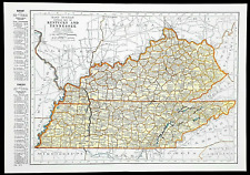
 1953 Kentucky Tennessee Map Knoxville Lexington Nashville Memphis Louisville
-
$58.88
 1916 UNITED STATES Map ORIGINAL LARGE Wisconsin Indiana Pennsylvania Delaware
-
$43.88
 1931 NORTH CAROLINA Map ORIGINAL Virginia Pamlico Sound Washington DC Maryland
-
$48.88
 1875 KENTUCKY TENNESSEE Map ORIGINAL OHIO WEST VIRGINIA INDIANA Maryland
-
$19.99
 Vintage 1956 Original Kentucky Map US Dept Of Interior 30x15
-
$13.00
 1943 Vintage Map - Indian Land Cessions 1784-1798 - Kentucky - Ohio - Tennessee
-
$28.76
 Vintage 1892 LOUISVILLE KENTUCKY Map 14"x11" Old Antique Original PORTLAND
-
$28.04
 1892 LOUISVILLE KENTUCKY Map 14"x11" ~ Old Antique Original SHIPPINGPORT ISLAND
-
$9.95
 Vintage 1967 Geologic Map of Clay City, Powell and Estill Counties, Kentucky
-
$35.24
 Vintage 1900 LOUISVILLE KENTUCKY Map 14"x11" ~ Old Antique Original WEST ALBANY
-
$20.84
 1891 LOUISVILLE KENTUCKY Map 14"x11" Old Antique Original SPALDING UNIVERSITY
-
$45.95
 1857 Colton Atlas Map ~ KENTUCKY - TENNESSEE ~ (14x17) ~ Free S&H -#511
-
$18.00
 Kentucky & Tennessee - Original 1907 Dated Map by Dodd Mead & Company. Antique
-
$59.00
 Original 1838 Antique Map KENTUCKY By Bradford Authenticity Slight Damage
-
$43.88
 1853 Map Ohio Kentucky Tennessee Indiana Louisville Cleveland Nashville Memphis
-
$79.00
 Denoyer-Geppert Visual Relief Wall Map S170vr 1968 Northeatern U.S. Chicago
-
$13.00
 1943 Vintage Map - Reconstruction 1865-1877 - Civil War - TX LA AR MS AL FL VA
-
$27.99
 1926 Clason Auto Road Map Kentucky Louisville Lexington Frankfurt Cincinnati OH
-
$53.00
 1861 Ohio River Engraving View Print Steamboats Nautical ORIGINAL Kentucky
-
$21.56
 Vintage 1891 LOUISVILLE KENTUCKY Map 14"x11" ~ Old Antique Original PORTLAND KY
-
$15.24
 Vintage 1937 Two-Sided Color Map of Louisiana Kentucky Tennessee 11" x 14"
-
$24.99
 1880 Antique Atlas Map / OHIO, MICHIGAN, INDIANA, KENTUCKY
-
$47.00
 OLD 1900 United States Map ORIGINAL LARGE Farming Agriculture Barley Grain
-
$60.00
 Kentucky Lithograph Elevation Wall Map Raven Maps 29”x58” Laminated, Frame Ready
-
$45.95
 Old Antique 1882 Plat Map ~ SAMUELS DEPOT Precinct #5, NELSON Co., KENTUCKY
-
$48.88
 1916 UNITED STATES Map ORIGINAL Rainfall Colorado Montana Michigan Wisconsin
-
$45.95
 Old Antique 1882 Plat Map ~ HIGH GROVE Precinct #10, NELSON Co., KENTUCKY
-
$24.99
 1894 USGS Reconnnaissance Map KENTUCKY TENNESSEE Coal Mines Williamsburg Jellico
-
$39.56
 Vintage 1901 KENTUCKY Map 22"x14" ~ Old Antique Original FRANKFORT LOUISVILLE KY
-
$14.99
 VINTAGE MAMMOTH CAVE KY KENTUCKY ORIGINAL 1922 USGS 17X21 QUADRANGLE MAP
-
$35.96
 1900 LOUISVILLE KENTUCKY Atlas Map 14"x11" ~ Old Antique Original PORTLAND KY
-
$16.00
 Framed Old Historical 1888 KENTUCKY Map, Color, Detailed, RR, Excellent Gift
-
$7.95
 Vintage Lexington KENTUCKY 2nd National Bank Map of LEXINGTON & Fayette County
-
$49.50
 1864 Map Kentucky & Tennessee County Map Antique Original Hand Colored Mitchell
-
$17.16
 1902 LOUISVILLE KENTUCKY Atlas Map 14"x11" ~ Old Antique Original SHIPPINGPORT
-
$35.00
 Rand-McNally city map: Paducah Kentucky © 1998 -Index- Metropolis Brookport
-
$45.95
 1882 Plat Map BOTLAND, NELSON Co., KENTUCKY ~ CHAPLIN - NELSONVILLE on Reverse
-
$17.05
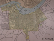
 1921 Antique LOUISVILLE Kentucky Street Map of Louisville City Map 1223
-
$120.00
 1865 Tennessee & Kentucky by Johnson Ward - beautiful antique map 26.5" x 18"
-
$35.96
 Vintage 1902 KENTUCKY Map 22"x14" ~ Old Antique Original FRANKFORT LOUISVILLE KY
-
$22.99
 Original 1925 USGS Topo Map MARION Kentucky Franklin Mines Illinois Central RR
-
$16.65
 1950s Vintage Kentucky State Map Animated Kentucky Picture Map Decor BW 1109
-
$19.99
 1883 Antique Map / STATES OF KENTUCKY AND TENNESSEE / 14.5x20.5 inches
-
$21.30
 1891 TENNESSEE MAP KENTUCKY ANTIQUE FULL COLOR RAILROADS RIVERS MOUNTAINS STATES
-
$7.50
 Antique 1926 World Atlas City Map of Louisville, Kentucky KY + Madrid Spain Plus
-
$25.95
 Rand-McNally regional state map: EASTERN UNITED STATES © 2004 - paper
-
$13.00
 1943 Vintage Map - The United States on March 4, 1861 - The Civil War
-
$24.99
 1911 USGS Topo Map DAWSON SPRINGS DANIEL BOONE Kentucky Tradewater River Ilsley
-
$27.95
 Kentucky Atlas of Bath & Fleming Counties D J Lake 1884 Reproduction 11" x 17"
-
$5.00
 1894 Cram's Atlas Map of Louisville and Sioux Falls SD
-
$21.51
 1855 Map ~ TENNESSEE - KENTUCKY - INDIANA - OHIO ~ (9.5x11.5) -#P310
-
$39.99
 Civil War Map - West Virginia Kentucky Ohio Charleston Cincinnati Appalachia
-
$7.99
 1882 Antique Map Illinois Indiana Ohio Kentucky Central USA approx 11"x8.5"
-
$45.95
 1862 Map ~ KENTUCKY - TENNESSEE ~ Authentic Johnson Atlas Map (18x26) -#012
-
$24.99
 Original 1929 USGS Topo Map SMITHLAND Kentucky Calvert City Ohio River Illiniois
-
$20.68
 1856 Cowperthwait Map ~ CENTRAL STATES TENNESSEE, KENTUCKY, OH, IN ~(9x11) -#180
-
$6.99
 RARE Antique 1914 Baltimore-Ohio & Chicago/ Great Western Railroad System Maps +
-
$17.88
 1893 LOUISVILLE KENTUCKY Map 14"x11" ~ Old Antique Original CHURCHILL DOWNS
-
$19.99
 1882 Antique COLOR Map / KENTUCKY
-
$24.99
 1881 Antique COLOR Atlas Map / KENTUCKY and TENNESSEE
-
$45.00
 1878 Kentucky & Tennessee Mitchell antique map 15.1" x 12" - nice color
-
$22.99
 1932 USGS Topo Map BIG CLIFTY Kentucky Asphalt Mines Perryville Dyer Summit Limp
-
$24.95
 KENTUCKY 10X13" & TENNESSEE 6 1/2X10" 1884 Maps. Rand, McNally & Co VG-Fine
-
$9.99
 Harper Civil War Map Mississippi Central Railroad Stations Cairo New Orleans
-
$19.95
 Vintage 1967 Geologic Map of Clay City, Powell and Estill Counties, Kentucky
-
$15.00
 Winchester KY 1967 USGS Topographical Geological Survey Quadrangle Map 22 x 32
-
$9.95
 Vintage 1975 USGS Topo Map Mammoth Cave FLINT MAMMOTH CAVE SYSTEM 8.5" X 11"
-
$45.95
 Old Antique 1882 Plat Map ~ FAIRFIELD Precinct #4, NELSON Co., KENTUCKY
-
$24.99
 1885 Antique Atlas Map / SOUTH ATLANTIC & SOUTH CENTRAL STATES
-
$45.95
 Old 1870 Johnson's Atlas Map ~ KENTUCKY TENNESSEE ~ (18x26) ~Inv#150
-
$20.68
 1896 Fisk & Co. Atlas Map ~ KENTUCKY - TENNESSEE ~ Free S&H ~(11x14) ~#251
-
$45.95
 Old Authentic 1862 Johnson Atlas Map ~ KENTUCKY - TENNESSEE ~ (18x26) ~ Free S&H
-
$13.94
 Kentucky Tennessee map page Vintage 1949 Collier's Encyclopedia Rand McNally
-
$15.00
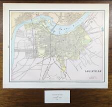
 Louisville, Kentucky ....Antique Map, Plan..1892
-
$22.99
 Original 1932 USGS Topo Map LaCenter Bandana Kentucky Ohio River Joppa Illinois
-
$20.68
 1891 Cram's Atlas Map ~ LOUISVILLE, KENTUCKY ~ Free S&H (11x14)
-
$19.99
 Canvas Reproduction Vintage Pictorial Map of Kentucky Print Ruth Taylor 1935
-
$90.00
 1849 Kentucky by Mitchell antique map ~17.4" x 13.8" Hand colored Lexington
-
$45.95
 Old Antique 1863 Johnson Atlas Map ~ KENTUCKY - TENNESSEE ~ Free S&H
-
$22.00
 1888 TENNESSEE & KENTUCKY Map, Colored County & Railroad Map 21" x 14"
-
$22.99
 1909 USGS Topo Map EARLINGTON Kentucky Circle City Madisonville L&N Railroad
-
$20.68
 Old 1892 Cram's Atlas Railroad Map ~ KENTUCKY - TENNESSEE ~ (XLG17x25) -#382
-
$20.68
 1959 Picture / Pictorial Map Geography of KENTUCKY by PS JOHST - VERNON QUINN
-
$20.68
 Old Antique 1896 Atlas Map ~ LOUISVILLE, KENTUCKY ~ Vintage Authentic ~ Free S&H
-
$55.00
 1862 Johnson Kentucky & Tennessee antique map 24.7" x 17.9" nice color
-
$38.00
 Kentucky Soil Survey of Scott County with b&w and color maps 1971 book vintage
-
$35.00
 Rand-McNally city map: BOWLING GREEN Kentucky © 1993 WARREN COUNTY
-
$17.88
 1901 LOUISVILLE KENTUCKY Map 14"x11" Old Antique Original PORTLAND SHIPPINGPORT
-
$15.00
 Antique 1889 Map Ohio TN KY by George F Cram Unrivaled Family Atlas 13x10
-
$17.16
 1898 LOUISVILLE KENTUCKY Atlas Map 14"x11" Old Antique Original CHURCHILL DOWNS
-
$11.99
 1944 Geographical Map Kentucky Tennessee Nashville Memphis Louisville Lexington
-
$13.86
 1892 Color Single Page County Maps Kentucky & Tennessee and Indiana
-
$8.10
 1902 state map of Alabama antique vintage Britannica 10th
-
$20.66
 1898 Antique KENTUCKY Map TENNESSEE Map George Cram Collectible Atlas Map 453
-
$17.16
 1894 LOUISVILLE KENTUCKY Atlas Map 14"x11" Old Antique Original CHURCHILL DOWNS
-
$17.23
 1897 LOUISVILLE KENTUCKY Atlas Map 14"x11" Old Antique Original NEW ALBANY IN
-
$20.68
 (Lg21x14) 1899 Cram's Atlas Map ~ KENTUCKY - TENNESSEE ~Inv#129
-
$125.00
 6 Lot 1924-35 Kentucky USGS Topographical Maps Geological Survey Quadrangle Map
-
$134.41
 Original 1860s KENTUCKY TENNESSEE- Antique hand colored JOHNSON's MAP 26.5 X 18"
-
$49.99
 Large Antique WH Gamble County Map of KENTUCKY & TENNESSEE,1877, 22.5"x15"


