 Antiques (US)
-
$156.86

 NORTH ENGLAND, ISLE OF MAN, 'Regni Angliae' original antique map, De Wit, c.1680
-
$21.32
 Antique/Vintage County Map of Lancashire - John Heywood, 1868
-
$12.54
 LANCASHIRE Map - Sheet SD 83 - 1954 Ordnance Survey Map
-
$11.29
 Antique/Vintage County Map of South Lancashire - Phillips Handy Atlas , 1887
-
$87.84
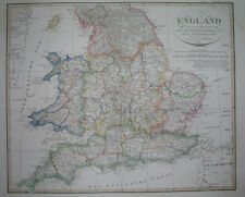
 Antique Map of England and Wales by John Cary 1789
-
$69.02
 1850 Geological Survey Denbigh 1867 ed. Liverpool Wales Handcoloured Antique Map
-
$52.49
 1823 ORIGINAL MAP UNITED KINGDOM ENGLAND WALES LONDON CAMBRIDGE LANCASTER YORK
-
$25.08
 ORDNANCE SURVEY WALL CHART/ MAP NORTH WALES & LANCASHIRE #10 vintage 1972
-
$20.08
 ENGLAND & WALES NW. Cumbria Lancashire Welsh coast Isle of Man. WELLER 1863 map
-
$11.29
 Antique/Vintage County Map of North Lancashire - Phillips Handy Atlas , 1887
-
$20.08
 England & Wales North Sheet. Yorkshire Lancashire. BARTHOLOMEW 1882 old map
-
$41.41
 England & Wales North Sheet. Yorkshire Lancashire. BARTHOLOMEW 1862 old map
-
$20.08
 England & Wales North. Yorkshire Lancashire Cumbria Lincs. THE TIMES 1895 map
-
$21.32
 NORTH WALES and LANCASHIRE Large Ordnance survey Map 1969 Sheet #10
-
$345.08
 IRISH SEA chart. Lancashire Cumbria North Wales Isle of Man. COLLINS 1693 map
-
$407.83
 IRISH SEA chart. Lancashire Cumbria North Wales Isle of Man. COLLINS 1723 map
-
$12.54
 VINTAGE ORDNANCE SURVEY MAP - North Wales & Lancashire - 1973 - Quarter Inch


