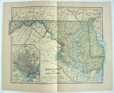
 Antiques (US)
-
$92.72

 SAN FRANCISCO CALIF City Map Rand McNally 1901 Railroad RR Business Large Folio
-
$103.02
 BALTIMORE MARYLAND City Map Rand McNally 1901 Railroad RR Business Large Folio
-
$75.99
 1873 Mitchell's County Map, New Jersey, Delaware Maryland Authentic Hand-Colored
-
$16.00
 Old Framed Historical 1888 MARYLAND Map, Color, Detailed, RR, Great Gift
-
$20.68
 1856 Map ~ MARYLAND - DELAWARE ~ Authentic CHARLES DESILVER Map (14x17) -#023
-
$58.00
 1861 Fort Washington Maryland Potomac River ENGRAVED PRINT Mount Vernon ORIGINAL
-
$21.51
 1889 Map ~ BALTIMORE, MD ~ (12x17) ~ Good Condition ~ Free S&H-#043
-
$38.88
 VINTAGE MARYLAND Map 1912 ORIGINAL Counties Population Annapolis Baltimore
-
$48.00
 1853 Map Virginia North Carolina Map ORIGINAL Maryland Cape Fear Washington DC
-
$14.89
 Maryland Geologic Atlas: Mount Vernon and Piscataway Quadrangles
-
$24.00
 Baltimore, MD - Original 1907 Dated City Map by Dodd Mead & Company. Antique
-
$31.50
 1891 MARYLAND DELAWARE MAP ANTIQUE FULL COLOR RAILROAD MOUNTAIN VICTORIAN ERA
-
$16.89
 Topographic Map of Charles County, Maryland
-
$92.72
 BOSTON MASS City Map Rand McNally 1901 Railroad RR Business Large Folio
-
$28.57
 1898 Map of the State of MARYLAND Hand Colored Lithograph 10.75 x 7.25
-
$265.00
 1863 CIVIL WAR MAP OF DELAWARE, MARYLAND & DC JOHNSON'S ATLAS, w/ C.O.A., VGC+
-
$44.88
 1931 NORTH CAROLINA Map ORIGINAL Virginia Pamlico Sound Washington DC Maryland
-
$15.26
 1930s Vintage Map of Maryland Antique Maryland & Delaware Map Wall Art Decor
-
$16.00
 West Point Civil War Map Gettysburg Campaign Troop Positions Pennsylvania Jun 30
-
$67.88
 1889 MARYLAND DELAWARE Map Original Chesapeake Bay Richmond Washington Norfolk
-
$11.99
 West Point Civil War Map Battle of Wilderness Campaign Virginia 7AM May 5, 1864
-
$68.00
 Civil War Map Chesapeake Bay Virginia Maryland Richmond Charlottsville Norfolk
-
$12.89
 USGS Geologic Map: Land-Use Planning, Prince Georges County, Maryland
-
$48.88
 1956 Maryland Map Washington DC Baltimore Annapolis Wilmington Easton Cambridge
-
$48.88
 1906 New England Map ORIGINAL Martha's Vineyard New York Pennsylvania Maine
-
$11.97
 Vintage 1980 FORT BELVOIR / INDIAN HEAD Maryland Military Topo Map
-
$35.00
 "Colton's Map of Delaware & Maryland" / 1855 / Mason & Dixie Line
-
$13.00
 1943 Vintage Map - The United States on March 4, 1861 - The Civil War
-
$32.55
 From 1895 Rand McNally Atlas of The World-Map of Maryland-Delaware & Baltimore.
-
$25.00
 2 Antique maps 1907 Chesapeake Md shellfish coast survey Somerset Wicomico
-
$66.21
 Map of the State of Maryland Delaware Color Lithograph 22.5 x 14.5 Crams Atlas
-
$13.86
 1892 Color Single Page County Maps Maryland & Delaware Virginia & West Virginia
-
$16.89
 Topographic Map of Anne Arundel County, Maryland
-
$9.99
 1877 Scenes - Westminster Court House Carroll County, MD Lake Griffing Stevenson
-
$11.99
 West Point Civil War Map Battle of Mine Run Orange County Virginia Nov 26-Dec 1
-
$39.99
 2 - 1877 Maps of Manchester in Carroll County, MD by Lake Griffing & Stevenson
-
$18.00
 Maryland & Delaware - Original 1907 Dated Map by Dodd Mead & Company. Antique
-
$11.95
 Vintage MARYLAND Map Wall Art Topographic Original 1920s Antique Delaware
-
$27.75
 Original 1903 Antique Map Population Table Maryland & DE Dodd Mead & Co 12"X10"
-
$13.00
 1943 Vintage Map - The Thirteen Colonies - New York City Boston Charleston
-
$10.86
 1911 Color County Map of Maryland and Delaware States
-
$15.99
 West Point Civil War Map Battle First Bull Run July 18 Tyler's Reconnaissance
-
$95.00
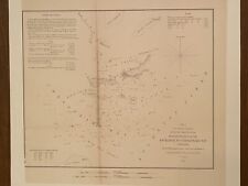
 1857 Coast Survey Chart Chesapeake Head of Bay to Magothy River Baltimore Havre
-
$19.99
 1877 Hampstead Snydersburg Carroll County, MD Map by Lake Griffing & Stevenson
-
$90.00
 1860s Map, Harper's Ferry, Sale of Government Property, 'John Brown's Fort'
-
$9.99
 Original 1925 Map MARYLAND DELAWARE DISTRICT OF COLUMBIA Washington Baltimore
-
$75.00
 1862 Johnson Virginia PA DE MD antique map 26.6" x 18.1" nice color - Richmond
-
$15.99
 West Point Civil War Map Battle First Bull Run July 18 1861 Manassas Washington
-
$19.99
 West Point Civil War Map Battle First Bull Run July 21 5:30 AM Manassas Virginia
-
$30.00
 Vintage S&MM 1978 Framed 12X18 Industrial Sales Map#5 South Atlantic States
-
$24.99
 1877 Map - Freedom Finksburg in Carroll County, MD by Lake Griffing & Stevenson
-
$11.99
 West Point Civil War Map Battle of Wilderness Campaign Virginia 5 AM May 6, 1864
-
$49.50
 1920 Map MARYLAND PRR B&O WM Steam Electric Railroad Highway Steamboat Lines
-
$69.99
 2 - 1877 Maps - Westminster in Carroll County, MD by Lake Griffing & Stevenson
-
$15.99
 West Point Civil War Map Battle First Bull Run July 15 Manassas Washington DC
-
$19.99
 1877 Middleburg in Carroll County, MD Map by Lake Griffing & Stevenson
-
$15.99
 West Point Civil War Map Battle of Wilderness Campaign Virginia May 6-7, 1864
-
$9.99
 West Point Civil War Map Battle Gettysburg to Wilderness Troop Movements July 14
-
$11.99
 West Point Civil War Map Battle of Wilderness Campaign Virginia May 4, 1864
-
$450.00
 1877 Lake Griffing & Stevenson An Illustrated Atlas of Carroll County, Maryland
-
$27.15
 1839 Map ~ MID-ATLANTIC STATES - PRE-WAR VIRGINIA, SOUTH CAROLINA (11x18)-#001
-
$23.99
 West Point Civil War Map Principal Campaigns Gettysburg Chattanooga Savannah US
-
$9.99
 West Point Civil War Map Gettysburg to Battle Wilderness Lee & Meade Oct 9, 1863
-
$12.89
 USGS Geologic Map: Construction Conditions, Prince Georges County, Maryland
-
$27.15
 1854 Map NORTH CAROLINA, DELAWARE, MARYLAND, VIRGINIA ~ Hand Colored (9x11)-#008
-
$45.95
 1889 Map MARYLAND - DELAWARE (XL17x23) Colored - Good Condition - Free S&H#006
-
$19.99
 1877 Map - New Windsor in Carroll County, MD by Lake Griffing & Stevenson
-
$12.89
 USGS Geologic Map: Southern Queen Annes County, Maryland - Aeromagnetic
-
$12.89
 USGS Geologic Map: Mineral Resources, Prince Georges County, Maryland
-
$16.00
 Map Sherman's Army Virginia Operations 1871 Victorian Lithograph History DWAA12
-
$10.95
 Vintage MARYLAND Map of Delaware Wall Art Decor 1940s Original Ellicott City
-
$16.00
 Map Of Original 13 Colonies 1871 Victorian Lithograph History Swinton DWAA12
-
$4.99
 1949 state maps Maryland Delaware Maine 14x11" sheet counties cities towns
-
$12.89
 USGS Geologic Map: Water Resources of Southern Maryland
-
$12.95
 1911 Antique Rand McNally Map of MARYLAND & DELAWARE w/copy History/Demographics
-
$37.95
 ANTIQUE ATLAS MAP #33 MARYLAND & DELAWARE DISTRICT OF COLUMBIA BALTIMORE DC 1911
-
$39.00
 1878 Virginia & West, MD DE & NJ Mitchell antique map 15.1" x 12" - nice color
-
$45.95
 Old 1897 Map ~ WASHINGTON DC ~ Authentic Atlas Map (XXL22x29) Free S&H #008
-
$55.00
 1878 Washington DC & Baltimore Mitchell antique map 15.1" x 12.3" - nice color
-
$15.99
 Original 1895 Streetcar Map BALTIMORE Maryland Railroads Camden Station Wharves
-
$15.99
 Vintage MARYLAND Map Topographic Original Antique Delaware Washington DC
-
$11.99
 West Point Civil War Map Battle of Wilderness Campaign Virginia 2 PM May 5, 1864
-
$12.95
 Maryland Vintage Pictorial Map (Small/Index Card size)
-
$24.99
 1877 Union Bridge Carroll County, MD Map by Lake Griffing & Stevenson
-
$55.00
 1851 US Coast Survey ,AD Bache Small Rare Map of The Entrance To Chesapeake Bay,
-
$37.50
 1908 USGS Geologic Atlas Accident Grantsville Maryland PA WV Coal McHenry Wisp
-
$28.00
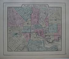
 Map Of Baltimore Town. Print On Smooth Paper.
-
$30.00
 1880 MIDDLE ATLANTIC STATES Map Hand color 7.5" x 9"
-
$49.00
 1862 Johnson Maryland Delaware DC & insets antique map 17.5" x 14.1" nice color
-
$45.00
 1851 US Coast Survey ,AD Bache Small Rare Map of Chesapeake Bay,United States
-
$19.95
 1875 MAP OF PIKESVILLE ARSENAL, MARYLAND ~ BOARD OF ARSENALS
-
$39.99
 Original 1887 Bradley City Map BALTIMORE Maryland Railroads Cemeteries Streets
-
$24.95
 1895 Antique Map of Baltimore Maryland MD Vintage Atlas Page
-
$19.99
 U.S. Geological Survey vintage 1952 18" x 22" map of NEW WINDSOR MD
-
$19.50
 MARYLAND & DELAWARE Map: Authentic 1907 (dated) County Town Topography Railroads
-
$29.99
 1877 Map - Franklin Union Bridge Carroll County, MD by Lake Griffing & Stevenson
-
$21.00
 1907 Antique Map Maryland & Delaware Dodd Mead & Co Railroads, Towns (inv217)
-
$20.79
 MARYLAND & DELAWARE (Washington, D.C.): 1891 Town County Rails, Area, Population
-
$12.74
 OLD ANTIQUE 1908 OHIO / MARYLAND & DELAWARE MAP COLOR CHROMOLITHOGRAPH PRINT
-
$12.50
 AAA Delaware D.C. Maryland Virginia Vintage 1998 Driving Guide Travel Map


