 Antiques (US)
-
$68.36

 1892 PORTLAND OREGON Map 14"x22" ~ Old Antique Original PEARL DISTRICT IRVINGTON
-
$34.95
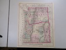
 Mitchell Original 1886 Map US West Coast CA ,OR, NV & Territories of WA,ID,UT,AZ
-
$34.99
 1988 Oregon US Geological Survey Map Lot Of 5 Maps 27"x 21" Each
-
$289.99
 Western US Map - Home & Cabin Decor Map - Shaded Relief Map
-
$19.99
 1920 TERMINAL FACILITIES PORT OF ASTORIA OREGON SHOWING THREE PIERS MAP!
-
$409.95
 1826 MAP of the UNITED STATES Oregon Territory Mexico Texas no Canada America
-
$30.00
 1880s Hand-Colored Map Of Oregon, Kansas, California, & The Territories Mitchell
-
$38.88
 1899 OREGON Map ORIGINAL Portland Eugene Salem Medford Port Orford Coos Bay
-
$9.99
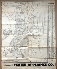 1950 Street Wall Map of Salem OR Compliments of Yeager Appliance Co.
-
$38.00
 1589 North America Map California Nova Hispania 1872 Florida Wheeler Ortelius
-
$24.99
 1875 Antique COLOR Gray’s Atlas Map / OREGON and WASHINGTON
-
$35.50
 1891 OREGON MAP WASHINGTON ANTIQUE FULL COLOR RAILROADS MOUNTAINS VICTORIAN ERA
-
$7.50
 Oregon Bend China Hat Topo Map USGS 7.5-minute Topographic 27" X 22"
-
$150.00
 Original Circa 1850 Map Of Oregon Boundary Lithograph By A. Hoen & Co.
-
$92.72
 OREGON State Map Rand McNally 1901 Railroad RR Business City Large Folio
-
$199.99
 Territory Of The Northern Plains Tribes Framed
-
$43.00
 1897 Oregon Map ORIGINAL Roseburg Klamath Pendleton Ashland RAILROADS TOWNSHIPS
-
$9.99
 1914 ENTRANCE TO COOS BAY OREGON ENGINEERING MAP 17 x 35!
-
$129.99
 Original 1872 Map OREGON & WASHINGTON TERRITORY Wagon Trails Indians Forts Mines
-
$12.89
 USGS Geologic Map: Pendleton Quadrangle, Oregon and Washington
-
$18.00
 1951 Tulelake California Oregon Topographic Map 13.75 X 19.25” Reprint?
-
$25.00
 1966 Fremont National Forest Oregon Topographic Map 29.25”X 22.5” Reprint?
-
$17.16
 Antique 1896 OREGON Map 14"x11" Old Antique Original ALBANY CORVALLIS SALEM OR
-
$12.25
 1956 Oakridge Oregon Willamette USGS Topographical Geological Survey Map USFS
-
$25.00
 1959 Crater Lake National Park Oregon Topographic Map 22.5 X 32.25” Reprint?
-
$38.88
 1900 United States Map ORIGINAL Oat Farming Production Agriculture Texas Iowa
-
$15.99
 c 1890 Cram Map - Oregon Salem Astoria Eugene Portland Klamath Falls Empire City
-
$17.88
 Antique 1897 OREGON Map 14"x11" ~ Old Original MCMINNVILLE PORTLAND TILLAMOOK OR
-
$25.08
 Antique 1887 OREGON Map 13"x11" Old Antique Original BAKER CITY PENDLETON UNION
-
$149.99
 1903 Rand McNally Co. Map of Alaska and the Yukon Gold Fields Canada California
-
$57.56
 Vintage 1893 PORTLAND OREGON Map 14"x22" ~ Old Antique Original IRVINGTON KENTON
-
$61.19
 Vintage 1892 PORTLAND OREGON Map 14"x22" ~ Old Antique Original IRVINGTON KENTON
-
$20.68
 1891 Cram's Atlas Railroad & Reservation Map ~ OREGON ~ Free S&H (11x14)
-
$24.95
 Sundale NW Oregon and Washington 1971 Original USGS Topographical Topo Map
-
$43.00
 1889 OREGON Map Original Portland Eugene Salem Medford Klamath RAILROADS
-
$24.95
 Esau Canyon Oregon 1969 Original USGS Topographical Topo Map John Day River
-
$19.99
 Vintage Aeronautical Chart La Grande Oregon Bordering Idaho Washington 1950s
-
$24.95
 Quinton Oregon and Washington 1971 Original USGS Topographical Topo Map
-
$23.40
 Vintage 1903 OREGON Map 22"x14" Old Antique Original BAKER CITY PENDLETON UNION
-
$19.99
 1895 Oregon Map Antique ORIGINAL 10" Harney Malheur Morrow Grant
-
$9.99
 c1905 Hammond Map - Oregon Salem Eugene Astoria La Grande Klamath Falls Portland
-
$15.00
 1950s Toketee Falls Oregon Willamette USGS Topographical Geological Survey Map
-
$11.99
 1937 Map Portland Oregon City Plan Washington Park Mt. Tabor Willamette River OR
-
$12.99
 1911 YAQUINA RIVER OREGON TOLEDO TO OYSTERVILLE ENGINEERING MAPS 2 MAPS!
-
$17.23
 Vintage 1902 OREGON Map 14"x11" Old Antique Original JACKSONVILLE KLAMATH FALLS
-
$24.95
 McDonald Oregon 1964 Original USGS Topographical Topo Map John Day River
-
$22.40
 1880’s Antique Cram's Atlas Map Of Washington OR Oregon (2 Sided) Framed 11x14
-
$11.95
 Land Use & Cover 1974 Crater Lake Oregon, Diamond Lake 1974Us Geological Survey.
-
$29.95
 1879 Original Engraved color MAP OF WESTERN STATES AND TERRITORIES new 11x14 mat
-
$15.99
 1891 McNally Map - Oregon Salem Eugene Astoria Klamath Empire City Mountains OR
-
$9.99
 c1970 McNally Cosmo Map - Oregon - Portland Eugene Salem Klamath Falls Coos Bay
-
$35.00
 1909 Original 2-Sided Color Map ~ CALIFORNIA & OREGON ~ Large Detailed Map Rare
-
$26.32
 Old 1931 Pictorial Map ~ OREGON by P.S. JOHST ~ Free S&H
-
$12.89
 USGS Geologic Map: John Day Quadrangle, Oregon
-
$19.99
 Vintage COUNTY AND TOWNSHIP MAP OF OREGON AND WASHINGTON - 1894 A. L. Smith
-
$19.99
 1885 McNally Map Oregon Salem Portland Eugene Klamath Falls Jackson Canyon City
-
$20.68
 1938 Colorful Pictorial Map ~ OREGON by Norman Reeves for 1939 World's Fair
-
$24.99
 1880 Antique Map / OREGON, KANSAS, CALIFORNIA, and the WESTERN TERRITORIES
-
$260.00
 1847 Stieler Map United States Texas Missouri Oregon Territory Mexico Canada
-
$18.00
 1957 Swan Lake Oregon Topographic Geological Map 13.75”X19” Reprint?
-
$22.95
 USGS Topographic Map LA GRANDE Oregon 1979 1980 -100K-
-
$45.95
 Old 1902 Cram's Railway Atlas Map ~ OREGON ~ (XXLG18x26) #604 - INDIAN LANDS
-
$17.16
 Antique 1896 OREGON Map 14"x11" ~ Old Antique Original ALBANY CORVALLIS SALEM OR
-
$19.00
 1890 Oregon Map w/ Idaho on Reverse, 14 1/8" x 10 7/8" Colored Counties
-
$6.95
 Vintage Hammonds 1911 Atlas Map Of Oregon
-
$29.90
 1903 Antique Map Oregon Salem Independence Aumsville Subliminity 27X14 #4306
-
$25.00
 1955/1962 Klamath Falls Oregon Topographic Geological Map 26.5”X 21” Reprint?
-
$23.39
 Old Colorful Antique 1878 R McNally (Lg 13x20) Atlas Map ~ OREGON ~ Free S&H
-
$19.00
 Oregon & Washington - Original 1903 Dated Map by Dodd Mead & Company. Antique
-
$9.99
 1917 Poates Map - Oregon - Salem Portland Eugene Astoria Klamath Falls Dalles OR
-
$45.00
 1893/1917 CRATER LAKE ASHLAND MEDFORD 60min TOPO MAP 16x20" USGS antique OREGON
-
$12.89
 USGS Geologic Map: Ochoco Reservoir Quadrangle, Crook County, Oregon
-
$12.89
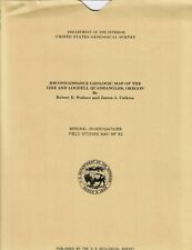 USGS Geologic Map: Izee and Logdell Quadrangles, Oregon
-
$17.88
 Vintage 1902 OREGON Map 14"x11" Old Antique Original JACKSONVILLE KLAMATH FALLS
-
$99.99
 Antique USGS Topographic map: 1896 Crater Lake Special Map, OR; 1:62500
-
$6.50
 Oregon Deschutes County Topo Map East Lake USGS 7.5-minute Topographic
-
$39.99
 1869 Chambers Map United States West Dakota California Colorado Oregon Utah et
-
$4.99
 1949 City Map of St Louis Missouri 14x11" sheet streets parks points interest
-
$32.79
 1884 Map ~ OREGON ~ Authentic Cram's Atlas Map (11x13) Free S&H -#P292
-
$7.95
 Mt Hood Oregon Green Trails Map 2005 Climbing Timberline Trail #462S Topographic
-
$12.71
 Vintage Official Highway Map OREGON Dept of Transportation (1986-1991?)
-
$39.00
 1878 Western Hemisphere Mitchell antique map 15.1" x 12.1" - nice color
-
$30.00
 TOPOGRAPHICAL MAP OF THE ROAD FROM MISSOURI TO OREGON Reprint of 1846 - 25x16
-
$49.99
 Original 1861 Coast Survey Shipwreck Map COOS BAY Oregon Soundings Tide Table
-
$18.00
 1955 Lake O’ Woods Oregon Topographic Map 13.75 X 19.25” Reprint?
-
$11.95
 Land Use & Cover 1974 Crater Lake Oregon, Diamond Lake 1974Us Geological Survey
-
$42.00
 1946 Original Classic B&W Litho Map ORCAS ISLAND, WA Ye Old Map Of Orcas Island
-
$45.00
 1894/1910 KLAMATH LAKE LINKVILLE 60 min TOPO MAP 16x20" USGS antique OREGON
-
$27.99
 1882 Watson Map Washington Oregon Idaho Montana Seattle Eugene Boise Olympia
-
$75.00
 TOPOGRAPHICAL MAP OF THE ROAD FROM MISSOURI TO OREGON Mid-20thc Reprint of 1846
-
$12.00
 c. 1941 Oregon Original Rand McNally Atlas Map
-
$2000.00
 1840 Oregon Territory antique map by Greenleaf - 14.25" x 12" scarce 1st edition
-
$17.54
 1945 Two-Sided Color Railroad Map Oklahoma/Oregon Hammond 9.25x12.25"
-
$12.89
 USGS Geologic Map: East Half of the Bend Quadrangle, Oregon
-
$19.99
 Canvas Reproduction, Vintage Pictorial Map of Oregon Ruth Taylor 1935
-
$19.90
 Antique 1903 Black Alkali Map Baker City Oregon area Hutchinson 20X23" #21069
-
$29.90
 Antique 1903 Map Salem Oregon area Independence Aumsville 27X14" #21071
-
$9.99
 1916 COQVILLE RIVER OREGON BORINGS AT BAR AND ENTRANCE ENGINEERING MAP!
-
$49.99
 Lot 2 Antique Maps Oregon Gaskell's Atlas of the World 1893 ca 1900 Color
-
$28.86
 1898 Map of the State of OREGON Hand Colored Lithograph 10.75 x 7.25


