 Antiques (US)
-
$57.88

 1899 Northern England Wales Map Liverpool Sheffield STEAMSHIPS RAILWAYS PORTS
-
$37.88
 1899 Scotland Map ORIGINAL Glasgow Aberdeen Shetland STEAMSHIP ROUTES
-
$99.00
 1812 Lapie Map of Great Britian Scotland and Ireland
-
$41.79
 1825 John Russell Antique Map of Scotland
-
$34.95
 Bartholomews Clan Map Scotland 1975, Scottish HUGE 30x40" Poster, Coats of Arms
-
$29.00
 Johnston's Clan Map of the Scottish Highlands & Historical Map of Scotland
-
$18.72
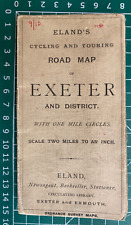 1900 Gall & Inglis / Cary: Eland's Cycling & Touring Road Map, Exeter & District
-
$24.97
 1827 Antique Map; Scotland by Sidney Hall
-
$36.22
 Antique Map of Scotland "L'Ecosse" after Pierre Vander Aa Etching Limited Print
-
$25.00
 Vintage Historical Map of Scotland by L.G. Bullock, Cloth Fold-Out 26.5" x 39.5"
-
$34.95
 1975 Bartholomew & Son Clan Map Scotland Scottish 30" x 40" Poster Coats of Arms
-
$75.00
 1876 British Isles antique map ~ 27.5" x 19.6" hand colored - Scotland & Ireland
-
$24.97
 1804 Antique Map; Scotland by John C. Russell
-
$102.02
 1780 Bonne - UNITED KINGDOM Ireland hand coloured engraved map
-
$24.97
 1870 British Isles Physical Map Antique Hand Coloured Map By William Hughes
-
$6.25
 1927 Map of Oban District Scotland antique chromolithograph
-
$20.00
 Bartholomews Clan Folded Paper Map - Scotland of Old - Unknown Year
-
$12.48
 1900 Gall & Inglis / Cary: Dumfries District Map, Scotland
-
$19.99
 1921 Johnston Map Netherlands Belgium Luxemburg Holland Amsterdam Brussels Ghent
-
$39.99
 1839 Stieler Physical Map Europe River Basins Mountain Ranges Rhine Danube Seine
-
$11.99
 GREAT BRITAIN (ENGLAND and SCOTLAND) & IRELAND - 1947 Post War PHYSICAL Map
-
$19.99
 1921 Johnston Physical Map British Isles Great Britain England Ireland Scotland
-
$19.99
 1875 Lange Map - British Isles - England Wales Scotland Ireland London Dublin UK
-
$15.99
 1875 Lange Physical Map - British Isles - England Wales Scotland Ireland London
-
$31.21
 1820 Antique Map; Scotland by A. Wright, published by Oliver & Boyd
-
$18.72
 1910 Gall & Inglis / Cary: Easton's Touring & Motoring Map of Peebles & District
-
$156.13
 Antique Map "Scotia" (Scotland) Abraham Ortelius, 1655 Ca
-
$25.00
 1901 Tunison Europe & South America antique map ~ 22.8" x 14.6" nice color
-
$11.75
 1966 SCOTLAND + NORTHERN ENGLAND Atlas Map, vintage World Book Atlas, full color
-
$32.00
 1879 Map British Isles England Scotland Victorian Geography 1st Edition DWAA9
-
$6.25
 1927 Street Plan of Ayr Scotland antique chromolithograph
-
$6.25
 1927 Street Plan of Perth Scotland antique chromolithograph
-
$11.99
 1895 Johnston Map - Physical Europe & Political England & Wales London Liverpool
-
$23.99
 1885 Stanford Map Rain & Rivers British Isles England Scotland Ireland Antique
-
$19.99
 1843 Woodbridge Map Europe France Spain Germany Italy Sweden Norway Austria UK
-
$29.43
 1922 PHYSICAL MAP OF GREAT BRITAIN SCOTLAND WALES IRELAND MOUNTAINS RIVERS
-
$6.25
 1927 Map of Loch Lomond and the Trossachs Scotland antique chromolithograph
-
$37.46
 1836 Antique Map; Scotland by William Murphy, Edinburgh
-
$59.90
 1873 German England Ireland Scotland London Historical 1800s Antique Map Wall
-
$18.00
 1925 VINTAGE PHYSICAL MAP OF SCOTLAND
-
$25.00
 1901 Tunison England Ireland Scotland antique map ~ 23" x 14.6" nice color
-
$30.00
 1860 Ireland & Scotland antique map by Mitchell 15.3" x 12.3"
-
$999.24
 Antique Map "Magnae Britanniae et Hiberniae Tabula" (United Kingdom)Hondius,1631
-
$19.99
 1843 Woodbridge Physical Map Europe France Spain Germany Italy Sweden Austria UK
-
$31.21
 1860 Antique Map; Scotland by J & C. Walker
-
$62.44
 1804 Antique Map; Scotland by J. Kirkwood & Sons
-
$19.95
 Historical Map of Scotland • Bullock Folding Illustrated Vintage Clans Coat Arms
-
$25.70
 1908 ANTIQUE PHYSICAL MAP OF UNITED KINGDOM GREAT BRITAIN ENGLANSCOTLAND IRELAND
-
$231.07
 Antique Map "Nuova Carta dell' Isole Britanniche" (U.K.) Albrizzi - Tirion, 1743
-
$23.61
 British Isles Great Britain old antique early map Munster 1544 art poster print
-
$99.00
 1840 British Isles map by Greenleaf 14.2" x 11.9" scarce 1st edition antique
-
$40.74
 1955 VINTAGE PHYSICAL MAP OF SWITZERLAND ALPS / SCALE 1:550,000
-
$12.48
 1886 Antique Map; Scotland by Virtue & Co. / William Hughes
-
$99.00
 1840 British Isles map by Greenleaf 14.2" x 11.9" scarce 1st edition antique
-
$218.00
 1744 Antique Map of United Kingdom, England, Ireland, Scotland
-
$6.25
 1927 Map of The Coolins Scotland antique chromolithograph
-
$37.46
 1812 Antique Map; Scotland by Tardieu
-
$112.41
 Antique Map "Scotland" R. Phillips, 1807
-
$18.72
 1860 Antique Map; Ireland by G. Virtue / William Hughes
-
$99.00
 1840 Europe map by Greenleaf 14.2" x 11.9" scarce 1st edition antique
-
$65.25
 1860 - S. Augustus Mitchell Jr - Antique Hand-Colored Map - Ireland and Scotland
-
$18.00
 Vintage Historical Map of Scotland by L.G. Bullock, Cloth Fold-Out 26" x 38"
-
$175.00
 1845 Scotland map by A.K. Johnston ~ 25.8" x 21.2" Antique Pastel Color Huge
-
$75.00
 1876 Europe antique map ~ 27.5" x 19.5" hand colored - large - ships
-
$6.25
 1927 Map of Inverness Scotland antique chromolithograph
-
$12.48
 1880 Antique Map; Scotland
-
$18.72
 1862 Antique map: Die Westküste von Schottland (West Coast of Scotland)
-
$200.00
 1845 Europe map by A.K. Johnston ~ 25.8" x 21.2" Antique Pastel Color Huge
-
$31.21
 1808 Antique Map; Scotland by Arrowsmith / Cooper
-
$12.48
 1895 Sportsman's & Tourist's Guide Map of Scotland - Bartholomew
-
$195.00
 1780 Kingdoms of England Scotland & Ireland antique map by Bonne/Lattre - framed
-
$31.21
 1847 Antique Map; Scotland by Fisher, Son & Co.
-
$31.21
 1827 Antique Map; Scotland by Assheton / Tegg
-
$18.72
 1833 Antique Map; Scotland by Robert Scott
-
$299.77
 Antique Map "Glottiana Praefectura Superior" (Scotland) T. Pont - J. Blaeu, 1654
-
$43.70
 1807 Antique Map; Scotland by Robert Wilkinson
-
$43.70
 1794 Antique Map; Scotland by Robert Wilkinson
-
$6.25
 1927 Map of Fort William District Scotland antique chromolithograph
-
$31.21
 1827 Antique Map; Scotland by Assheton / Tegg
-
$18.72
 c.1845 Antique Map; Scotland by J&C Walker
-
$16.23
 1874 Antique Map; Scotland by Virtue & Co. / William Hughes
-
$87.43
1780 Bonne - UNITED KINGDOM Ireland hand coloured engraved map
-
$24.97
 1839 Antique Map; Scotland by Robert Scott
-
$37.46
 1831 Antique Map; Scotland by Neele
-
$31.21
 1854 Antique Map; Scotland by John Dower / William Orr
-
$9.99
 Original 1896 BATHY-OROGRAPHICAL Map BRITISH ISLES Ocean Depths Mountain Heights
-
$12.48
 1899 Antique Map; Scotland - G.W. Bacon
-
$7.48
 Old Antique picture map British Isles England Scotland Wales 1643 1600s Reprint
-
$16.23
 1875 Antique Map; Scotland by Virtue & Co. / William Hughes
-
$31.21
 1836 Antique Map; Scotland by John Dower / Orr & Smith
-
$24.97
 1808 Antique Map; Scotland by Arrowsmith / Cooper
-
$12.48
 Scotland Physical Map 1917 from Prof Meiklejohn Bartholomew Atlas
-
$37.46
 1827 Antique Map; Scotland by Neele
-
$18.72
 1842 Antique Map; Scotland by F.P. Becker
-
$31.21
 1861 Antique Map; Scotland by Johnson & Ward
-
$24.98
 Physical Map of England & Wales (Survey of England & Wales) (46 X 61cm)
-
$24.97
 1896 Antique Map; Scotland by Bradley-Garretson
-
$24.97
 1896 Antique Map; Schottland / Scotland by Richard Andree
-
$31.23
 BRITISH ISLES, MOUNTAINS, PHYSICAL MAP, original antique map, Johnston, 1853


