 Antiques (US)
-
$250.00

 Large Vintage Double Pull Down School Maps USA And World 5 Foot Wide
-
$13.95
 1530s Old Map of the World as seen from the North & South Poles - 16x24
-
$164.99
 MCM 1964 Vintage Masketeers 1628 World Map Brass and Wood Wall Metal Art 44 x 30
-
$250.00
 1962 CALTEX World Wide Marine Oil Bunker Facilities Map George Phillip Roll-Up
-
$485.00
 Vintage Copyright 1932 Geographical Pull Down School Map (Beautiful Colors) Nice
-
$28.04
 Vintage 1903 WORLD Map 22"x14" ~ Old Antique Original NORTH AMERICA AFRICA ASIA
-
$29.98
 The New Encyclopedic Atlas and Gazetteer of the World 1919 Edition
-
$149.99
 Rand McNally 3in1 Markable Pulldown Map World/USA/Alaska 5ft9in W x 4ft1.5in H
-
$22.00
 1863 Map ~ THE ROMAN EMPIRE ~ Authentic Johnson Atlas Map (18x26)-#1871
-
$9.95
 Rand McNally - Cosmopolitan WORLD ATLAS (1958) MISSING the Pocket MAP of ALASKA
-
$17.95
 Rand McNally Readers WORLD ATLAS Book Old Maps 1955 Vintage
-
$80.00
 Vintage Denoyer Geppert Cesar's Gull Pull Down Map
-
$22.00
 Old 1886 National Atlas Map ~ AFRICA ~ (LG14x17) ~ Free S&H-#999
-
$249.00
 New 54 in Rand McNally School Roll Down Map 20th Century AM History 11 Maps
-
$179.99
 Vintage 1964 Masketeers Large Brass and Wood Map of the World in 1628 43” X 30”
-
$127.50
 Sacred geography a gazetteer of the bible by elijah parish 1813
-
$160.00
 Vintage World Atlas Map, Classroom Wall Tapestry Geography School Chart
-
$395.00
 MINT! War Map of Europe World War 1 by Buchardt Petersen 1914 World Syndicate
-
$22.00
 1863 Map ~ EASTERN & WESTERN HEMISPHERES of the WORLD, Johnson Map (18x27)-#1968
-
$22.00
 1829 Map ~ HUNGARY ~ (9x11) Free S&H -#1699
-
$15.99
 1872 Muller South Pole Map Magnetic Meridians Antarctica Patagonia New Zealand
-
$45.99
 Vintage Pull-Down School Map South America Classroom 1982 Goshen IN 53x44" Read*
-
$9.95
 Vintage Colorprint World Atlas
-
$22.00
 Dated 1887 Map of MEXICO, CENTRAL AMERICA, CARIBBEAN, TEXAS, JAMAICA (15x23)
-
$13.95
 1661 Celestial Map of the Constellations Historic Vintage Style Map - 16x20
-
$800.00
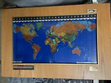 Kilburg Geochron World Map with Wood Frame
-
$13.95
 1630 Historic Old World Illlustrated Vintage Map - 16x24
-
$10.00
 1899 Vintage "Map of the World" from an antique Encyclopedia old cartography
-
$272.37
 Natgeo ng-continents-bundle 7 Continent Maps - Classroom Pull Down -7 Map Bundle
-
$249.00
 New 54" Rand McNally School Roll pull Down Map Exploration to 1865 11 Maps
-
$76.50
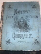 Monteith’s physical and political geography 1866
-
$120.00
 Antique Vtg C 1850s Map by Levasseur Planisphere Americas Hand Colored Litho
-
$12.00
 VTG World map 1960's printed on blue burlap 38" x 45"
-
$11.92
 Vintage Map 1959 Western Soviet Union
-
$38.88
 WORLD MAP 1873 Original Mountains Regions Plateaus Plains Warren's Atlas
-
$38.88
 OLD 1896 WORLD Map ORIGINAL United States Europe Africa Asia Australia Polar
-
$11.92
 Vintage 1956 Map of Alaska
-
$11.92
 Vintage Map of the West Indian Antilles
-
$153.00
 A Dictionary, Geographical, Statistical and Historical Places 1846
-
$199.00
 Vintage Denoyer-Geppert pull down school Map H-22 H-23 Europe Russo Japanese war
-
$24.90
 1904 - World Map Earthquakes/Seaquakes - Vintage Map ORIGINAL 11.5 x 9.5"- C17-5
-
$11.92
 Vintge 1964 Map of China
-
$11.92
 1966 Vintage Map of Western Canada
-
$11.92
 Vintge 1949 Map Europe and the Near East
-
$11.92
 Large Folding Vintage Map of West Indies 1954
-
$11.92
 1974 Map of the North Central States North & Sound Dakota, Nebraska, Kansas Etc
-
$11.92
 1964 Vintage Map of Northwestern South America
-
$11.92
 Vintage 1961 Map of Italy Atlas Plate 37
-
$11.92
 1959 Vintage Map of Southwestern United States
-
$15.00
 1967 Rand McNally World Atlas Imperial Edition (Hardcover)
-
$27.00
 1914 Collier & Sons Encyclopedic Atlas & Gazetteer of the World: maps railroads
-
$11.92
 Vintage 1962 Map of West Indies Atlas Plate 23
-
$11.92
 1965 Vintage Map of the Top of the World
-
$11.92
 1964 Vintage Map of North America Atlas Plate 17
-
$11.92
 1062 Vintage Map of United States Washington to Boston
-
$11.92
 1939 Vintage National Geographic Map of Mexico, Central America & West Indies
-
$11.92
 Gulf of Mexico South Central United States Atlas Plate 10 Feb 1961 Vintage Map
-
$11.92
 Bible Lands & the Cradle of Western Civilzation Vintage 1946 Map
-
$22.00
 Authentic Antique 1863 Johnson Atlas Map ~ CENTRAL AMERICA ~ (14x18) -#1426
-
$22.00
 1862 Map of AFRICA ~ Authentic Johnson Atlas Map (XL18X26)-#1824
-
$665.10
 Vtg Rand McNally 14 in 1 American History School Pull Down Roll Map
-
$22.00
 1887 Map ~ CUBA - GULF of FLORIDA, GREAT BAHAMA BANK, ANDROS ISLANS (12X15)#1801
-
$6.99
 Handsome Vintage Color World Map of Distribution of Volcanoes and Earthquakes
-
$24.50
 Beautiful Antique 1891 Map Of The World 21x13 Inches
-
$20.68
 Old 1878 Mitchell's School Atlas Map ~ WINDS & HURRICANES AROUND the WORLD
-
$34.50
 1865 Map New Zealand Black's Atlas Edinburgh Bartholomew Original Antique
-
$100.00
 Antique map of the world by Tho Bowen 1778
-
$20.00
 Indian Ocean Communication - Original 1926 Map by George Philip. Vintage
-
$22.00
 Rare 1853 Map ~ SOUTH ASIA - HINDOOSTAN - SIAM - ARABIA - TIBET (12x18) -#1642
-
$23.95
 1689 Interesting Detailed Old World Exploration Map Poster - 24x28
-
$49.00
 World Map Mercator's Projection c. 1790's Capt. Cook Death map w/ hand color
-
$1750.00
 VINTAGE 1952-54 DENOYER-GEPPERT 12 LARGE 43" X 32-43" PULL DOWN SCHOOL MAPS
-
$46.95
 Valdez Alaska JULY 1910 HIGHLY DETAILED STREET MAP 17" X 20" (two maps)
-
$38.88
 1898 Ancient World Maps Herodotus Descendants of Noah Libya Asia Africa ORIGINAL
-
$38.88
 1870 Western Hemisphere Map Arctic Antarctic Views Highest Mountains
-
$22.98
 Hammond’s New Era Atlas of the World 13.5” by 10” Colorful
-
$22.00
 1867 Map ~ PALESTINE - JERUSALEM - SYRIA ~ Johnson Map (14x18)-#1930
-
$22.50
 1932 Map Of The Bible Lands Holy Land Maps Palestine Map George Cram Book
-
$38.88
 1904 North Polar Region Map Arctic Exploration Russia Canada Siberia Alaska
-
$18.99
 1857 WORLD MAP, MORSE GASTON ANTIQUE HAND-COLORED WORLD IN TWO HEMISPHERES
-
$21.90
 1886 Global Impacts of Black Death Map Pestilence Vintage ORIG. 11.5 x 9" C15-9
-
$15.99
 1872 Muller North Pole Map Magnetic Meridians Canada Alaska Arctic Ocean Climate
-
$22.00
 1855 Historical Map ~ THE ROMAN EMPIRE - ANCIENT GREECE ~ 11x18) -#1674
-
$38.88
 ARCTIC POLAR REGION Map 1889 ORIGINAL Recent Discoveries Expeditions CRAM ATLAS
-
$37.50
 Antarctica South Pole Polar Expeditions Scott Shackleton Byrd 1932 large clr map
-
$17.99
 VINTAGE MAPS OF ANCIENT TIMES 4 FULL-COLOR LITHOGRAPHY PRINTS
-
$49.99
 Original 1912 WORLD ATLAS & GAZETTEER Color Maps City Plans Railroads Steamships
-
$34.00
 guyots physical geography 1873
-
$39.99
 1846 Stieler Map North Pole Arctic Ocean Canada Alaska Russia Greenland Norway
-
$20.95
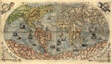
 1500s Waldseemuller Map of America - First Map to Name "America" - 20x36
-
$39.99
 Collier's World Atlas and Gazetteer Old Maps 1939 HARDCOVER Color Black & White
-
$22.00
 1865 Map ~ AFRICA ~ Authentic Johnson Map (18x27)-#1978
-
$31.64
 Vintage 1902 WORLD Map 22"x14" ~ Old Antique Original NORTH AMERICA EUROPE ASIA
-
$24.95
 1600s “Typus Orbis Terrarum” Vintage Style Abraham Ortelius Map - 24x32
-
$28.76
 Vintage 1903 WORLD Map 22"x14" ~ Old Antique Original NORTH AMERICA AFRICA ASIA
-
$46.95
 Juneau Alaska JULY 1904 HIGHLY DETAILED STREET MAP 17" X 20" (two maps)
-
$26.95
 1565 Exploration World Map Large Terra Wall Print 24x42
-
$50.00
 Vintage Gold Ancient World Map Framed Nova Totivs Terrarvm Orbis Lithograph
-
$106.25
 mitchell’s new school atlas 1867
-
$212.50
 A Universal Pronouncing Gazetteer With Map By Thomas Baldwin 1845


