 Antiques (US)
-
$400.00

 Historic map Town of Providence beautifully framed - great for office decor
-
$22.05
 1904 Antique PROVIDENCE Street Map City Map of Providence Rhode Island 1608
-
$11.04
 USGS Topographic Map 1984 Survey 30"x60" RI, MA Providence 41071-E1-TM-100
-
$11.25
 USGS Topographic Map PROVIDENCE Rhode Island/MA 1987 1:25000 scale folded map
-
$34.99
 1881 Rand McNally Railroad Map Rhode Island Providence Newport Block Island RI
-
$12.49
 1917 McNally Map - Rhode Island Providence Connecticut New Haven Hartford Mystic
-
$45.95
 1882 Plat Map ~ ROGER WILLIAMS PARK, PROVIDENCE, RHODE ISLAND #19 (XL18x28)
-
$34.99
 1830 Nathan Hale Map Rhode Island Providence Newport Greenwich Watch Hill Canal
-
$24.99
 ORIGINAL 1875 Lancaster PA Map - Providence Township
-
$39.99
 1830 Nathan Hale Map - Rhode Island - Providence Newport Greenwich Bristol - RI
-
$45.95
 1882 Plat Atlas Map ~ Part of WARWICK, RHODE ISLAND -#44 (14x18)
-
$17.24
 Vintage 1901 RHODE ISLAND Map 11"x14" Old Antique Original PROVIDENCE CRANSTON
-
$22.50
 1911 McNally Index Map - Rhode Island Providence Bristol Woonsocket Kingston RI
-
$20.00
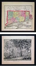
 Connecticut & Rhode Island - Original 1902 Map by The Century Co. RI Antique
-
$23.32
 Vintage 1902 MASSACHUSETTS RHODE ISLAND Map 22"x14" Old Antique Original BOSTON
-
$36.69
 1843 Tallis Antique Print First Baptist & Unitarian Churches Providence Rhode Is
-
$12.49
 1958 McNally Map - Rhode Island - Providence Newport Narrangansett Bay Warwick
-
$14.99
 1884 McNally Map Connecticut Rhode Island Providence New Haven Newport Mystic
-
$45.95
 1882 Plat Map ~ PAWTUCKET - MINERAL SPRING CEMETERY, PROVIDENCE, RI #31 (18x28)
-
$20.00
 1885 McNally Map Connecticut Rhode Island New Haven Hartford Providence Newport
-
$12.99
 Antique 1914 World War WWI Old Atlas City Map Providence, Rhode Island, RI L@@K!
-
$5.99
 L@@K! Vintage 1940 World Atlas Map Rhode Island & South Carolina WWII Providence
-
$45.95
 1882 Plat Map ~ WOODVILLE - JOHNSON - NORTH PROVIDENCE, RI #36 (18x28)
-
$9.99
 1916 PAWTUCKET RIVER RHODE ISLAND PAWTUCKET TO PROVIDENCE HARBOR ENGINEERING MAP
-
$45.95
 1882 Plat Map ~ MOUNT PLEASANT, PROVIDENCE, RHODE ISLAND #13 (XL18x28)
-
$45.95
 Old 1873 Plat Map ~ Twp. 11N - Range 12W ~ NEW PROVIDENCE, GREENE CO., ILLINOIS
-
$45.95
 1882 Plat Map ~ NORTH BURIAL GROUND - PROVIDENCE, RHODE ISLAND #10 (XL18x28)
-
$18.49
 USGS Topographic Map PROVIDENCE Rhode Island MA CT -1984- 100K -
-
$99.00
 1847 Williams Map Connecticut Rhode Island New Haven Hartford Providence RR
-
$65.00
 1892 Rand McNally Railroad Map Connecticut Rhode Island New Haven Hartford RR
-
$39.99
 1857 Morse x 2 - Map & Print - Connecticut Rhode Island & View of Yale College
-
$24.99
 1885 McNally Map Connecticut & Rhode Island Newport Providence New Haven Norwalk
-
$45.95
 1882 Plat Atlas Map ~ BROWN UNIVERSITY - PROVIDENCE, RHODE ISLAND -#2 (XL18x28)
-
$45.95
 1882 Plat Atlas Map PROVIDENCE, RHODE ISLAND - Portion of WARD 10 - #5 (14x18)
-
$87.49
 1891 Massachusetts Topographical Map of Counties East of Providence, RI
-
$45.95
 1882 Plat Atlas Map ~ FOX & INDIAN POINT - PROVIDENCE, RHODE ISLAND #1 (XL18x28)
-
$21.51
 Old 1909 Rand McNally Atlas Map ~ RHODE ISLAND - PROVIDANCE ~ Free S&H
-
$45.95
 1882 Plat Map ~ PAWTUCKET - CATHOLIC CEMETERY, PROVIDENCE, RI #3 (18x28)
-
$24.99
 1846 Boynton Map Connecticut Hartford New Haven Greenwich Stamford Stonington
-
$14.99
 1902 Century Map Connecticut & Rhode Island Newport Providence Mystic New Haven
-
$45.95
 1882 Plat Map ~ GENEVA & WANSKUCK, PROVIDENCE, RHODE ISLAND #11 (XL18x28)
-
$45.95
 1882 Plat Map ~ PROMENADE STREET - PROVIDENCE, RHODE ISLAND #8 (XL18x28)
-
$45.95
 1882 Plat Atlas Map ~ MASHAPAUG POND - PROVIDENCE, RHODE ISLAND -#20 (14x18)
-
$12.00
 Connecticut & Rhode Island - Original 1902 Map by The Century Co. RI Antique
-
$45.95
 1882 Plat Atlas Map ~ HOPE RESERVOIR - PROVIDENCE, RHODE ISLAND -#3 (XL18x28)
-
$104.99
 1891 Massachusetts Topographical Map of Counties East of Providence, RI / B
-
$150.00
 Henry F. Walling 1855 Map of The State of Rhode Island Plantations
-
$21.51
 Old Vintage 1913 Cram's Atlas Map ~ RHODE ISLAND ~ Free S&H
-
$45.95
 1882 Plat Atlas Map ~ BLACKSTONE POND - PROVIDENCE, RHODE ISLAND -#4 (XL18x28)
-
$104.99
 1891 Massachusetts Topographical Map of Counties East of Providence, RI
-
$45.95
 1882 Plat Atlas Map ~ City of PAWTUCKET, RHODE ISLAND -#32 (14x18)
-
$35.00
 C. 1864 Hand-Colored Atlas Map Of Providence Twp., Lancaster, PA 15.75 x 15.5”
-
$50.00
 C. 1864 Colored Atlas Map Of Providence Twp., Lancaster Co., PA 15.75 x 15.5”
-
$20.68
 Vintage 1911 Railroad & County Map ~ RHODE ISLAND ~ Old Authentic ~ Free S&H
-
$28.80
 Large Original 1898 Antique Map RHODE ISLAND Pawtucket Warwick Cranston Newport
-
$19.99
 1873 Illinois Berdan New Providence Township 11 Range 12 Greene Co Antique Map
-
$45.95
 1882 Plat Map ~ PAWTUCKET - CENTRAL FALLS, PROVIDENCE, RHODE ISLAND #30 (18x28)
-
$20.68
 Vintage 1950 Atlas Map ~ RHODE ISLAND - NEWPORT ~ Old & Authentic ~ Free S&H
-
$12.49
 1884 Rand McNally Map - Connecticut Rhode Island - Providence New Haven Newport
-
$12.49
 1902 Century Atlas Map Connecticut & Rhode Island - Newport Providence New Haven
-
$20.68
 Old Vintage 1925 State & County Map ~ RHODE ISLAND ~ Free S&H
-
$23.50
 Bridgen Atlas 1864 Antique Colored Map Providence Township Lancaster PA VG-
-
$45.95
 1882 Plat Atlas Map ~ Part of SEEKONK, RHODE ISLAND Plate #26 (14x18)
-
$45.95
 1882 Plat Map ~ PUBLIC & EDDY STREET, PROVIDENCE, RHODE ISLAND #17 (XL18x28)
-
$48.75
 1918 Map of PROVIDENCE Rhode Island w/ Chalkstone Pleasant Valley & Smith Street
-
$45.95
 1882 Plat Map ~ FRUIT HILL, NORTH PROVIDENCE, RI #35 (18x28)
-
$45.95
 1882 Plat Map ~ RHODE ISLAND HOSPITAL - PROVIDENCE, RHODE ISLAND #6 (XL18x28)
-
$500.00
 Vintage One-of-Kind 1963 RHODE ISLAND and Providence Plantations US Map Poster
-
$15.00
 Providence, Rhode Island....Antique Map, Plan..1892
-
$45.95
 1882 Plat Map 10 MILE RIVER, HAMMONDS POND, PROVIDENCE, RHODE ISLAND #28 (18x28)
-
$45.95
 1882 Plat Map ~ DYERVILLE POND, PROVIDENCE, RHODE ISLAND #12 (XL18x28)
-
$45.95
 1882 Plat Map ~ LEONARDS POND - PROVIDENCE, RHODE ISLAND #8 (XL18x28)
-
$22.99
 Original 1909 USGS Topo Map PROVIDENCE Kentucky Tradewater River Wheatcroft Clay
-
$45.95
 1882 Plat Map ~ HUGHESDALE - DYERVILLE, JOHNSTON, RHODE ISLAND #37 (18x28)
-
$215.00
 1895 WESTERLY, RI., MAP REMOVED FROM THE EVERTS & RICHARDS ATLAS OF 1895
-
$78.00
 HOPKINS 1871 LOWER PROVIDENCE MAP MONTGOMERY COUNTY PA
-
$12.00
 vintage 1939 atlas map of South Carolina and Rhode Island 2 sided 11x14 to frame
-
$19.99
 Original 1897 Map CONNECTICUT RHODE ISLAND Newport New Haven Hartford Providence
-
$9.99
 Original 1888 Map MASSACHUSETTS RHODE ISLAND Newport Providence Worcester Revere
-
$29.99
 1890 Topo Map of PROVIDENCE QUADRANGLE, MASSACHUSETTS & RHODE ISLAND
-
$30.00
 Antique Original 1917 USGS Map of Providence, R.I., Area
-
$47.50
 1876 Providence RI Map Rhode Island JD Thompson folded
-
$95.00
 Original 1906 map of Provincetown, Mass. Cape Cod topographic
-
$78.00
 HOPKINS 1871 UPPER PROVIDENCE MAP MONTGOMERY COUNTY PA TRAPPE COLLEGEVILLE
-
$31.96
 Pennsylvania Lancaster County Map Providence Township 1875 Dbl Side Y15#26


