 Antiques (US)
-
$75.99

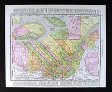
 1873 Mitchell's Map Of Quebec counties Authentic Hand-colored Antique Montreal
-
$55.00
 1886 Mitchell Map No. Amer.-Canada's Extinct Prov.-Arctic Explorers-Alaska Terr
-
$19.00
 Original 1860 S. Augustus Mitchell map of canada east hand colored!
-
$49.99
 1867 antique map Canadian Maritimes New Brunswick Nova Scotia hand-colored
-
$9.99
 1907 Rand McNally Map - Quebec Montreal St. Johns Joilette Lawrence River Canada
-
$109.99
 1849 Vintage ORIGINAL North America USA Antique Map Mitchell Atlas 14" x 17.5"
-
$17.99
 1888 Mitchell Map Dominion of Canada Ontario Nova Scotia Alberta Manitoba Quebec
-
$75.00
 1860 US Canada Mexico C. America Mitchell antique map 15.3" x 12.5" hand color
-
$89.00
 1849 Canada East by Mitchell antique map ~ 17.4" x 13.8" - Quebec city
-
$105.00
 1849 Canada West by Mitchell antique map ~ 17.4" x 13.8" - Toronto
-
$49.99
 1867 Antique map of Quebec and Montreal Mitchell Brothers Hand-colored engraved
-
$109.99
 1849 Vintage ORIGINAL East Canada Quebec Antique Map Mitchell Atlas 14" x 17.5"
-
$109.00
 1849 United States by Mitchell antique map ~ 17.4" x 13.8" - Eastern US
-
$127.00
 1849 Mitchell Map Quebec, Lower Canada, Canada East, Nova Scotia, New Brunswick
-
$109.00
 1849 North America by Mitchell antique map ~ 17.4" x 13.8" - US Canada Mexico +
-
$99.99
 New Brunswick, Cape Breton Island and Prince Edward Island 1876 Original Map
-
$99.99
 Quebec 1876 Original Map Published by S. Augustus Mitchell, Jr., Philadelphia


