 Antiques (US)
-
$225.00

 Palm Beach Atlas Sheets 25 and 25-A - Via Vizcaya to Via Bellaria
-
$225.00
 Palm Beach Atlas Sheets 1 and 1-A North End of Palm Beach and the Inlet
-
$225.00
 Palm Beach Atlas Sheets 18 and 18A - Barton Ave to Sea View Ave
-
$125.00
 Palm Beach Atlas Sheet 26-A Borders Mar-A-Lago Palmsicle Island
-
$49.95
 National Geographic Map - Africa - 1935 - with Index Booklet - Vintage
-
$56.21
 Antique Map Of Warwickshire,colour And Framed 16 Inches Tall ,watermark Bottom R
-
$12.48
 National Geographic Map - The Earth's Moon 1969
-
$18.72
 National Geographic Map - West Indies - 1954 - Vintage
-
$31.21
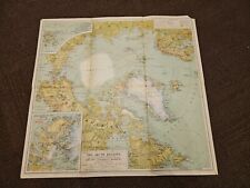 National Geographic Map - Arctic Regions - 1925 - Vintage
-
$24.97
 National Geographic Map - Australia - 1948 - Vintage
-
$24.97
 National Geographic Map - British Isles - 1958 - Vintage
-
$24.97
 National Geographic Map - British Isles - 1949 - Vintage
-
$225.00
 Palm Beach Atlas Sheets 16 and 16A - Royal Poinciana Way- Breakers - Post Office
-
$225.00
 Palm Beach Atlas Sheets 14 and 14A - Wells Road South to Root Trail/Oleander Av
-
$125.00
 Palm Beach Atlas Sheet 17-A - The Breakers Cocoanut Walk to Barton Ave Whitehall
-
$125.00
 Palm Beach Atlas Sheet 23-A - Jungle Point - Everglades Island
-
$24.97
 National Geographic Map - Indian Ocean Floor - 1967 - Vintage
-
$24.97
 National Geographic Map - Northwestern Africa - 1966 - Vintage
-
$18.72
 National Geographic Traveler's Map of Italy - 1970 - Vintage
-
$16.23
 National Geographic Map - Australia - 1963 - Vintage
-
$31.21
 National Geographic Map - Africa - 1943 - Vintage
-
$18.72
 National Geographic Map - Lands Of The Eastern Mediterranean - 1959 - Vintage
-
$31.21
 National Geographic Map - Indian Ocean- 1941 - Vintage
-
$24.97
 National Geographic Map - Northern And Southern Hemispheres - 1943 - Vintage
-
$24.97
 National Geographic Map - West Indies and Central America - 1970 - Vintage
-
$18.72
 National Geographic Map - Europe and The Near East - 1949 - Vintage
-
$18.72
 National Geographic Map - the World - 1957 - Vintage
-
$18.72
 National Geographic Map - the World - 1951 - Vintage
-
$16.99
 Antique Map 127 Years Old - World Map with Ocean currents and political division
-
$331.00
 Antique Map London Post Office Directory 1885 South London
-
$28.99
 VINTAGE GIFT WRAP WRAP PAPER WORLD MAP Rossler Papier 3393 WEST GERMANY
-
$60.00
 Antique 1865 Bible Map Engravings Canaan Jerusalem Travels of Jesus and St. Paul
-
$18.72
 National Geographic Map - Mexico and Central America - 1953 - Vintage
-
$12.48
 National Geographic Map Of The Top Of The World Oct 1949
-
$18.72
 National Geographic Map - West Indies - 1962 - Vintage
-
$43.70
 National Geographic Map - Antarctic Regions - 1932 - Vintage
-
$24.97
 1971 GULF of SUEZ - RED SEA North Africa Navigation Sea MAP CHART 28" x 41" C47
-
$31.21
 National Geographic Map - The Nile Valley - 1965 - Vintage
-
$32.48
 Antique Map of The British Graham Land Expedition & earlier Antarctic Expeds
-
$24.97
 Antique/Vintage Map of Depth of the Polar Ice Caps - 1954
-
$24.97
 National Geographic Map - South America - 1950 - Vintage
-
$24.97
 National Geographic Map - Eastern South America - 1955 - Vintage
-
$35.00
 Map of Products (Hay, Tobacco, Cotton) in the USA - 1877
-
$22.47
 National Geographic Map of The Heavens -Monthly Star Chart Both Hemispheres 1970
-
$131.15
 Antique Engraving "Geometry" Richard Blome, 1710
-
$24.97
 1966 CANADA Nova Scotia STRAIT of CANSO Admiralty Map Chart 28" x 41" D100
-
$325.00
 1928 Chocolate Map of The World Game of Goose, Talmone-Unica Cacao Factory
-
$50.00
 Map of Orange County California Reusable Plastic Bag - BLUE Handles & Border -
-
$100.00
 Palm Beach Atlas Sheet 24-A
-
$125.00
 Palm Beach Atlas Sheet 15 - Seminole Ave. to Main Street and The Breakers
-
$125.00
 Palm Beach Atlas Sheet 3 - North End of Palm Beach
-
$8.74
 1962 LARGE MAP ~ NEW ZEALAND NORTH ISLAND AUCKLAND AND ENVIRONS
-
$6.00
 Leisure World Map - 1982 - Mesa, AZ
-
$75.00
 Historie Complète de la Grande Éruption du Vésuve de 1631 (1865) (Matted)
-
$24.97
 Arthurian Cornwall framed vintage illustrated map King Arthur legends hippie
-
$50.00
 Map of Orange County California Reusable Plastic Bag - Orange Handles & Border -
-
$16.23
 Antique/Vintage Map of Western Dronning Maud Land - 1955
-
$27.00
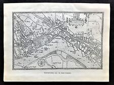 1904 Antique Map of "Westminster in 1593 " by John Norden ~ Birds Eye View
-
$24.97
 1971 BRAZIL East Coast RECIFE to RIO DOCE Admiralty Sea MAP Chart 28" x 46" C34
-
$218.58
 Rare Chronological Tree of Scottish History Hanging Scroll 25 x 18in c1832.
-
$131.15
 Antique Engraving "Metaphisicks" Richard Blome, 1710
-
$24.97
 1965 ARGENTINA River Plate CABO Dos BAHIAS Navigation Sea MAP 28" x 41" B33
-
$22.47
 Antique/Vintage Map of The Arctic Flights of the Aries - 1946
-
$475.00
 WWII Poster "1,250,000 TONS OF AXIS SHIPPING SUNK IN THE CENTRAL MEDITERRANEAN"
-
$1250.00
 Original 1956 Pictorial Map Illustration of Oregon, Senator Wayne Morse Campaign
-
$9.93
 CENTRAL & WESTERN USA MAP (Rand McNally) Including Hawaii & Honolulu
-
$5.35
 G9187 Canton Ticino - Svizzera - 1953 Mappa epoca - Vintage map
-
$37.46
 x1969 NAHA KO Nansei Shoto Okinawa Shima JAPAN Sea Map Chart 28" x 41" D03
-
$8.12
 London and wider area. Original Victorian map 1897.
-
$12.48
 1964 CANADA St LAWRENCE RIVER Entrance ADMIRALTY Map Chart 28" x 48" D64
-
$375.00
 WWII Poster “1000000 Tons of Axis Shipping Sunk in North Sea and English Channel
-
$108.38
 1922 LARGE ANTIQUE MAP ~ PROVINCES OF THE LOWER GANGES ~ BENGAL
-
$31.21
 1969 NEW ZEALAND North Island - Port of TAURANGA Sea Chart MAP 28" x 41" B67
-
$108.38
 1922 LARGE ANTIQUE MAP ~ RUMANIA & ADJACENT STATES ~ BULGARIA
-
$37.46
 1971 NORWAY BRANDS FJORD to LEKA Nautical SEA Navigation MAP Chart 28" x 41" B88
-
$12.48
 Vintage Hector Powe Store Map By Geographia Ltd
-
$24.97
 1969 FLAMBOROUGH HEAD to RIVER TYNE Admiralty Map Sea Chart 28" x 41" C58
-
$68.70
 Vintage SYMBOLS & ABBREVIATIONS Used on Admiralty Navigation Charts 20"w x 28"h
-
$18.72
 1971 GABBARD & GALLOPER BANKS to HOOK of HOLLAND Sea Chart MAP 28" x 44" C09
-
$24.97
 1971 South TURKEY - GELIDONYA BURNU to ANAMUR Admiralty Map Chart 28" x 41" D53
-
$186.11
 Britannia Antique map after Bohn James Gillray Edition c1851 Albinia verso mono
-
$16.99
 Antique Railway Map 127 Years Old - British Isles
-
$37.46
 1971 GREECE Akra Killini to Akra Psaromita - ADMIRALTY Map Chart 28" x 41" D52
-
$37.46
 1963 SPAIN & FRANCE South Coast NAUTICAL Sea Navigation Chart MAP 28" x 52" B72
-
$24.97
 1970 West Coast SPAIN & PORTUGAL Admiralty Navigation Map 28" x 41" D67
-
$93.68
 1875 Austrian Map South Coast England Brighthelmstone! Brighton Vienna Antique.
-
$4.37
 VINTAGE MAP KAART VAN TEXEL NETHERLANDS 1962
-
$24.97
 1965 MEXICO BAHIA SAN HIPOLITO to ROSARIO Navigation Sea MAP CHART 28" x 41" C36
-
$18.72
 1972 LIBYA Mediterranean Sea EZ ZUEITINA - Navigation Chart MAP 28" x 20½" B84
-
$18.72
 1971 CANADA Saint Lawrence River (Above Quebec) Navigation Map 23½" x 41" B26
-
$24.97
 1969 THE SOUND Copenhagen Denmark Sweden BALTIC SEA MAP Chart 28" x 47" D33
-
$24.97
 1969 North Coast SPAIN FOZ to CAMARINAS Admiralty Navigation Map 28" x 41" D68
-
$18.72
 1969 TUNISIA to LIBYA Keliba~Tripoli - Admiralty Sea MAP CHART 28" x 41" D11
-
$24.97
 1969 Germany KIELER HAFEN-FJORD Baltic - Admiralty Sea MAP CHART 41" x 28" C81
-
$24.97
 1967 The SOUND Denmark & Sweden ENTRANCE to BALTIC SEA MAP Chart 28" x 47" D31
-
$24.97
 1972 ENGLAND WEST COAST Approaches BRISTOL CHANNEL Sea MAP Chart 28" x 41" B92
-
$24.97
 1970 AFRICA SE Coast PORT ST JOHN's To DURBAN Sea MAP CHART 28" x 41" C52
-
$24.97
 1971 West Coast SPAIN & PORTUGAL Admiralty Sea MAP CHART 28" x 41" C59
-
$24.97
 1970 SW SPAIN - BAHIA de CADIZ Admiralty Map Chart 28" x 41" D72
-
$37.46
 1970 NORWAY - HELGOY to SOROY Admiralty Sea MAP CHART 28" x 41" D05


