 Antiques (US)
Anchors
Diving Helmets
Fishing Nets & Floats
Harpoons
Maritime Bells, Whistles & Horns
Maritime Blueprints
Maritime Cannons & Cannon Balls
Maritime Cleats & Chocks
Maritime Clocks
Maritime Compasses
Maritime Flags, Ensigns & Pennants
Maritime Folk Art
Maritime Lamps & Lighting
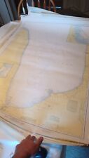
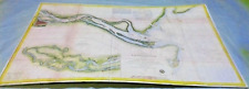
Maritime Navigational Charts
Maritime Navigational Instruments
Maritime Parallel Rules
Maritime Plaques & Signs
Maritime Portholes & Hatches
Maritime Price Guides & Publications
Maritime Propellers
Maritime Pulleys
Maritime Reproductions
Maritime Scrimshaw Replicas
Maritime Telegraphs
Maritime Telescopes
Maritime Wheels
Model Ships
Other Maritime Antiques

-
$1200.00

 Vintage Red Channel Marker Rare Works
-
$41.95
 Massachusetts Geodetic Survey Map x 2 USC & GS Essex County WPA Vintage
-
$22.50
 Pocket NOAA Nautical Chart of Lake Erie #14820
-
$250.00
 Antique Wood Chair from Smith Island Va USLSS Descendants Estate Salty
-
$18.57
 NOAA Nautical Chart of Lake Huron #2297 Drummond Island Wall Art
-
$22.57
 NOAA Nautical Chart of Lake Michigan
-
$20.00
 C&GS Coastal Map. Chesapeake Bay - Rappahannok River Ent. - #573 14th Ed. 1973
-
$19.99
 Vintage Hydrographic Chart Bougainville Strait Solomon Islands 1940s WW2
-
$22.95
 Massachusetts Geodetic Survey Map USC & GS Essex County Haverhill Vintage
-
$199.00
 37 Nautical Signal Flags -Pennants, Letters & Numbers, Heavy Duty Stitched Nylon
-
$9.95
 Five Vintage Seamanship/Navigation Booklets
-
$40.00
 3 U. S. COAST PILOT ATLANTIC COAST PTS. I-IV - ST. CROIX RIVER TO NEW YORK 1903
-
$19.99
 Vintage Hydrographic Chart Savaii Samoa Islands 1928 with WW2 Revisions
-
$34.95
 EDER SIGNAL CODE NAUTICAL FLAG Letter K KILO 2 'X 2' Size 3 ICOS Brass Grommets
-
$64.98
 World War II Era (May 1943) Nantucket Sound & Approaches Nautical Map 8th Ed.
-
$22.50
 Pocket NOAA Nautical Chart of Lake Ontario #14800
-
$20.00
 Nautical Chart Catalog 2 Pacific Coast Hawaii Guam April 1979
-
$19.99
 Vintage Hydrographic Chart San Pedro Bay California 1940s
-
$24.99
 1942 United States Coast Pilot Pacific Coast 6th Edition 1942
-
$30.00
 C&GS Coastal Map - Chesapeake Bay Entrance #1222, 1973, 37th Edition 35”X 45”
-
$35.00
 Survey of Northern & Northwestern Lakes #48 War Dept Corps of Engineers, 1939
-
$30.00
 C&GS Coastal Map - Delaware Bay - #12304 21st Ed. 1974
-
$19.99
 Vintage Hydrographic Chart Los Angeles Harbor Vicinity 1940s
-
$28.57
 NOAA Nautical Chart of Lake Huron Sleeping Bear Dunes Empire Bluffs Glen Arbor
-
$35.00
 Vintage San Diego Bay Nautical Chart #5107 1968 35x43
-
$800.00
 Marine navigation light LED. Brass. never installed..
-
$34.95
 EDER SIGNAL CODE NAUTICAL FLAG 2' x 2' Letter G GOLF ICOS Size 3 Brass Grommets
-
$24.00
 C&GS Coastal Map - Chesapeake Bay - Mobjack Bay To York River #494 18th Ed. 1973
-
$22.00
 Pocket NOAA Nautical Chart of Manitowoc and Sheboygan #14922
-
$34.95
 EDER SIGNAL CODE NAUTICAL FLAG Letter J JULIET 2'X2' Size 3 ICOS Brass Grommets
-
$20.00
 Pocket NOAA Nautical Chart of Lake Huron # 14860 in excellent condition
-
$750.00
 US SHIPWRECK LIFESAVING VOLUNTEERS BROADSIDE 1783 BOSTON MASSACHUSETTS
-
$38.57
 NOAA Nautical Chart of Lake Michigan Green Bay Long Tail Point, Point Sable,
-
$40.00
 “1907” Catalog of charts, coast pilots, and the tide tables By Commerce Dept.
-
$595.00
 Vintage Original Fog Horn Signal Timer Control Box Lighthouse Coast Guard Nautic
-
$22.57
 NOAA Nautical Chart of Lake Huron # 14885 Port Dolomite Marquette Island.....
-
$32.57
 NOAA Nautical Chart of Lake Huron # 14913 Lake Michigan Grand Traverse Bay
-
$18.57
 NOAA Nautical Chart of Lake Huron
-
$34.95
 EDER SIGNAL CODE NAUTICAL FLAG Letter I INDIA 2'X2' Size 3 ICOS Brass Grommets
-
$80.82
 Antique Brass Lighthouse Lantern 15" Ship/Boat Lamp Nautical Home Decor
-
$35.00
 C&GS Coastal Map. Head Of Chesapeake Bay #12274 13th Edition 1974
-
$22.00
 C&GS Coastal Map - New Jersey/Delaware- Cape May To Fenwick #12244 28th Ed. 1975
-
$3500.00
 USLHS US LIGHTHOUSE SERVICE VINTAGE SUPPLY CHEST
-
$750.00
 USLSS Life Saving Service Copper Beach Flare Lantern Original
-
$28.00
 C&GS Costal Map - Fenwick lsland Light -Chincoteague Inlet #12211, 1975, 22nd Ed
-
$25.00
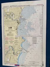
 Original Nautical Chart Map Portsmouth to Cape Ann, MA 1206 Issued 1941
-
$35.00
 C&GS Coastal Map - Baltimore Harbor Entrance #12278, 1974, 40th Edition 36”X 45”
-
$125.00
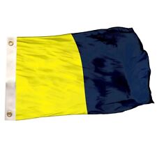
 Vintage Signal Flag “R”
-
$348.00
 Ship's Propeller Iron 22" across Large Cotter Key Older 4 Blade Great!
-
$30.98
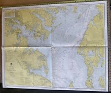
 Nautical plotting Chat SALEM & LYNN MASS HARBORS VTG 1963 edition 36x 39
-
$22.57
 NOAA Nautical Chart of Lake Huron #
-
$99.99
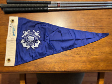 Vintage 1960s USCG U.S. COAST GUARD AUXILLIARY Pennant Flag ~ 23" x 11" ~ EUC
-
$28.00
 C&GS Coastal Map. Chesapeake Bay - Smith Point To Cove Point #1225 26th Ed. 1974
-
$195.00
 Antique Perkins Ship Lantern Electric
-
$22.57
 NOAA Nautical Chart of Lake Huron # 14885 Port Dolomite Marquette Island.....
-
$19.99
 Maritime Nautical Flag Double Sided Letter D Nylon Style 18” Long 12” High
-
$18.95
 VINTAGE NAUTICAL CHART MAP NJ DE DELAWARE RIVER SMYRNA RIVER to WILMINGTON
-
$30.00
 C&GS Coastal Map - Chesapeake Bay - Wolf Trap To Smith Point. #1223 26thEd. 1973
-
$48.57
 NOAA Nautical Chart of St Mary's River
-
$25.00
 Original Nautical Chart Map Chesapeake Bay Entrance 1222 Issued 1940.
-
$125.00
 USCG Coast Guard Auxiliary Pennant Flag- Yellow
-
$25.00
 Original Nautical Chincoteaque inlet to Hog Island Light 1221 Issued 1940
-
$20.00
 C&GS Map 561 7th Edition 1973 Patuxent River, Solomon Island And Vicinity 3’x4’
-
$26.00
 C&GS Costal Map - Delaware River - Smyrna River To Wilmington #12311, 1974, 23rd
-
$45.00
 Vintage Nautical Chart, C & G S #241 -Salem Marblehead and Beverly Harbors
-
$25.00
 Original Nautical Chart Map Delaware River Bombay Hook to Wilm. Issued 1935.
-
$32.57
 NOAA Nautical Chart of Lake Huron #14881 Straits Of Mackinac, St.Igace, Cheboy
-
$200.00
 Vintage Maritime Nautical 'Squadron' Signal Flag 3 1/2 Coast Guard
-
$25.00
 C&GS Costal Map - Chesapeake Bay, Cape Charles To Norfolk Bay #562 11th Edition
-
$25.00
 Original Nautical Chart Map Chesapeake Bay Wolf Trap to Smit Pt 1223 Issue 1942.
-
$55.00
 20+ Vtg. Hydrographic Maritime Maps Charts Lake Huron Erie St. Clair Islands
-
$28.57
 NOAA Nautical Chart of Lake Huron Michigan Make Great Wall Poster Free SHIPPIN
-
$29.99
 VINTAGE NAUTICAL CHART 4/5/1969 POINT SUR TO SAN FRANCISCO 7423g
-
$28.00
 FISHER ISLAND SOUND Nautical Chart C.& G.S. 358
-
$45.00
 Vintage Nautical Chart, C & G S #346 -Edgartown Harbor, Marthas Vineyard
-
$47.00
 Savannah River Chart 1855 40''X24''
-
$34.99
 VINTAGE NAUTICAL CHART 1997 WEST QUODDY HEAD TO NEW YORK 43023e
-
$55.77
 Maritime Nautical Flag Double Sided (Letter O) Nylon Style 18” Long 12” High
-
$45.00
 Vintage Nautical Chart, C & G S #347 -Vineyard Haven, Marthas Vineyard
-
$29.99
 VINTAGE 1963 NANTUCKET SOUND OSTERVILLE TO GREEN POND NAUTICAL CHART 62023j
-
$26.97
 Maritime Nautical Flag Double Sided (Letter I) Nylon Style 18” Long 12” High
-
$49.99
 LOT OF 2 Nautical Chart Map Sandy Hook to Little Egg Harbor NJ 1984 & 1985
-
$14.99
 NAUTICAL CHART 1997 NANTASKET BEACH COHASSET HARBOR 2 SIDED 5723e
-
$275.00
 Antique ARTS AND CRAFTS Brass Lamp Light 3 WICK Lantern HANDLED Nautical Ship
-
$3294.00
 70 x Antique Maritime Nautical Charts - Maine, California, Cape Cod, MA, Etc.
-
$120.00
 VINTAGE NAUTICAL CHARTS - 8 TOTAL - GUADELOUPE AND MARTINIQUE - SHIPS FREE
-
$288.75
 USCG "Star Pathfinder" 1930s 2 1/2" Compass With Mahogany Dovetail Box & Papers
-
$108.19
 VINTAGE ORANGE SMOKE DISTRESS SIGNAL CANISTER, COPPER & BRASS, COSTON SUPPLY CO.
-
$24.50
 Weems & Plath Ultralight Divider #176 No Case Light Use
-
$24.99
 VINTAGE 1973 PORTSMOUTH HARBOR NAUTICAL MAP 33X44 INCH #211 NOAA 51423d
-
$39.99
 VINTAGE 1976MARTHA'S VINEYARD TO BLOCK ISLAND NAUTICAL CHART 37 X 42 INCH 71123f
-
$39.99
 VINTAGE 08 NAUTICAL CHART NAVESINK AND SHREWSBURY RIVERS & SANDY HOOK BAY 42423d
-
$8.00
 U.S. Coast Guard Auxiliary Boating Skills & Seamanship 9th & 10th Editions
-
$170.00
 Antique 1800s Boat Anchor with a long Chain
-
$2950.00
 Bronze Ship's Propeller
-
$900.00
 Marine navigation light removed from bridge after hurricane-new wiring.


