 Antiques (US)
-
$159.99

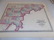
 Vintage 1938 Map Historic & Scenic Reaches of the Nation's Capital Washington DC
-
$32.25
 1875 Iowa 17" Map Keokok County Sigourney, Brighton, Agency, Washington Plats S1
-
$24.95
 1886 Original Mitchell Map Virginia, West Virginia, North Carolina Maryland &DC
-
$40.00
 USGS Topo Map 7.5 Min Vintage : Washington, CA 1979 Used BEAUTIFUL Rare Gem
-
$58.00
 1861 Fort Washington Maryland Potomac River ENGRAVED PRINT Mount Vernon ORIGINAL
-
$21.30
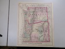
 1891 OREGON MAP WASHINGTON ANTIQUE FULL COLOR RAILROADS MOUNTAINS VICTORIAN ERA
-
$12.89
 USGS Geologic Map: Pendleton Quadrangle, Oregon and Washington
-
$11.99
 1884 McNally Map Vermont New Hampshire Concord Montpelier Mt. Washington NH VT
-
$48.00
 1853 Map Virginia North Carolina Map ORIGINAL Maryland Cape Fear Washington DC
-
$24.99
 1875 Antique COLOR Gray’s Atlas Map / OREGON and WASHINGTON
-
$295.00
 1887 Antique reprint of 1792 Plan of the City of Washington DC Hand Colored Map
-
$44.88
 1931 NORTH CAROLINA Map ORIGINAL Virginia Pamlico Sound Washington DC Maryland
-
$58.88
 1861 Civil War Engraving Georgetown Washington Heights New York Regiment Camp
-
$15.00
 Map Washington USGS Maine 1973 Topographic Vintage 1:24000 27x22" #2 TOPO11
-
$14.00
 WASHINGTON 1894 Original plan map United States
-
$75.99
 1873 Mitchell's Atlas Map, City Plan of Washington D.C. Authentic Hand-Colored
-
$48.00
 1831 WASHINGTON DC Engraved Print Department of States ORIGINAL Fenner & Sears
-
$129.99
 Original 1872 Map OREGON & WASHINGTON TERRITORY Wagon Trails Indians Forts Mines
-
$9.99
 American Revolutionary War Washington's March to Yorktown New Jersey Virginia
-
$67.88
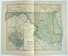
 1889 MARYLAND DELAWARE Map Original Chesapeake Bay Richmond Washington Norfolk
-
$24.95
 Quinton Oregon and Washington 1971 Original USGS Topographical Topo Map
-
$24.95
 Sundale NW Oregon and Washington 1971 Original USGS Topographical Topo Map
-
$9.99
 1903 Tunison Antique - 2 Charts - United States Economy Imports Exports Industry
-
$15.99
 1937 Cram Map Pittsburgh Pennsylvania Mt. Washington Duquesne Hts Point Park PA
-
$12.50
 1914 Plat Map City of Springfield & Environs Illinois Jefferson & Washington
-
$16.16
 1937 Antique WASHINGTON DC City Map Washington DC Street Map Wall Decor 1418
-
$11.99
 1937 Map Portland Oregon City Plan Washington Park Mt. Tabor Willamette River OR
-
$17.50
 1910 Plat Map City of Joliet Illinois Will County Broadway Washington Heights #4
-
$175.00
 RARE OVERSIZE VINTAGE WASHINGTON DC MAP 1939 -G.W. BAIST- SPECIAL PRICING!
-
$22.05
 1895 Antique WASHINGTON DC Street Map City Map Of DC Gallery Wall Decor 495
-
$39.99
 Washington DC 1986 Map Union Station Merchandising Map Souvenir Retail Map
-
$35.99
 Antique 1921 Topographic Map - Washington, Kansas - 20" x 16.5"
-
$39.99
 1855 Johnston Military Map War of 1812 United States Canada Great Lakes Niagara
-
$19.99
 Vintage Aeronautical Chart La Grande Oregon Bordering Idaho Washington 1950s
-
$48.88
 1956 Maryland Map Washington DC Baltimore Annapolis Wilmington Easton Cambridge
-
$56.88
 1855 Montana Native Americans Gov Stevens LITHOGRAPH ORIGINAL Washington Terr.
-
$30.08
 1874 Map ~ St CLAIR - MONROE - RANDOLPH - PERRY - WASHINGTON Co., ILLINOIS
-
$19.00
 1890 Colored County Wisconsin Map w/ Michigan on Reverse, 14 1/8" x 10 7/8"
-
$24.75
 1900 Antique WASHINGTON DC Street Map George Cram Washington DC City Map 1239
-
$18.00
 Map Washington Maine USGS 1973 Topographic Vintage 1:24000 27x22" TOPO11
-
$29.00
 Antique Map Washington DC Virginia Maryland Delaware W Virginia Potomac 2 sided
-
$45.95
 Old 1898 Map WASHINGTON Twp., HARRISON Co. MISSOURI ~ WHITE OAK Twp. on Reverse
-
$45.95
 Vintage 1874 Railroad & Land Owner Plat Map ~ WASHINGTON Twp. SANDUSKY Co, OHIO
-
$24.50
 1910 Plat Map Town of Beecher Will County Illinois Washington Township
-
$19.99
 Vintage COUNTY AND TOWNSHIP MAP OF OREGON AND WASHINGTON - 1894 A. L. Smith
-
$19.00
 Oregon & Washington - Original 1903 Dated Map by Dodd Mead & Company. Antique
-
$32.50
 City of Armada Antique Plat Map 1895 Macomb County Michigan Washington P.O.
-
$19.99
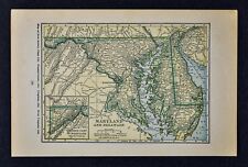
 c 1900 George Cram Map Maryland Delaware Washington DC Baltimore Alexandria VA
-
$54.00
 1876 Plat Map WASHINGTON GEORGETOWN Ohio DEFIANCE County LARGE ORIGINAL
-
$22.40
 1880’s Antique Cram's Atlas Map Of Washington OR Oregon (2 Sided) Framed 11x14
-
$45.95
 Vintage 1922 Plat Map ~ WASHINGTON Twp. HARRISON Co. IOWA ~ Ancestry Land Owners
-
$20.68
 Old Antique 1895 City Map WASHINGTON CD - GEORGETOWN - POTOMAC RIVER - Free S&H
-
$9.99
 1900 McNally Map - Vermont New Hampshire Concord Montpelier Mt. Washington NH VT
-
$15.99
 1907 Lithographed Economic Geology Map of The Amity Quadrangle Pennsylvania
-
$45.95
 1917 Plat Map ~ EMERALD Twp., PAULDING Co., OHIO / WASHINGTON Twp. on Reverse
-
$7.00
 What did our National Parks System look like in 1958 ? Original Map US & Canada
-
$11.99
 West Point Civil War Map Battle of Mine Run Orange County Virginia Nov 26-Dec 1
-
$45.00
 1861 Plan of Washington by Mitchell beautiful antique frame City map Civil War
-
$79.20
 1926 Clason Auto Road Map & Distance Chart United States Transcontinental Trails
-
$27.99
 1882 Watson Map Washington Oregon Idaho Montana Seattle Eugene Boise Olympia
-
$18.00
 Maryland & Delaware - Original 1907 Dated Map by Dodd Mead & Company. Antique
-
$45.95
 1876 Railroad & County Map ~ ST CLAIR Co., ILLINOIS ~ WASHINGTON Co. on Reverse
-
$20.00
 1882 Watson Map Maryland Delaware Washington DC Baltimore Annapolis Dover MD DE
-
$27.99
 c 1889 Cowperthwait Map - United States - Indian Territory & Oklahoma Lands Rush
-
$45.95
 1875 Map CEDAR RAPIDS, MARION, Twps. /LEXINGTON, WASHINGTON Co. IOWA on Reverse
-
$11.60
 USGS Geologic Map: West Half of Spokane Quadrangle, Washington and Idaho
-
$79.00
 Antique Map Washington Territory Milk & Columbia River Montana WA 1860 LARGE
-
$7.99
 Great Vintage 1946 OLD Atlas City Map Washington, DC Antique Post World War WWII
-
$45.95
 1876 Map CARLYLE - LEBANON Twp, St CLAIR Co, ILLINOIS / WASHINGTON Co on Reverse
-
$45.95
 Old 1866 Johnson Atlas Map ~ WASHINGTON TERRITORY - OREGON - MINNESOTA ~Free S&H
-
$21.45
 USGS Topographic Map WALLOWA - Oregon Washington - 1982 - 100K -
-
$13.00
 1895 Antique Rand McNally city map of Main Portion of WASHINGTON DC, 11"x14".
-
$349.99
 3 - Potomac Anacostia Rivers & Rock Creek Maps Washington D.C. c. 1880s
-
$45.95
 1876 Map ~ DAVIESS Co.- WASHINGTON, INDIANA // MITCHELL - BEDFORD on Reverse
-
$175.00
 1855 Antique Washington & Oregon Territories - Hand-Colored From Colton's Atlas
-
$20.68
 1897 Century Atlas Map ~ MARYLAND DELAWARE WASHINGTON DC (12x18) ~ Free S&H #264
-
$255.00
 1860 Washington & Oregon Mitchell antique map 15.4" x 12.6" rare 1st edition
-
$52.00
 Civil War Map Richmond & Petersburg Battles Virginia Shenandoah Washington DC VA
-
$75.00
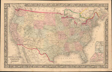 1860 United States & Territories by Mitchell beautiful antique map 22.7" x 14.7"
-
$12.99
 OREGON WASHINGTON 1967 MAP FOLD OUT THE DALLES DAM OR VINTAGE BROCHURE WASCO WA
-
$39.99
 1868 Atlas of OHIO Map / COUNTIES OF WASHINGTON, ATHENS, MEIGS / B
-
$24.99
 1963 Washington, Indiana US District Court Plat Wall Map 30"x23.5" - folded
-
$22.00
 1890 Colored Arizona Map w/ New Mexico on Reverse, 14 1/8" x 10 7/8", Counties
-
$25.95
 1935 Vintage Antique MT. WASHINGTON NH New Hampshire USGS Topographic Map
-
$20.68
 Old 1896 Fisk & Co. Atlas Map ~ WASHINGTON - OREGON ~ Free S&H ~(11x14) #257
-
$19.99
 c 1900 George Cram Map Maryland Delaware Washington DC Baltimore Dover Anapolis
-
$9.99
 1927 Hammond Map - Maryland Delaware Washington DC Dover Baltimore Wilmington
-
$39.00
 1878 Oregon Washington MT ID Mitchell antique map 15.1" x 12.3" - nice color
-
$19.99
 1886 Banker Attorney Map by Cram - Virginia & West VA Maryland Washington DC
-
$9.99
 Original 1925 Map MARYLAND DELAWARE DISTRICT OF COLUMBIA Washington Baltimore
-
$15.99
 1937 McNally Map Washington DC US Capitol Mint Lafayette Square Potomac Park
-
$9.99
 1917 McNally Map - United States America - Texas California Florida New York
-
$9.99
 1914 McNally Map New Hampshire Concord Manchester Seabrook Laconia Mt Washington
-
$16.00
 1885 McNally Map - Vermont New Hampshire Concord Montpelier Mt. Washington
-
$24.99
 1886 Van Wert County, OH, Map / WASHINGTON TOWNSHIP, OHIO
-
$39.99
 1903 Tunison Map United States - Indian Territory Oklahoma Alaska Texas Florida
-
$23.99
 1878 Pennsylvania Geology Map Washington County Canonsburg California Coal Beds
-
$60.00
 1886 Tunison Map United States Indian Territory Oklahoma Dakota Texas California
-
$24.18
 1840 W Bartlett Antique Print George Washingtons Tomb Mt Vernon Virginia (35166)
-
$17.00
 WASHINGTON 1905 JANUARY dated Original plan map United States


