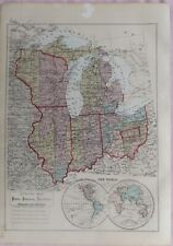
 Antiques (US)
-
$128.88

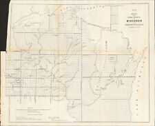
 1840 Wisconsin Green Bay Map ORIGINAL Astor Lake Michigan Survey RARE
-
$57.00
 1956 Map WISCONSIN Milwaukee Green Bay Appleton Madison Eau Claire Lake Superior
-
$97.00
 1949 United States Map ORIGINAL West Indies America Mexico Florida Great Lakes
-
$37.00
 1934 Map WISCONSIN County Township Railroads Madison Lake Superior Milwaukee
-
$22.50
 Original 1915 Plat Map City West Bend Wis Aluminum Co. Train Depot Brewery Nice
-
$17.50
 1899 Plat Map Albion Township Dane County Wisconsin Rich Lake Koshkonong
-
$43.88
 1899 WISCONSIN Map ORIGINAL Green Bay Madison RAILROADS Superior Milwaukee
-
$18.79
 MICHIGAN & WISCONSIN Map: Genuine 1891 Towns Counties Railroads Area Population
-
$19.99
 Burlington Wisconsin Vintage Map 1974 Racine County
-
$17.50
 1899 Plat Map City of Mazomanie or Oregon Dane County Wisconsin
-
$2.99
 Rare 1954 Map of Milwaukee County, Milw. County Department of PublicWorks
-
$47.88
 1900 United States Map ORIGINAL Oat Farming Production Agriculture Texas Iowa
-
$39.95
 1986 Historical Atlas Richland County WI Illustrated Taylor Publishing Co.- Good
-
$197.50
 Geological Map of Iowa Minnesota & Wisconsin Coal Field 1851 huge scarce
-
$75.00
 Wisconsin Lake Michigan 1872 scarce large Asher & Adams hand colored state map
-
$29.25
 1930s Animated WISCONSIN Picture Map RARE Map of Wisconsin State Map BLU 9976
-
$45.95
 1876 WISCONSIN Map ~ Original National Atlas Map by O.W. Gray ~ (14x17) #019
-
$13.95
 Bird's Eye View 1898 Milwaukee Wisconsin Vintage Style City Map - 8x24
-
$11.86
 Vintage WISCONSIN Map Wall Art Old Original 1940s Antique Milwaukee Green Bay
-
$68.95
 1908 antique WISCONSIN STATE MAP 28x21 includes railroad
-
$12.95
 Vintage WAUSAU Map Wisconsin Topographic Old Original Antique Marathon County
-
$16.00
 Midwestern USA - Original 1909 Map by John Bartholomew. Antique
-
$45.95
 1873 Plat Map ~ HUSTISFORD, RANDOLF, WAUPUN, NEOSHO Twp., DODGE Co., WI
-
$45.95
 1874 Plat Map FAYETTE Twp., YELLOWSTONE, LAFAYETTE COUNTY, WISCONSIN (16x26) #8
-
$22.50
 Original 1915 Plat Map City West Bend Wis Bottling Works Railroad Canning Gehl
-
$22.50
 Original 1915 Plat Map Town Of West Bend Nabob Cedar Lake Silver Lake Timmers
-
$23.96
 Map Walworth Township Lake Geneva Wisconsin F Krause As Is Antique Early Vintage
-
$45.95
 1923 Original Plat Map ~ WAUPACA Twp. County Seat of WAUPACA Co., WISCONSIN
-
$89.95
 Rare Earliest Version 1852 Mitchell Map №15 Wisconsin & Michigan & U .P.
-
$44.95
 Antique 1891 29" x 34 1/2" Map of Elkhorn, Walworth County, WI (2 Sections), EUC
-
$19.50
 Antique 1914 Map Of Milwaukee Wisconsin 11x15 Inches
-
$22.05
 1900 Antique SUPERIOR Wisconsin Street Map George Cram City Map of Superior 6789
-
$17.50
 1899 Plat Map Dunn Township Dane County Wisconsin Lake Waubesa Kegonsa Mud Hook
-
$17.50
 1899 Plat Map Mazomanie Township Dane County Wisconsin River
-
$200.00
 1916 Standard Atlas of Lafayette County Wisconsin Plat Book Ogle
-
$18.00
 Michigan & Wisconsin - Original 1903 Map by Dodd Mead & Company. Antique
-
$45.00
 1844 one-page School Atlas Map by Olney "MICHIGAN, WISCONSIN and Part of Iowa"
-
$10.00
 1895 ANTIQUE PLAT ATLAS OF WISCONSIN-MAP OF SEYMOUR TOWNSHIP-EXCELLENT DETAIL
-
$48.00
 1916 WISCONSIN Map ORIGINAL Madison Green Bay Lake Superior Portage Ashland
-
$32.50
 Wisconsin & Michigan Great Lakes 1852 Mitchell JH Young early hand colored map
-
$17.50
 1899 Plat Map Bristol Township Dane County Wisconsin
-
$67.49
 1846 RARE ORIGINAL MAP TEXAS REPUBLIC UNITED STATES NEW YORK FLORIDA MICHIGAN
-
$45.95
 1874 Plat Map ~ ARGYLE Twp., LAFAYETTE COUNTY, WISCONSIN (14x16) #008
-
$45.12
 Old 1913 Plat Atlas Map ~ WESTBORO & RIB LAKE Twp., TAYLOR Co., WISCONSIN
-
$45.95
 1923 Plat Map WEYAUWEGA - EVANSWOOD Twp., WAUPACA Co., WISCONSIN ~ ADAM'S PLAT
-
$19.99
 1876 Wisconsin Illinois Ohio Indiana Michigan Antique Centinnial Atlas Map
-
$17.50
 1899 Plat Map Cottage Grove Township Dane County Wisconsin Vilas P.O.
-
$9.95
 1898 ANTIQUE CRAM ATLAS MAP OF WISCONSIN-UNITED STATES-EXCELLENT DETAIL
-
$5.35
 1915 Antique WISCONSIN Miniature Atlas Map (8" x 5.5") Hammond's Handy Atlas
-
$79.99
 Marquette County Wisconsin 1938 Plat Book w/ 1938 County Map
-
$23.50
 Antique Multicolor 1885 Map Michigan Wisconsin Illinois Ohio Kentucky Indiana
-
$17.99
 1875 Warrens Report Wisconsin River Map Ghost Town Richland City Spring Green
-
$17.50
 1899 Plat Map York Township or City of Stoughton Dane County Wisconsin
-
$9.75
 Rand, McNally & Co Antique 1904 Map Of Wisconsin 7x6
-
$24.99
 1880 Antique Atlas Map / ILLINOIS, WISCONSIN, IOWA, MISSOURI, MINNESOTA
-
$17.50
 1899 Plat Map Pleasant Springs Township Dane County Wisconsin Clarkson Kegonsa
-
$14.50
 1899 Plat Map Blooming Grove Township Dane County Wisconsin Lake Monona
-
$25.15
 Vintage 1903 WISCONSIN Map 14"x22" ~ Old Antique Original ASHLAND MILWAUKEE WI
-
$23.74
 Huge Lot Of Wisconsin Maps plus One Large US Map
-
$45.95
 Antique 1878 Map ~ OUTAGAMIE Co. - APPLETON, WISCONSIN ~ Old Authentic Ancestry
-
$17.50
 1899 Plat Map Perry Township Dane County Wisconsin Forward P.O.
-
$45.95
 (Lg17x28) Old 1890 Plat Map ~ FOX LAKE, DODGE Co., WISCONSIN ~ JUNEAU on Reverse
-
$6.98
 1956 Antique WISCONSIN Atlas Map Vintage Hammond's Family Reference World Atlas
-
$39.99
 1853 Gunnison Survey Map FOR NEW CHANNEL FROM MILWAUKEE RIVER TO LAKE MICHIGAN
-
$4.35
 1947 Antique WISCONSIN Authentic Old Atlas Map - Rand McNally World Atlas
-
$45.95
 Old 1861 Johnson Atlas Map ~ MICHIGAN - WISCONSIN ~ DETROIT - MADISON - SUPERIOR
-
$45.95
 Old 1915 Plat Map ~ SHELDON, OIL CITY, Twp., MONROE Co., WISCONSIN (LG14x17)
-
$45.95
 Old 1890 Plat Map ~ CITY of BEAVER DAM (SOUTH), DODGE Co., WISCONSIN (Lg17x28)
-
$46.76
 Vintage 1878 BUFFALO COUNTY WISCONSIN Map 14"x17" ~ Old Antique Original MONDOVI
-
$30.00
 Antique Wisconsin De Forest Windsor Deansville Monona Prospect Hill Plat Map
-
$45.95
 1863 Map ~ WISCONSIN - MICHIGAN ~ Authentic Johnson Atlas Map (18x27)-#013
-
$24.99
 1940's Army Topo Map Tomah Wisconsin 2871 I Wilton Norwalk Camp McCoy
-
$17.24
 Vintage 1901 MILWAUKEE WISCONSIN Map 11"x14" Old Antique Original CONCORDIA
-
$45.95
 1874 Plat Map MARSHFIELD Twp., FOND du LAC Co, WISCONSIN Local Scenes on Reverse
-
$14.99
 1961 DODGE COUNTY, WISCONSIN PLAT BOOK 56 PAGES
-
$15.95
 Wisconsin & Minnesota Vintage 1894 MAP ~Unique Atlas ~ Original Color Map
-
$99.99
 Ashland Bayfield Wisconsin WI Wis County Fold Out Maps 1917 ABSOLUTELY BEAUTIFUL
-
$17.00
 1944 Vintage Map - State of Wisconsin - Madison - Milwaukee - Green Bay
-
$16.95
 1940s Vintage Wisconsin Picture Map Wisconsin State Map Wall Art Decor 1565
-
$22.50
 Original 1915 Plat Map City Of West Bend Wis WI North Part Water Tower Home Lots
-
$19.99
 1876 Wisconsin Green Lake County Berlin Township North America Antique Map
-
$45.95
 Rare Vintage 1878 Map ~ MILWAUKEE, WISCONSIN ~ Old & Authentic ~ Free S&H #010
-
$17.50
 1899 Plat Map Sun Prairie Township Dane County Wisconsin
-
$16.96
 Vintage MILWAUKEE Map City Street Wisconsin Suburban Vicinity Area 1920s
-
$22.57
 1893 ORIGINAL ANTIQUE MAP OF COLORADO DENVER COLORADO SPRINGS / VERSO WISCONSIN
-
$9.99
 Wisconsin, Grant County 1918 Plat Map Towns/ Clifton Lima Potosi village
-
$20.68
 1892 Cram's Atlas Railroad Map ~ MILWAUKEE, WISCONSIN ~ (LG12x17) -#411
-
$45.95
 1874 Plat Map ~ BYRON Twp., FOND du LAC Co., WISCONSIN ~ Local Scenes on Reverse
-
$9.99
 Wisconsin, Grant County 1918 Plat Map Towns of Paris & Harrison
-
$17.50
 1899 Plat Map City of Sun Prairie Dane County Wisconsin Mendota Beach
-
$45.95
 1874 Plat Map ~ SEYMOUR Twp., LAFAYETTE COUNTY, WISCONSIN (14x16) #006
-
$75.00
 1856 Wisconsin & MN Survey Antique Map Lithograph - Ackerman NY ~ 21.5" x 18.7"
-
$45.00
 Vintage 1936 Map Walworth County WI Vote For Joseph A. Dorr For Sheriff
-
$45.95
 Old 1915 Plat Map ~ LA GRANGE, Twp., MONROE Co., WISCONSIN (LG14x17) Free S&H
-
$8.12
 1902 state map of Wisconsin antique vintage Britannica 10th
-
$17.50
 1874 Plat Map The City of Ripon East Half Fond du Lac County Wisconsin
-
$11.95
 Vintage WISCONSIN Railroad Map Depot Towns Superior Madison MStP&SSM RR WWII Era
-
$45.95
 **Old 1921 - 20" x 28" Folio Size Atlas Map WISCONSIN - RAILROADS - SHIP ROUTES
-
$47.50
 Minnesota Iowa Michigan Wisconsin Midwest U.S. Great Lakes 1873 William map
-
$178.82
 Original 1864 WISCONSIN MICHIGAN-) Antique hand colored JOHNSON's MAP 26.5 X 18"


