 Antiques (US)
-
$82.50

 Acapulco Mexico Coastal Survey Star Fort 1754 engraved hand color map
-
$275.00
 Northern United States 1797/1804 Bradley Morse map Waynes Treaty proposed states
-
$87.50
 Jamaica British Colony Caribbean Island Kingston Port Royal 1760 British mag map
-
$147.50
 Holy Land Ancient World Egypt Nile 1720 Chatelain folio map not in Laor
-
$450.00
 A Corrected Map of the United States of North America by T. Bowen 1784
-
$1.00
 Virginia Revolutionary War Map 1774 1783 Independence Bicentennial Commission
-
$1650.00
 Carte Nouvelle de L'Amerique Angloise contenant tout ce que les Anglois…
-
$13.00
 1943 Vintage Map - Indian Land Cessions 1784-1798 - Kentucky - Ohio - Tennessee
-
$17.95
 1700s New World Spanish Colonies Old Map - 20x28
-
$225.00
 1787 PF Tardieu Ohio River Tributary Maps Muskingum Beaver Sioto Indian Villages
-
$600.00
 RARE 1799 Early Map of State of South Carolina from Payne's Universal Geography
-
$600.00
 1807 Plan of the Siege of Charleston in South Carolina, SC Revolutionary War Map
-
$23.95
 1771 Early American 13 Colonies - East Coast Map - 24x28
-
$658.90
 1744 Georg Mattaus Seutter Antique Map of North America - California as Island
-
$250.00
 Antique Map "Carte De La Lousiane et Pays Voifins" 1757
-
$120.00
 4 Vintage Maps From Around The World 1720 G. De L'Isle Penn Prints NY 1960s Rare
-
$16.95
North America 1771 Colonial Map - 13 Colonies - 20x24
-
$12.95
 1796 PENNSYLVANIA CYRUS HARRIS MAP MANY OLD TOWN NAMES WITH LONG “S”(f) PRINTING
-
$16.95
 Historic Map of New England 1747 Vintage Style Colonial Map - 20x24
-
$13.95
 1770s Early Map of Connecticut, New Jersey, New York & Long Island - 16x20
-
$16.95
 1747 Map of the Gulf Coast - Louisiana to Florida - 20x24
-
$47.20
 Historic Map Groton Conn 1655-1799 Town Owner Names Genealogy Date Unknown
-
$40.00
 Oyster and Huntington Bays 1778 Published by an Act of Parliament Repro.
-
$13.95
 Carolina 1732 Interesting Old Historic Map - 18x24
-
$16.95
 1750s L' Amerique Septentrionale New World Map - 20x24
-
$27.49
 1877 RARE ORIGINAL ENGRAVING UNITED STATES WASHINGTON, D.C. CAPITOL panorama
-
$2800.00
 Original Sectional Case Map 1746: D'Anville: Amerique Septentrionale Insular CA
-
$600.00
 NORTH AMERICA CALIFORNIA AS AN ISLAND 1706 DE LA FEUILLE ANTIQUE MAP
-
$419.30
 Antique 1792 Original Map of Washington DC -Andrew Ellicott Thackara & Vallance
-
$467.50
 1778 Antonio Zatta Antique Map of Lake Superior & Florida
-
$137.50
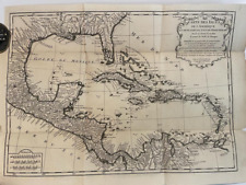
 Caribbean Sea Central America Cuba Jamaica Hispaniola Bahamas 1793 Doolittle map
-
$275.00
 1780 Bonne Map of Southwest America and New Spain
-
$23.95
1740s Map of the New Orleans and the Gulf Coast - 24x30
-
$13.00
 1943 Vintage Map - British Florida 1763-1783 - St. Augustine Alabama, Louisiana
-
$24.00
 St. Croix Danish Reproduction Map of 1767 Caribbean Plantation, Paul Kuffner
-
$13.95
1750s Early North America New World Exploration Map - 16x20
-
$175.00
 Antique 1784 Nautical Chart Cook Inlet Prince William Sound Alaska Original Map
-
$9.99
 American Revolutionary War Washington's March to Yorktown New Jersey Virginia
-
$4125.00
 1730 Georg Seutter Antique Map of New England & New York City - Rare 2nd State
-
$97.50
 Martinique Caribbean Island Fort-de-France 1762 Kitchin charming hand color map
-
$13.95
1740s Early Map of the Gulf Coast - Texas, Louisiana, Florida - 16x20
-
$48.00
 Hudson Bay Canada Map America Amerique Engraving Map Carte Bellin 1758
-
$17.95
1732 Carolina Historic Old American Map - 20x28
-
$24.99
 “Order Of Battle For 1781” Published 1847 In Facsimile From Washington’s Journal
-
$49.00
 Isla del Carmen Mexico Campeche Bay Port Royal 1754 Bellin coastal map
-
$13.95
 North America 1718 Louisana Territory Historic Map - 18x24
-
$29.99
 Map of Louisiana & Mississippi River by John Senex Antique 1721 Reprint
-
$395.00
 The State of New York Samuel Lewis Mathew Carey 1795 Antique Engraved Map
-
$13.95
 1700s “Map of New France” Vintage Style Early United States Map - 16x20
-
$24.95
 Map of the Mississippi River and Louisiana 1730 Vintage Style US Map - 24x32
-
$750.00
 Nice AMERICAN COLONIES Colonial MAP & George Washington at 22 Yrs. 1754 Magazine
-
$23.95
1718 Carte De La Nouvelle France Historic Vintage Style Wall Map - 24x28
-
$149.99
 Framed 18th C. Johann Baptista Homann Nova Anglia Map of New England
-
$17.95
1730 Mississippi River Louisiana Territory Historic Vintage Style Wall Map 20x28
-
$23.95
1740s “New Jersey, Pennsylvania, New York” Vintage Style Land Map - 24x30
-
$13.00
 1943 Vintage Map - Boston in 1775 and 1776 - Revolutionary War - Bunker Hill
-
$175.00
 1793 Surveyor Map Big Bushkill Poconos, To Daniel Brodhead By George Palmer Copy
-
$50.00
 Denoyer Geppert Social Science Maps A9 State Claims and Ratification 1776-1802
-
$1200.00
 1776 Tobias Lotter Antique Post Revolutionary North America Map 13 Colonies
-
$13.95
 1759 New England NY NJ PA Historic Old German Map - 18x24
-
$13.95
North America 1703 Historic Spanish Territory Vintage Style Map - 18x24
-
$1759.59
 ORIGINAL 1799 JOHN SCOLES Map GEORGIA FLORIDA From The Latest Authorities FRAMED
-
$350.00
 Original 1781 Map Carta Del Golfo Dell' Isole Antille Florida & Gulf Coast
-
$49.99
 1846 RARE ORIGINAL MAP CANADA GREENLAND ONTARIO QUEBEC NOUVELLE GALLE MAINE USA
-
$16.95
 1750s Detailed Map of New Spain and the Spanish Colonies - 20x24
-
$889.93
 1805 Original Map Of Charleston South Carolina Engraved Akin Colored Framed
-
$23.95
1777 Map of Connecticut, New York, New Jersey & Long Island - 24x30
-
$100.00
 1780 Partie Meridionale De L'Ancien Mexique ou de la Nouve le Espagne. R Bonne
-
$24.95
1718 Lousiana Territory & Mississippi River Historic Map - 24x32
-
$20.00
 RARE Republic County Atlas LIBERTY Township Wayne, Kansas Plate - 1776-1976 Ltd
-
$1347.50
 1790, SURVEYORS MAP, WILL COCKBURN, NY, LINWOOD, THOMAS TILLOTSON f VAN ETTEN
-
$450.00
 Map and Chart of the Chesapeak, York & James Rivers VIRGINIA, Seat of War, 1781
-
$78.00
 Map L'Isle DeTerre - Neuve New England Canada ca. 1780
-
$1150.00
 1772 Peter Kalm Map of Eastern North America British Colonies Rare
-
$243.56
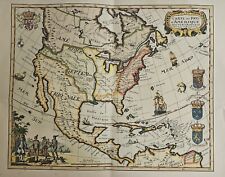
 A New Map of North America. Thomas Conder. 18th Century Original
-
$28.00
 Map Shawmut Trimountain c1630 Boston 1925 Historical Massachusetts DWX3A
-
$19.95
 Vintage Map The Town of Boston Mass 1722 Captain John Bonner 11" x 15 1/2"
-
$14.95
 Vintage Reproduction 1778 – 1780 West Point Map
-
$14.99
 Antique Map "Palaestine" 1747, Copperplate Engraving
-
$23.95
1759 North America Map of New Spain Spanish Colonies - 24x30
-
$13.95
1730s “Carte de la Louisiane et Mississippi” Vintage Style French Map - 18x24
-
$12.00
 Map 1942 United States c1790-1800 12 x 13" Settlement History Colonial DWW6B
-
$2500.00
 1783 Sawyer and Bennett NEW MAP OF NORTH AMERICA WITH WEST INDIA
-
$50.00
 Denoyer Geppert Social Science Maps A4 International Rivalries 1580-1750
-
$13.95
 1760s “A New Map of North America” Vintage Style American Map - 16x20
-
$16.95
1777 Map of Connecticut, Long Island & Manhattan 20x24
-
$350.00
 BOSTON NORTH AMERICA 1747 NICOLAS BELLIN NICE ANTIQUE PLAN 18TH CENTURY
-
$16.95
Map of New France 1718 Vintage Style North America Map - 20x24
-
$13.95
1747 English Colonies Historic Vintage Style New England Wall Map - 16x20
-
$415.00
 Rare & Early SOUTHERN AMERICA Florida Gulf Coast & West Indies MAP 1762 Magazine
-
$16.95
A New Map of North America 1760s Vintage Style Early US Map - 20x24
-
$550.00
![Partie Occidentale Du Canada et Septentrionale De La Louisiane Avec [...]](https://i.ebayimg.com/thumbs/images/g/ErUAAOSwXbRl6ZRX/s-l225.jpg) Partie Occidentale Du Canada et Septentrionale De La Louisiane Avec [...]
Partie Occidentale Du Canada et Septentrionale De La Louisiane Avec [...]
-
$200.00
 2 America Island Maps by Jean Baptist Anville Circa 1730 Hispaniola Mexican Gulf
-
$350.00
 1755 ORIGINAL MAP OF THE ATLANTIC OCEAN ROUTES DURING THE FRENCH AND INDIAN WARS
-
$27.49
 1877 RARE ORIGINAL ENGRAVING UNITED STATES CHARLESTON SOUTH CAROLINA Meeting St.
-
$25.00
 Framed Map of Historical Ride of Paul Revere,William Davis,Dr.Prescott
-
$45.00
 Carte Des Pays D'Amerique SEPTENTRIONALE Dresses en 1778 (20th Century Litho)
-
$23.95
1757 North America and Louisiana Territory New World Map - 24x30
-
$225.00
 Mer de L'Ouest myth California Japan fantasy 1779 Buache Sloane large map
-
$270.00
 1795 Laminated Map Of Rhode Island After Survey By Caleb Harris


