 Antiques (US)
Africa Maps
Asia Maps
Australia/Oceania Maps
Celestial Maps
Central America/Caribbean Maps
Curiosities Maps
Digital Maps
Europe Maps
Map & Globe Mixed Lots
Map & Globe Reproductions
North America Maps
South America Maps
World & Celestial Globes
World Maps

-
$48.75

 The ES&A Bank: Chichester's Picture Map of London - 1955 - Vintage Map
-
$19.95
 Hagstroms Map Of Queens New York 1950's Subways, Elevated Surface Lines
-
$20.68
 1959 Picture / Pictorial Map Geography of ARIZONA by PS JOHST - VERNON QUINN
-
$20.68
 1959 Picture / Pictorial Map Geography of RHODE ISLAND - PS JOHST - VERNON QUINN
-
$20.68
 1952 Pictorial Map EGYPT - SUDAN, AFRICA ~ Illus. by Charles Pont - Vernon Quinn
-
$17.75
 1959 Picture / Pictorial Map Geography of UNITED STATES PS JOHST - VERNON QUINN
-
$20.68
 1959 Picture / Pictorial Map Geography of IOWA by PS JOHST - VERNON QUINN
-
$14.95
 c.1950s Hackney's Restaurant Atlantic City Pictorial Map Brochure NJ Vintage VG+
-
$20.68
 1959 Picture / Pictorial Map Geography of MARYLAND by PS JOHST - VERNON QUINN
-
$20.68
 1959 Picture / Pictorial Map Geography of ARKANSAS by PS JOHST - VERNON QUINN
-
$20.68
 1959 Picture / Pictorial Map Geography of INDIANA by PS JOHST - VERNON QUINN
-
$20.68
 1959 Picture / Pictorial Map Geography of LOUISIANA by PS JOHST - VERNON QUINN
-
$20.68
 1959 Picture / Pictorial Map Geography of NEW YORK by PS JOHST - VERNON QUINN
-
$27.15
 1959 Picture / Pictorial Map Geography of HAWAII by P.S. JOHST - VERNON QUINN
-
$20.68
 1959 Picture / Pictorial Map Geography of NORTH CAROLINA PS JOHST - VERNON QUINN
-
$20.68
 Old 1952 Pictorial Map ~ SOUTH AFRICA ~ Illus. by Charles Pont - Vernon Quinn
-
$20.68
 1959 Picture / Pictorial Map Geography of DELAWARE by PS JOHST - VERNON QUINN
-
$20.68
 1959 Picture / Pictorial Map Geography of KANSAS by PS JOHST - VERNON QUINN
-
$20.68
 1959 Picture / Pictorial Map Geography of PENNSYLVANIA - PS JOHST - VERNON QUINN
-
$20.68
 1959 Picture / Pictorial Map Geography of ALABAMA by PS JOHST - VERNON QUINN
-
$20.68
 1959 Picture / Pictorial Map Geography of OKLAHOMA by PS JOHST - VERNON QUINN
-
$20.68
 1959 Picture / Pictorial Map Geography of MICHIGAN by PS JOHST - VERNON QUINN
-
$20.68
 1959 Picture / Pictorial Map Geography of MISSISSIPPI by PS JOHST - VERNON QUINN
-
$20.68
 1959 Picture / Pictorial Map Geography of ILLINOIS by PS JOHST - VERNON QUINN
-
$20.68
 1952 Pictorial Map ~ NORTH AFRICA ~ Illustrated by Charles Pont - Vernon Quinn
-
$20.68
 1952 Pictorial Map ~ EQUTORIAL AFRICA ~ Illus. by Charles Pont - Vernon Quinn
-
$20.68
 1959 Picture / Pictorial Map Geography of GEORGIA by PS JOHST - VERNON QUINN
-
$20.68
 1959 Picture / Pictorial Map Geography of MONTANA by PS JOHST - VERNON QUINN
-
$20.68
 1959 Picture / Pictorial Map Geography of SOUTH CAROLINA PS JOHST - VERNON QUINN
-
$20.68
 1959 Picture / Pictorial Map Geography of ALASKA by P.S. JOHST - VERNON QUINN
-
$20.68
 1959 Picture / Pictorial Map Geography of MASSACHUSETTS PS JOHST - VERNON QUINN
-
$20.68
 1959 Picture / Pictorial Map Geography of TENNESSEE by PS JOHST - VERNON QUINN
-
$20.68
 1959 Picture / Pictorial Map Geography of NEBRASKA by PS JOHST - VERNON QUINN
-
$20.68
 1959 Picture / Pictorial Map Geography of CONNECTICUT by PS JOHST - VERNON QUINN
-
$20.68
 1959 Picture / Pictorial Map Geography of KENTUCKY by PS JOHST - VERNON QUINN
-
$20.68
 1959 Picture / Pictorial Map Geography of NEW JERSEY by PS JOHST - VERNON QUINN
-
$27.15
 1959 Picture / Pictorial Map Geography of MAINE by PS JOHST - VERNON QUINN
-
$20.68
 1959 Picture / Pictorial Map Geography of NEW MEXICO by PS JOHST - VERNON QUINN
-
$32.79
 1952 Pictorial Map ~ THE CONGO REGION, AFRICA ~ Illus. by C. Pont - V. Quinn
-
$7.99
 1950’s Map of US Resources, Products And Natural Features By Department of State
-
$27.15
 1959 Picture / Pictorial Map Geography of MISSOURI by PS JOHST - VERNON QUINN
-
$95.00
 1950s Grand Rapids Itasca County Minnesota Pictorial Cartoon Map Vintage Orig.
-
$20.68
 Old 1952 Pictorial Map ~ EAST AFRICA ~ Illus. by Charles Pont - Vernon Quinn
-
$20.68
 Old 1952 Pictorial Map ~ SOUTEAST AFRICA ~ Illus. by Charles Pont - Vernon Quinn
-
$76.46
 c.1950s Emily and Outing Vacationaland Minnesota Pictorial Cartoon Map Witkus
-
$27.15
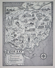 1959 Picture / Pictorial Map Geography of OHIO by PS JOHST - VERNON QUINN
-
$27.15
 1959 Picture / Pictorial Map Geography of NEW HAMPSHIRE PS JOHST - VERNON QUINN
-
$12.99
 UNITED STATES- Vegetation, Population Density, Rainfall, Temperature - 1950s Map
-
$95.00
 1959 Little Crow Lake Region of Minnesota Pictorial Cartoon Map Vintage Original
-
$95.00
 c.1950s Little Crow Lake Region of Minnesota Pictorial Cartoon Map Vintage Orig.
-
$99.99
 VINTAGE UNBIASED CARTOON MAP ALBERTA LAZY SUSAN GRILL HILARIOUS OIL SKI 1950's
-
$13.49
 Roma Imperiale/Imperial Rome Map, In Plastic Case Glossy & No Markings 1950/60’s
-
$58.50
 Map East Africa Land Of Sunshine 1954 Rare
-
$249.99
 VINTAGE LOVELY CARTOON ILLUSTRATED MAP THE NILE EGYPT ALEXANDRIA TO ASWAN c.1950
-
$350.00
 Vintage Pictorial Map of California by Millard Sheets, 1950
-
$180.00
 EGYPT c. 1950 LARGE PICTORIAL WALL MAP


