 Antiques (US)
-
$47.88

 1875 Oveanica Map Hawaii Australia New Zealand Philippines Samoa Fiji ORIGINAL
-
$238.50
 1989 Map Of The Sandwich Isles Artist Cartographer Blaise Domino Hand Signed
-
$57.00
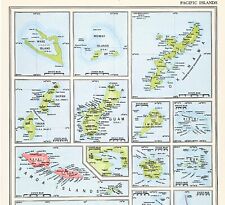 1956 Pacific Islands Map Fiji Guam Samoa Okinawa Iwo Bikini Palau Tinian
-
$49.00
 Australia New Zealand Papua New Guinea Polynesia Hawaii 1818 Walch map
-
$11.86
 Vintage OCEANIA Map of the SOUTH PACIFIC Islands ca 1937 Wall Art Decor Original
-
$37.88
 1853 Polynesia Australasia Map Pacific Ocean Philippines Sumatra Hawaii Fiji
-
$24.00
 Australia - Original Map c1906 by G Philip & Son. Antique
-
$14.99
 Vintage Map "Port Foulke and Vicinity"
-
$37.88
 OLD MAP 1853 Oceanica Pacific Hawaii New Zealand Australia Polynesia ORIGINAL
-
$27.50
 1912 Antique Philippines Map Vintage Map of the Philippine Islands Map 1600
-
$49.99
 1950s Guam Booklets Brochures Cold War Post War Map Military Marinaras
-
$48.88
 1897 Oceanica Map ORIGINAL Australia New Zealand Philippines Hawaii Borneo
-
$57.00
 1899 Australia Map ORIGINAL Sydney Perth Melbourne STEAMSHIPS RAILWAYS
-
$57.00
 1956 Australia Map Melbourne Sydney Adelaide Brisbane Rockhampton Newcastle
-
$191.40
 1785 Capt Cook Antique Print Interior of a Heiau, Island of Kauai Hawaii in 1778
-
$218.90
 1857 A H Dufour Large Rare Antique Map of Australia, New Zealand & South Pacific
-
$23.50
 Antique Multicolor 1885 Map Of Malaysia, Australia & Part Polynesia 12x10
-
$47.88
 1853 Oceanica Australia Map ORIGINAL Pacific Hawaii New Zealand Polynesia
-
$37.88
 1843 Oceanica Pacific Ocean Islands Map ORIGINAL United States Australia Hawaii
-
$43.88
 1897 AUSTRALIA Map Brisbane Sydney Tasmania Queensland Adelaide ORIGINAL Perth
-
$8.49
 Australia Collins Map Featuring Bartholomew Mapping 1999 Pre Owned Paper Folded
-
$53.00
 1904 Australia Map Perth Sydney Brisbane Tasmania Melbourne Victoria Hookina
-
$19.99
 Map of the Sandwich Isles Hawaii by CARTOGRAPHER BLAISE DOMINO Matted Art Print
-
$14.90
 Antique 1899 Color Map Luzon Philippine Islands 11" X 16" #4156
-
$57.88
 1899 New Zealand Map Tasmania New Plymouth Wellington Dunedin North Cape
-
$17.00
 Samoa - Original 1909 Map by Meyers. German Language Map
-
$15.00
 Australia & New Zealand - Original 1874 Hydro-Orographic Map by Meyers.
-
$53.00
 AUSTRALIA Map 1889 ORIGINAL New South Wales Queensland Victoria Western Perth
-
$89.00
 Map Of The Sandwich Isles Cartographer's Notes By Artist Blaise Domino Signed 93
-
$185.00
 Carte des isles des Amis. Voyage Captain Cook 1778
-
$37.50
 Polynesia Pacific Islands Hawaii c. 1830's Brue large detailed map hand color
-
$62.50
 Mariana Islands Pacific Ocean Sailing Ships 1719 Mallet hand color miniature map
-
$17.00
 Australia - Original 1882 Map by Phillips & Hunt. Antique Philips
-
$23.00
 Antique Map - New People's Cyclopedia, 1887 - South Australia
-
$20.00
 Australia - Original 1895 Map by W A. K. Johnston. Antique
-
$23.99
 1911 Stieler Map - Australia Victoria New South Wales Sydney Melbourne Adelaide
-
$35.00
 Map of New Guinea and New Caledonia (1875)
-
$30.00
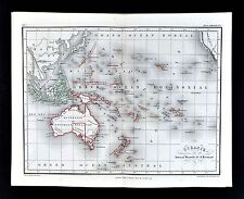
 Oceania Australia New Zealand Polynesia Hawaii Fiji Galapagos 1872 Mitchell map
-
$275.00
 1835 Henry Teesdale Large Antique Map of Van Diemens Land, Tasmania, Australia
-
$328.90
 1851 John Tallis Antique Map of Western Australia or The Swan River Settlement
-
$16.96
 SOUTHEAST ASIA Map Vintage East Indies Indian Archipelago Indonesia Philippines
-
$23.00
 Antique Map - New People's Cyclopedia, 1887 - New South Wales, Australia
-
$16.00
 1896 Map Australia New Zealand Hawaii Tahiti Singapore Philippines Fiji Oceania
-
$18.00
 1936 ORIGINAL VINTAGE MAP NEW ZEALAND AUCKLAND WELLINGTON CHRISTCHURCH DUNEDIN
-
$15.26
 South PACIFIC OCEAN Map Vintage Oceania Islands Australia Wall Art Original
-
$17.88
 Vintage 1902 SAMOA Map 14"x11" ~ Old Antique Original SAVAII UPOLU TUTUILA MANUA
-
$14.90
 Antique 1899 Color Map Australia 11" X 16" #4153
-
$23.00
 Antique Map - New People's Cyclopedia, 1887 - Queensland, Australia
-
$5.97
 Cute Tourist Trinkets from Guam and Australia
-
$19.99
 1900 Times Map Polynesia South Pacific Fiji Tahiti Hawaii Marshall Oceania Cook
-
$16.96
 Vintage OCEANIA Map South Pacific Ocean Islands Australia Wall Art Original
-
$20.31
 Western Australia Map; Genuine 1907 (Dated) City Town Physical Proposed Railroad
-
$16.16
 1889 Antique OCEANIA Map POLYNESIA Map Pacific Islands Map Oceanica Map 1412
-
$14.99
 TOURIST MAP OF SYDNEY AUSTRALIA 1940'S
-
$24.75
 1939 Antique PHILIPPINES Map Vintage Map of the Philippine Islands Map 1424
-
$49.00
 Captain Cook Exploration Pacific Ocean New Caledonia New Hebrides 1780's map
-
$55.00
 1834 Dumont d'Urville Engraved Map ~ Carte des Iles TAHITI ~ Society Islands
-
$20.00
 Map of New Zealand by John Tallis 1851 In Gold, 8x10 Inch Frame, Antique
-
$17.16
 Antique 1902 NEW GUINEA Map 14"x11" Old Antique Original ARAWA LAE PAPUA KOKOPO
-
$25.46
 Vintage OCEANIA Map South Pacific Ocean LARGE Islands Australia Original ca 1945
-
$45.95
 1945 Vernon Quinn Pictorial Map ~ POLYNESIA - TAHITI ~ Maps by Frank Beaudouin
-
$17.00
 New South Wales - Original 1895 Map by Dodd Mead & Co. Australia NSW Antique
-
$28.76
 Vintage 1900 AUSTRALIA Map 14"x11" ~ Old Antique Original BRISBANE PERTH SYDNEY
-
$90.00
 ANTIQUE 1897 BUREAU OF THE AMERICAN REPUBLICS, HI HAWAII HANDBOOK w MAP & INFO.
-
$20.19
 1924 VINTAGE MAP OF QUEENSLAND BRISBANE AUSTRALIA
-
$5.00
 1875 ANTIQUE POATES ATLAS MAP-AUSTRALIA-NEW ZEALAND-POLYNESIAN ISLANDS
-
$18.00
 Tasmania - Original 1903 Dated Map by Dodd Mead & Company. Australia. Antique
-
$30.00
 1864 Australia by Johnson Ward antique map 18.1" x 14.25" - nice color
-
$18.94
 1924 VINTAGE MAP OF AUSTRALIA AND TASMANIA / MELBOURHE SYDNEY PERTH BRISBANE
-
$21.37
 1940 ORIGINAL VINTAGE WWII MAP OF NEW ZEALAND TASMANIA AUSTRALIA NORTHERN TERR.
-
$93.68
 AUSTRALIA NEW HOLLAND NEW ZEALAND c1804 BY JOHN RUSSELL GENUINE ANTIQUE MAP
-
$17.05
 1943 Antique OCEANIA Map Philippines PACIFIC Islands South Pacific Map 593
-
$22.00
 Tasmania, New Guinea Fiji, Samoa & NZ - Large Original 1926 Map by George Philip
-
$24.99
 1885 Antique Atlas Map / OCEANICA AND AUSTRALIA
-
$11.00
 1897 ANTIQUE MEYERS GERMAN ATLAS MAP OF SAMOA-EXCELLENT DETAIL
-
$20.68
 Vintage 1903 Atlas Map ~ PACIFIC OCEAN w/ INTERNATIONAL DATE LINE Old Authentic
-
$5.00
 1895 RARE ANTIQUE MCNALLY ATLAS MAP OF LUZON-EXCELLENT DETAIL
-
$8.12
 1902 Map of Australia antique vintage Britannica 10th
-
$19.95
 CENTURY ATLAS MAP #114 "OCEANICA" OCEANIA POLYNESIA SOUTHEAST ASIA 1911 ANTIQUE
-
$27.96
 Vintage 1900 NEW ZEALAND North Island Map 11"x14" Old Antique Original AUCKLAND
-
$18.94
 1935 ORIGINAL VINTAGE MAP OF AUSTRALIA PERTH MELBOURNE SYDNEY ADELAIDE BRISBANE
-
$20.68
 1962 Pictorial Maps of JAPAN - KOREA - CHINA SEA by F. BEAUDOUIN & V. QUINN
-
$4.99
 1949 color map of Australia on one side & The Philippines on back 14x11"
-
$19.99
 1865 Meissas & Michelot Map - Oceania Australia New Zealand Hawaii Tonga Tahiti
-
$15.99
 1885 Cortambert Map Oceania South Pacific Australia New Zealand Tahiti Hawaii
-
$17.00
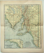 Original 1910 Map of South Australia by Dodd Mead & Company. Antique
-
$22.57
 1908 ANTIQUE MAP OF NEW ZEALAND FIJI HAWAII SANDWICH ISLANDS TASMANIA AUSTRALIA
-
$20.19
 1900 ORIGINAL ANTIQUE MAP OF AUSTRALIA
-
$20.19
 1924 VINTAGE MAP OF OCEANIA HAWAII NEW CALEDONIA SAMOA FIJI TAHITI PACIFIC
-
$23.99
 1869 Bartholomew Map New Zealand Aukland Wellington Christchurch Riverton Kawia
-
$16.25
 Antique Print: Relics of Captain Cook: NZ & Pacific Islands The Graphic Oct 1887
-
$20.19
 1927 MAP OF OCEANIA PACIFIC AUSTRALIA NEW ZEALAND HAWAII GUAM NEW CALEDONIA FIJI
-
$9.86
 1905 Color Country Maps of New South Wales, Victoria & Tasmania and Australia
-
$18.94
 1907 ORIGINAL ANTIQUE FRENCH MAP AUSTRALIA
-
$20.19
 1908 ORIGINAL ANTIQUE MAP OF AUSTRALIA
-
$17.00
 Australia - Original 1902 Map by Dodd Mead & Company. Antique
-
$23.99
 1902 Century Map New Zealand Aukland South Pacific Fiji Samoa Tonga Marshall
-
$23.00
 Antique Map - New People's Cyclopedia, 1887 - New Zealand/Tasmania
-
$302.50
 1842 D Urville & Goupil Antique Print Chief Pea, Daughter & Wife of Apia, Samoa
-
$302.50
 1774 Capt. Cook, S. Parkinson & G. Stubbs - Antique Print of a Kangaroo in 1770


