 Antiques (US)
-
$142.14

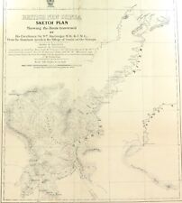
 RARE 1892 Colonial British New Guinea Large Map of The Gulf of Papua. #2
-
$522.50
 1882 Edward Stanford Large Folding Antique Map Eastern Australia, QLD, NSW, Vic
-
$14.99
 TOURIST MAP OF SYDNEY AUSTRALIA 1940'S
-
$715.00
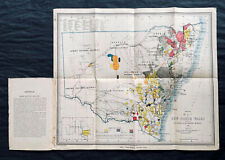 1876 Thomas & Tayler Scarce Antique Goldfields & Minerals Map of New South Wales
-
$19.95
 Antique Map AUSTRALIA 1897 Very Good Condition 12x16"
-
$118.68
 1784 ANTIQUE MAP CHART OF VAN DIEMEN'S LAND TASMANIA - HOGG BOWEN - CAPTAIN COOK
-
$39.99
 Vintage 1930s 2nd Edition Robinson's Sydney Austalia #103 Folding Map 29" X 39"
-
$120.00
 1829 Map of Pacific, George Pollard, Whaleship "Essex", Nantucket "Two Brothers"
-
$39.99
 Vintage Map PACIFIC OCEANIA GLC-7N 9th Edition 5/1966🇺🇸57”x41” USAF NAV CHART
-
$212.38
 Map of Australia approx 1810
-
$43.00
 Australia Philippines Goode Physical Map Rand McNally Folding School Wall Map
-
$2596.20
 Rare 1891 Alexander Black Contour Map of Mornington Peninsula Victoria Australia
-
$57.77
 1974 Brisbane Flood Large Map + Official QLD Dept. of Lands Accompanying Letter
-
$328.58
 1916 Thomas Hewitt Large Folding Antique Map of Southern Tasmania w/ Hobart
-
$522.50
 1854 Arrowsmith Rare Antique Map Plan of Gladstone, Queensland Australia (82045)
-
$194.07
 RARE 1906 Colonial British New Guinea Large Map. Tamata to Mt Albert Edward.
-
$495.00
 Original Captain Cook Map of the Fleet of the Otaheite by Hodges & Wollette 1777
-
$24.97
 1903 large colour fold out map titled - australia - south east part !
-
$24.97
 1903 large colour fold out map titled - oceanica !
-
$174.90
![[Australia] New South Wales Central Coastal District 1940 Fold-Out Tourist Map](https://i.ebayimg.com/thumbs/images/g/WPIAAOSwdphjvDQU/s-l225.jpg) [Australia] New South Wales Central Coastal District 1940 Fold-Out Tourist Map
[Australia] New South Wales Central Coastal District 1940 Fold-Out Tourist Map
-
$32.45
 OLD PORT PHILLIP BAY MAP CHART HARBOUR AND CHANNEL LIGHTS 1959 VIC MRLBOURNE
-
$19.47
 OLD MAP 1st ED DARRIMAN GIPPSLAND VICTORIA AUSTRALIAN MILITARY MAP
-
$103.20
 RARE 1894 Colonial British New Guinea Map of Tauwara or Milne Bay
-
$142.14
 RARE 1883 Colonial British New Guinea Map. Areas East of Port Moresby
-
$23.36
 WARRAGUL GIPPSLAND MAP DEPT OF MINERALS AND ENERGY 1ST EDITION AUSTRALIA
-
$150.00
 Capt. Cook's Hawkesworth First Edition 1773 " Queen Charlotte's Islands
-
$195.00
 Capt. Cook's First Edition 1773 Hawkesworth "Mas-a-Fuera" Southern Hemisphere
-
$142.14
 RARE 1894 Colonial British New Guinea Large Map of Collingwood Bay & Cape Nelson
-
$522.50
 1861 Arrowsmith Rare Antique Map of Queensland, Australia - Brisbane to Warwick
-
$522.50
 1854 Arrowsmith Rare Antique Map, Town Plan of Gladstone, Queensland, Australia
-
$142.14
 RARE 1896 Colonial British New Guinea Large Map. Mambare River to Gosisi Village
-
$142.14
 RARE 1896 Colonial British New Guinea Map. Mambare River & Kumusi Valley
-
$39.00
 ANTIQUE AUSTRALIA MAP 1900s FRENCH ENGRAVING SYDNEY OLD VINTAGE DOUBLE PAGE RARE
-
$58.41
 OLD MAP 1st ED COLAC VICTORIA AUSTRALIAN MILITARY MAP 1942 WW11 ANZAC
-
$32.45
 OLD MAP CORIO VICTORIA AUSTRALIAN MILITARY MAP ROYAL AUSTRALIAN CORPS
-
$103.20
 RARE 1901 Colonial British New Guinea Large Map. Sketch of the Kumusi River.
-
$226.52
 RARE 1906 Colonial British New Guinea Large Map. The Summit of Mt Albert Edward.
-
$109.69
 RARE c1900 Colonial British New Guinea Large Map of The Morehead River
-
$129.16
 RARE 1914 British New Guinea Large Sketch Map of Fly & Alice Rivers
-
$246.64
 1824 Large Sea Chart Voyages French Polynesia, Duperrey Carte des îles Pomotou
-
$129.16
 RARE 1899 Colonial Western Part British New Guinea Huge Folding Map.
-
$96.71
 RARE 1899 Colonial Western Part British New Guinea Huge Folding Map. #2


