 Antiques (US)
-
$252.95

 antique Map of Vogtlandiae (southern Germany) 18th century Paullo Longolio
-
$21.99
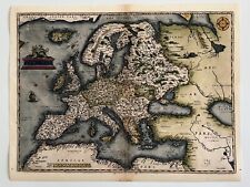 Old World Map of Europe 1600s Ancient Maps Vintage Style Poster Print
-
$150.00
 Antique Map "The Smaller Islands of Great Britain"
-
$43.73
 Antique Map Bay of Naples Italy - Virtue & Co Ltd London 1885 13" x 10.5"
-
$34.99
 ANTIQUE 1859 COLTON'S ATLAS HAND COLORED ENGRAVING MAP SPAIN & PORTUGAL
-
$54.99
 LOT OF 3 ANTIQUE 1859 COLTON'S ATLAS HAND COLORED ENGRAVING MAP OF GERMANY
-
$42.99
 SOUTHERN ITALY NAPLES SICILY 1790 ORIGINAL HAND COLORED MAP DE VAUGONDY
-
$34.99
 ANTIQUE 1859 COLTON'S ATLAS HAND COLORED ENGRAVING MAP PRUSSIA & SAXONY
-
$34.99
 ANTIQUE 1859 COLTON'S ATLAS HAND COLORED ENGRAVING MAP AUSTRIA W/INSET OF VIENNA
-
$39.00
 1844 1-page Atlas Map by Olney "BRITISH ISLES" including Ireland / Eire
-
$40.00
 Beautiful Map-SWITZERLAND 1911 -SCHWEIZ-SUISSE Muir Way New Topographical
-
$34.99
 ANTIQUE 1859 COLTON'S ATLAS HAND COLORED ENGRAVING MAP SWEDEN & NORWAY
-
$19.99
 Original 1897 Map LAKES OF KILLARNEY County Kerry Ireland Lough Leane Aghadoe
-
$156.16
 NORTH ENGLAND, ISLE OF MAN, 'Regni Angliae' original antique map, De Wit, c.1680
-
$19.99
 1895 France Map Antique ORIGINAL 11" Switzerland Mediterranean Sea
-
$24.99
 Genuine Original Antique 1877 France Hand Colored Map PYRENEES ORIENT French
-
$6.25
 1888 Map of environs Glengarriff Kenmare Bantry Ireland antique chromolithograph
-
$34.99
 ANTIQUE 1859 COLTON'S ATLAS HAND COLORED ENGRAVING MAP OF HOLLAND & BELGIUM
-
$31.23
 ISLE of MAN ANTIQUE MAP LEWIS TOPOGRAPHICAL c1850
-
$34.99
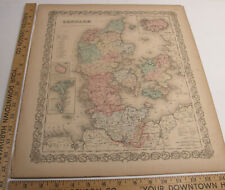 ANTIQUE 1859 COLTON'S ATLAS HAND COLORED ENGRAVING MAP DENMARK INSET OF ICELAND
-
$115.00
 Antique Maps-Carte Ancien and Nouveau Continent Buffon Theorie De La Terre 1829
-
$48.72
 TURKEY IN EUROPE, BOSPORUS, CRETE, original antique map, Johnston, 1871
-
$62.47
 Large original antique map BALTIC, ESTONIA, LIVONIA, ST PETERSBURG Johnston 1886
-
$24.99
 1901 Andrees Map Germany Thuringische Thuringia Frankfurt Gotha Weimar Halle
-
$6.25
 1888 Map of the Environs of Kilkee Ireland antique chromolithograph
-
$67.50
 Antique Plan of Konstantinopel-Istanbul and Turkey-Konstantinopel-Meyers-1895
-
$39.00
 two-page 1844 historical School Atlas Map by Olney of the ROMAN EMPIRE
-
$24.99
 SPAIN & PORTUGAL, BALEARIC ISLANDS original antique map, SDUK, 1844
-
$24.19
 Genuine Original Antique 1877 France Hand Colored Map INDRE ET LOIRE French
-
$24.19
 Genuine Original Antique 1877 France Hand Colored Map SAONE ET LOIRE French
-
$23.75
 Genuine Original Antique 1877 France Hand Colored Map DEUX SEVRES French Europe
-
$23.75
 Genuine Original Antique 1877 France Hand Colored Map ARIEGE French Europe
-
$37.48
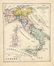
 ITALY, SICILY, MALTA, SARDNINIA, CORSICA, original antique map, SDUK, 1844
-
$61.22
 BALTIC SEA, ESTONIA, LATVIA, ST PETERSBURG, original antique map, Johnston, 1871
-
$109.99
 TOURAINE FRANCE BLAEU FRANCO MAP CIRCA 1630'S ORIGINAL COLOR LG. FOLIO PG. 143
-
$109.99
 BRESSIA BOURG FRANCE BLAEU FRANCO MAP CIRCA 1630'S ORIGINAL COLOR LG. FOLIO
-
$42.48
 Original antique map GERMANY, UPPER SAXONY, DRESDEN, Mercator, Hondius, 1637
-
$39.00
 1844 two-page School Atlas Map by Olney EUROPE with "Central Europe" inset
-
$23.75
 Genuine Original Antique 1877 France Hand Colored Map MEUSE French Europe
-
$23.75
 Genuine Original Antique 1877 France Hand Colored Map SEINE French Europe
-
$396.00
 Antique Map Greece Aegean Sea Insularum Archipelagi Johann Jan Janssonius 17th C
-
$84.50
 Antique Map-SLUIS-SLUYS-ZEELANDIC FLANDERS-NETHERLANDS-Guicciardini-1660
-
$29.99
 1901 Andrees Map Ireland Dublin Londonberry Tipperary Cork Kerry Galway Limerick
-
$447.50
 Antique Map-ITALY-BARI-Hondius-Janssonius-1636
-
$109.99
 GASTINOIS ORLEANS FRANCE BLAEU FRANCO MAP CIRCA 1630'S ORIGINAL COLOR LG. FOLIO
-
$109.99
 BELSIA CHARTES FRANCE BLAEU FRANCO MAP CIRCA 1630'S ORIGINAL COLOR LG. FOLIO
-
$49.97
 Original antique map MORAVIA, CZECH REPUBLIC, AUSTRIA, Tardieu, c.1824
-
$37.48
 Original antique map SWITZERLAND, AARGAU, 'ARGOU', Mercator / Hondius, 1637
-
$84.50
 Antique Map-OOSTENDE-OSTEND-BELGIUM-Guicciardini-1660
-
$55.00
 J. & C. Walker Antique 5 Maps Of England Published By Baldwin & Cradock 1830-31
-
$6.25
 1888 Map of Youghal to Lismore Ireland antique chromolithograph
-
$33.67
 Great Britain & Ireland 'antique' map beautifully hand-coloured, 490mm x 369mm
-
$100.00
 Thermopylae, steelengraving, anno 1860, Bibliographisches Institut -edit
-
$229.50
 Antique Print-ISLAND-MADEIRA-FUNCHAL-GOREE-SENEGAL-Bonne-ca. 1780
-
$16.23
 1833 Antique map: Wiltshire by Creighton, Lewis' Topographical Dictionary
-
$20.00
 1822 GERMANY SUD-OSTLICHES DEUTSCHLAND enthalt die OESTERREIEHISEHEN BESITZUNGEN
-
$299.50
 Antique Map-ROTTERDAM-NETHERLANDS-Guicciardini-1613
-
$297.50
 Antique Manuscript Map-ITALY-SICILY-Van Bommel-1863
-
$12.49
 4 antique maps of UK Islands in original colour by William Hughes pub c. 1868
-
$31.23
 Original antique map NORTH BALKANS, CROATIA, BOSNIA, SERBIA, Stieler, 1891
-
$124.50
 Antique Map-Coat of arms-Province of Gelderland in 1855-Veelwaard-1855
-
$24.99
 Original antique map SWEDEN, NORWAY, SCANDINAVIA, A.K. Johnston, 1896
-
$36.23
 TURKEY, GREECE, CYPRUS, ALBANIA, BULGARIA, original antique map SDUK, 1844
-
$124.93
 Antique map, Silesia, Plan de la bataille de Lissa, 1757
-
$74.95
 1851 Antique Map; Islands in the Atlantic by John Tallis / Rapkin
-
$90.00
 Palace of Mafra, steelengraving, anno 1860, Bibliographisches Institut -
-
$124.93
 Antique map, Plan de la ville et siege de Colberg (Kolobrzeg, Poland), 1758
-
$6.25
 1888 Map of Connemara northern section Ireland antique chromolithograph
-
$31.23
 Original antique map FRANCE, QUERCY, 'CADURCIUM', Mercator / Hondius, 1637
-
$6.25
 1888 Map of Glendalough and the Seven Churches Ireland antique chromolithograph
-
$59.50
 Antique Plan of the city of St. Petersburg in Russia-St. Petersburg-Meyers-1895
-
$1500.00
 Dalmatia, anno 1789, 46 x 122 cm.!! Schraembl/Santini Coppermap-two sheets
-
$24.99
 GREECE, TURKEY, EASTERN MEDITERRANEAN, original antique map, SDUK, 1844
-
$18.74
 NORTH WEST FRANCE, BRITTANY, ENGLISH CHANNEL, original antique map, SDUK, 1844
-
$68.71
 Original antique map, CENTRAL ENGLAND, MIDLANDS, Von Reilly, c.1790
-
$124.93
 Antique map, Silesia, Bataille de Palzig ou Zulichau, 1759
-
$6.25
 1888 Map of Killarney Lough Leane Ireland antique chromolithograph
-
$6.25
 1888 Map of Killarney district Ireland antique chromolithograph
-
$93.70
 Antique map Plan de la rencontre des Saxons et des Prussiens aupres de Naumbourg
-
$8.73
 1922 Map The Times Atlas Bartholomew SOUTHERN RUSSIA Plate 46
-
$44.50
 Antique Print-HAUTES ALPES-GAP-BRIANCON-EMBRUN-FRANCE-Brugere-Trousset-1877
-
$6.25
 1888 Map of Dargle and Powerscourt Ireland antique chromolithograph
-
$100.00
 Canakkale, entrance to Dardanelles, steelengraving, anno 1860, Bibliographisches
-
$124.50
 Antique Map-Coat of arms-Province of Utrecht in 1855-Netherlands-Veelwaard-1855
-
$31.23
 Original antique map FRANCE, BOURBONNAIS REGION, Mercator / Hondius, 1637
-
$7.49
 2 AGOSTINI GEOGRAPHY INSITITUTE ATLAS MAP PAGE PLATE CENTRAL ITALY 1928 VINTAGE
-
$487.50
 Antique Print-XVII PROVINCES-THE NETHERLANDS-Tirion-1738
-
$124.50
 Antique Map-The German empire-Bavaria-Bohemaia-Westphalia-Rhine-Lorraine-1714
-
$31.23
 RUSSIA, VOLGOGRAD (TSARITSYN), ORSK, KAZAKHSTAN, original antique map SDUK, 1844
-
$31.23
 1861 EGYPT Lower NUBIA Keith Johnston Royal Atlas 24 by 19 inches Large
-
$174.89
 1851 Antique Map; Ireland - John Tallis / Rapkin
-
$157.50
 Antique Print-ANTWERP-ANVERS-BELGIUM-Riegel-1691
-
$9.98
 1922 Map The Times Atlas Bartholomew SOUTH WESTERN ASIA Plate 50
-
$56.22
 ANCIENT BALKANS, MACEDONIA, THRACIA, ILLYRIA, original antique map SDUK 1844
-
$247.50
 Antique Manuscript Map-DENMARK-ICELAND-Van Bommel-1865
-
$137.50
 Antique Print-DUBLIN-WATERFORT-LONDONDERRY-CORKE-IRELAND-Le Rouge-1756
-
$249.50
 Antique Map-France with provinces-Auvergne-Brittany-Normandy-Robbe-De Fer-1721
-
$39.50
 Antique Map of Stockholm region in Sweden-Umgebung von Stockholm-Meyers-1895
-
$24.19
 Genuine Original Antique 1877 France Hand Colored Map CORREZE French Europe
-
$24.19
 Genuine Original Antique 1877 France Hand Colored Map GAULE French Europe


