 Antiques (US)
-
$522.50

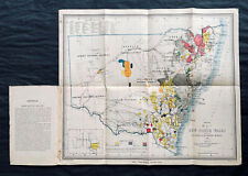
 1882 Edward Stanford Large Folding Antique Map Eastern Australia, QLD, NSW, Vic
-
$715.00
 1876 Thomas & Tayler Scarce Antique Goldfields & Minerals Map of New South Wales
-
$328.58
 1916 Thomas Hewitt Large Folding Antique Map of Southern Tasmania w/ Hobart
-
$357.50
 1890 John Forrest Large Antique Folding Map of Western Australia Pastoral Leases
-
$29.50
 Vintage National Geographic 1988 Bicentennial Australia Map
-
$19.95
 Antique Map AUSTRALIA 1897 Very Good Condition 12x16"
-
$39.99
 Vintage Map PACIFIC OCEANIA GLC-7N 9th Edition 5/1966🇺🇸57”x41” USAF NAV CHART
-
$24.99
 vintage NEW ZEALAND SOUTH ISLAND MOTOR TOURING MAP 1959
-
$2644.00
 Rare 1891 Alexander Black Contour Map of Mornington Peninsula Victoria Australia
-
$144.76
 RARE 1883 Colonial British New Guinea Map. Areas East of Port Moresby
-
$105.10
 RARE 1894 Colonial British New Guinea Map of Tauwara or Milne Bay
-
$175.66
![[Australia] New South Wales Central Coastal District 1940 Fold-Out Tourist Map](https://i.ebayimg.com/thumbs/images/g/WPIAAOSwdphjvDQU/s-l225.jpg) [Australia] New South Wales Central Coastal District 1940 Fold-Out Tourist Map
[Australia] New South Wales Central Coastal District 1940 Fold-Out Tourist Map
-
$50.19
 1906 British New Guinea Mekeo Inauvorene Bensbach River Gawa Alcester Island MAP
-
$522.50
 1861 Arrowsmith Rare Antique Map of Queensland, Australia - Brisbane to Warwick
-
$522.50
 1854 Arrowsmith Rare Antique Map, Town Plan of Gladstone, Queensland, Australia
-
$522.50
 1854 Arrowsmith Rare Antique Map Plan of Gladstone, Queensland Australia (82045)
-
$144.76
 RARE 1894 Colonial British New Guinea Large Map of Collingwood Bay & Cape Nelson
-
$197.64
 RARE 1906 Colonial British New Guinea Large Map. Tamata to Mt Albert Edward.
-
$105.10
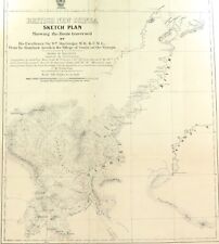
 RARE 1901 Colonial British New Guinea Large Map. Sketch of the Kumusi River.
-
$230.69
 RARE 1906 Colonial British New Guinea Large Map. The Summit of Mt Albert Edward.
-
$144.76
 RARE 1896 Colonial British New Guinea Map. Mambare River & Kumusi Valley
-
$144.76
 RARE 1896 Colonial British New Guinea Large Map. Mambare River to Gosisi Village


