 Antiques (US)
-
$59.87

 1890s Map of Asia Full Color Lithography 14.25 x 21.5
-
$395.00
 Europe 1950 school pull down wall map - Weber Costello - On Canvas Roll
-
$395.00
 South America 1950 school pull down wall map - Weber Costello - On Canvas Roll
-
$310.00
 Asia - Vintage 1950 school pull down wall map - Weber Costello - On Canvas Roll
-
$45.99
 Vintage Pull-Down School Map South America Classroom 1982 Goshen IN 53x44" Read*
-
$28.88
 1904 North Polar Region Map Arctic Exploration Russia Canada Siberia Alaska
-
$36.88
 ARCTIC POLAR REGION Map 1889 ORIGINAL Recent Discoveries Expeditions CRAM ATLAS
-
$53.59
 1899 Map of Luzon Philippine Islands Full Color Lithography 16.5 x 11
-
$12.55
 c1895 map of the Polar Regions antique vintage Britannica 9th
-
$15.00
 Vintage Hammond International Map of the World Colorful Wall Map 33 x 50" C5
-
$175.00
 Vintage Cram’s Europe George F. Cram Co. Pull Down School Wall School Map - 1939
-
$475.00
 1845 World Hemispheres map by A.K. Johnston ~ 25.8" x 21.2" Antique Pastel Color
-
$50.00
 Maps of Ancient Times Authentically Reproduced in Full Color Lithography
-
$49.99
 1898 German Map of Spain and Portugal Full Color Lithography
-
$350.00
 Asia - Vintage 1950 school pull down wall map - Weber Costello - semi-Contour
-
$25.08
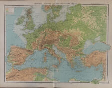 1902 Europe, Mediterranean, Black Sea Physical Map By John Bartholomew
-
$15.99
 1900 Meyers Physical World Map Mountains Rivers Europe Asia America Africa
-
$12.55
 c1895 Ptolemys map of the world antique vintage Britannica 9th
-
$175.00
 3Vintage 1970 school pull down Political Map Weber Costello Africa, N & S Americ
-
$19.99
 1873 Guyot Physical Map Nature Animals Trees Latitudes Jungle to Arctic Antique
-
$57.42
 1898 German Map of Atlantic Ocean and Shipping Routes Steamship Cruise Military
-
$60.62
 1890s Map of Turkey in Europe plus Full Color Lithography 14.25 x 21.5
-
$395.00
 United States 1950 school pull down wall map - Weber Costello - On Canvas Roll
-
$17.55
 Antique Map North Polar Regions With Results Of Latest Explorations Dated C1870
-
$74.29
 1890s German Map of Egypt and Holy Land Full Color Lithography 14.25 x 17.75
-
$56.85
 1898 German Map of East Africa Egypt and Nubia Full Color Lithography 18 x 23
-
$22.99
 1898 ORIGINAL MAP WORLD AMERICA ASIA AUSTRALIA EUROPE AFRICA sea currents OCEANS
-
$61.85
 1890s Map of Cuba with inset of Havana Full Color Lithography 14.5 x 22
-
$198.04
 1926 Harvard University Vintage US History Linen Wall Map Albert Bushnell Hart
-
$395.00
 North America 1950 school pull down wall map - Weber Costello - On Canvas Roll
-
$42.00
 Vintage 1960’s Rand McNally “Vinland” Map Circa 1440 Including American Lands
-
$49.99
 1890s Map of Russia Full Color Lithography Map EUROPAEISCHES RUSSLAND
-
$61.24
 1890s Map of Netherlands and Belgium Full Color Lithography 14.25 x 21.75
-
$7.00
 General Whitman's Adventures of Famed Explorers Book & Map by George Elrick,1965
-
$57.42
 1898 German Map of Korea and Japan Full Color Lithography 18 x 23
-
$19.99
 Original 1902 DOUBLE-HEMISPHERE WORLD MAP South Pole Explorations Mountains Seas
-
$57.42
 1898 German Map of South America Northern Half Full Color Lithography 18 x 23
-
$60.62
 1890s Map of Russia Full Color Lithography 14.5 x 22.5
-
$350.00
 South America 1950 school pull down wall map - Weber Costello
-
$57.42
 1898 German Map of Lower Danube & Western Turkey Full Color Lithography 18 x 23
-
$52.02
 1897 German Map of Part of Germany - Berlin from Stieler's Hand Atlas 19 x 15
-
$55.73
 1898 German Map of Lower Danube Countries and Turkey Color Lithography 18 x 23
-
$55.73
 1898 German Map of Eastern Asia Full Color Lithography 18 x 23
-
$44.19
 1890s Map of Russia Full Color Lithography 14.5 x 22.5 paper toned
-
$36.09
 1898 German Map of Denmark Full color Lithography 18x11.5
-
$59.43
 1899 Map of Cuba and West Indies Full Color Lithography 16.5 x 22.25
-
$61.24
 1897 German Map of Spanish Peninsula part 2 from Stieler's Hand Atlas 19 x 15
-
$58.85
 1897 German Map of East Europe No 1 from Stieler's Hand Atlas 19 x 15
-
$61.24
 1890s Map of Nova Scotia Full Color Lithography 14.5 x 22
-
$149.00
 Antique Print Solar System Theory of the Seasons Rand McNally illustration 1890s
-
$60.62
 1890s Map of West Australia Full Color Lithography 14.5 x 22.5
-
$10.97
 Antique map. THE WORLD PHYSICAL MAP. Circa 1885
-
$37.19
 1890s Map of New South Wales Australia Full color Lithography 14.5x11.25
-
$149.00
 Antique Illustration North Polar Regions Map Asia Russia Arctic Pacific Ocean
-
$65.00
 1860 World Mercator Projection Mitchell antique map 23.6" x 15.4" hand color
-
$53.07
 1897 German Map of Spain and Portugal Full Color Lithography 15 x 18.75
-
$59.43
 1890s Map of Asia Full Color Lithography 13.5 x 21.75
-
$56.85
 1898 German West African Colonial Maps Color Lithography 18 x 11.5
-
$149.00
 Antique Print National Debts Foreign Countries United States 1890 Illustration
-
$25.00
 1863 Eastern Hemisphere by Johnson Ward beautiful antique map 17.2" x 14"
-
$53.07
 1897 German Map of France Full Color Lithography 15 x 18.75
-
$56.95
 1890s Map of Russia Full Color Lithography 14.5 x 21.75
-
$75.00
 World Hemispheres rare 1860 Mitchell antique map 15.2" x 12.5" hand color
-
$60.62
 1890s Map of Africa and NW Africa Full Color Lithography 13.75 x 21.25
-
$53.07
 1890s Map of South America Full Color Lithography 14 x 22 Tunison's Toned Paper
-
$60.62
 1899 Map of Africa and Egypt Full Color Lithography 16.5 x 22.25
-
$61.24
 1890s Map of Russia in Asia Full Color Lithography 14.5 x 22
-
$57.42
 1898 German Map of Southeast France Full Color Lithography 18 x 23
-
$57.42
 1898 German Map of the Balkan Peninsula Full Color Lithography 18 x 23
-
$57.99
 1898 German Map of Northwest Germany Full Color Lithography 18 x 23
-
$51.49
 1897 German Map of Part of Austria Hungary from Stieler's Hand Atlas 19 x 15
-
$57.42
 1898 German Map of Traffic Map of North Baltic Sea Color Lithography 18 x 23
-
$56.85
 1898 German Outline Map of Africa Full Color Lithography 18 x 23
-
$56.85
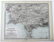
 1898 German Map of Spain and Portugal Full Color Lithography 18 x 23
-
$175.00
 Vintage Cram’s Asia George F. Cram Co. Pull Down School Wall School Map - 1939
-
$57.99
 1898 German Map of British & German South Africa Full Color Lithography 18 x 23
-
$61.24
 1890s Map of Argentina Chile Uraguay Full Color Lithography 14.5 x 22.5
-
$61.24
 1890s Map of Porto Rico Full Color Lithography 14.5 x 22.25
-
$37.56
 1890s Map of Ontario / Quebec Canada Full color Lithography 14.5x11.25
-
$53.07
 1897 German Map of Part of Italy from Stieler's Hand Atlas 19 x 15
-
$61.24
 1899 Map of Asia Full Color Lithography 16.5 x 22.25
-
$57.99
 1898 German Map of West India Southern Part Color Lithography 18 x 11.5
-
$58.56
 1898 German Map of Burma and Malaysian Peninsula Color Lithography 18 x 11.5
-
$250.94
 Antique Map "Johnson's Map of the World on Mercator's Projection" Johnson, 1866
-
$53.07
 1890s Map of South America Full color Lithography 21.75 x 14.5 George Cram
-
$61.24
 1890s Map of Queensland Australia Full Color Lithography 14.5 x 22.25
-
$25.00
 1678 Athanasius Kircher Americas Map Coast & Geodetic Survey Report 1890.
-
$57.42
 1898 German Map of Political Europe Full Color Lithography 18 x 23
-
$57.42
 1898 German Map of Eastern France Full Color Lithography 18 x 23
-
$61.24
 1890s Map of Germany Full Color Lithography 14.5 x 22
-
$55.73
 1898 German Map of Algeria and Tunisia Color Lithography 18 x 11.5
-
$58.84
 1890s Map of Africa Full Color Lithography 13.5 x 21.75
-
$56.85
 1898 German Map of Provinces of West and East Prussia Color Lithography 18 x 23
-
$35.00
 1863 Native American Indians overlooking settler encroachment Johnson Ward map
-
$56.85
 1898 German Overview Map of Asia Full Color Lithography 18 x 23
-
$60.62
 1897 German Map of Spanish Peninsula part 4 from Stieler's Hand Atlas 19 x 15
-
$60.62
 1897 German Map of France part 1 from Stieler's Hand Atlas 19 x 15
-
$59.43
 1890s Map of South Australia Full Color Lithography 14.5 x 22.5
-
$37.64
 Antique Folding World Map Duke of York 1901 Empire Tour 16" x 9.5"
-
$150.00
 1835 Map-South East Asia-Dutch East Indies-Spice Islands-US made


