 Antiques (US)
Africa Maps
Asia Maps
Australia/Oceania Maps
Celestial Maps
Central America/Caribbean Maps
Curiosities Maps
Digital Maps
Europe Maps
Map & Globe Mixed Lots
Map & Globe Reproductions
North America Maps
South America Maps
World & Celestial Globes
World Maps

-
$34.51

 antique map plan Edinburgh Edenburgh Johnson Bowles De Wit 1710 art poster print
-
$23.72
 London antique panorama view plan map 1720 Londinium Londinum art poster print
-
$27.23
 antique map plan London as in Q Elizabeth time Stow Strype 1720 art poster print
-
$29.74
 antique historical map plan guide Georgian London by Homann 1730 XL print poster
-
$1900.00
 VERY LARGE WALL MAP OF PARIS & ENVIRONS (FRANCE) 1722 by DANET 18TH CENTURY
-
$29.74
 antique map plan London Westminster Southwark J. Strype survey 1720 art poster
-
$23.72
 Pocket guide antique plan London & Westminster map Ellis Bowles 1770 art poster
-
$23.72
 BERLIN BEROLINUM old antique antike panorama plan view map 1720 art poster print
-
$15.05
 Large Print of a London Map First Published in 1746. The Kent Road. f3
-
$15.05
 Large Print of a London Map First Published in 1746. Kent Street. e3
-
$1200.00
 1747.ORIGINAL ANTIQUE MAP.BRUGES ONE OF THE PRINCIPAL CITIES OF FLANDERS.26"x22"
-
$36.01
 antique Londinium Londinum Elizabethan London map Agas Wallis 1563 poster print
-
$1200.00
 1747. ORIGINAL ANTIQUE MAP. "PORT TOWN IN FLANDERS".26"x22"
-
$335.00
 Rare Original Antique Map of DURHAM Hand Colored Framed 13x11
-
$550.00
 MAP OF THE LOWER RENANIA. JOHAN HOMMAN. ENGRAVING ON PAPER. EDITED IN 1740.
-
$15.05
 Large Print of a London Map First Published in 1746. Kings Road a3
-
$119.99
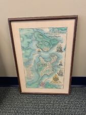 A Plan Of The Town Of Boston & The Charleston Peninsula In NE 1775 Map 1st EDT
-
$44.90
 13 Old Maps from the Collection of the Benaki Museum Greece


