 Antiques (US)
Africa Maps
Asia Maps
Australia/Oceania Maps
Celestial Maps
Central America/Caribbean Maps
Curiosities Maps
Digital Maps
Europe Maps
Map & Globe Mixed Lots
Map & Globe Reproductions
North America Maps
South America Maps
World & Celestial Globes
World Maps

-
$31.30

 1882 Map of Lake Tanganyika Tanzania Congo Zambia Burundi Africa antique vintage
-
$50.09
 1882 Map of the Nguru mountain district Tanzania coast antique vintage
-
$75.00
 Folding Pocket Map "ROUTE MAP OF MARYLAND" - State Roads Commission - 1920
-
$50.09
 1882 Map of the Mozambique coast antique vintage
-
$375.00
 1831 Justin Pierce Reference & Distance Map State of New York H/C Erie Canal
-
$450.00
 1865 GLO Surveyor Generals Office Washington Territory Color Map Gold Mines More
-
$24.99
 1894 USGS Reconnnaissance Map KENTUCKY TENNESSEE Coal Mines Williamsburg Jellico
-
$175.00
 1875 N Little Pocket Map of Mining Lands at Newbury Essex County Massachusetts
-
$225.00
 1891 Map Southern Portion Lassen County California Eagle Lake Land & Irrigation
-
$34.00
 1890's? Topographical Map Hamilton County, IN - Prairie Farmer Pub. Co. Chicago
-
$29.00
 1884 HIMALAYAN Mountain Ranges Large Map by Godwin Austen, Royal Geographical
-
$125.00
 1896 Appalachian Mountain Club Map of Country About Boston Massachusetts Topo
-
$265.00
 1874 Asher & Adams Rare Commercial Topo RR Pocket Map & Guide Ohio and Indiana
-
$50.09
 1882 general and route Map of the Makua country Mozambique antique vintage
-
$100.17
 1882 Map of the South East Provinces of Madagascar antique vintage
-
$50.09
 Antique Map London & Thames Estuary - Virtue & Co Ltd London 1885 13" x 10.5"
-
$18.78
 1882 Map of the southern part of Lake Tanganyika Africa antique vintage
-
$37.56
 1882 Map of Iceland and Plan of the Great Geyser antique vintage
-
$18.78
 1882 Map of the Routes through the Yao country Mozambique antique vintage
-
$12.50
 Sierra Club Founded 1892 Washington D.C. Honolulu Oklahoma City Travel Guide Map
-
$42.00
 Original 1897 Antique Color Map of America ~ English Colonies 1763-1775 ~ RARE
-
$95.99
 Original 1855 Survey Map LOUISIANA Overflowed Land District Rejected Claims
-
$31.30
 1882 Preliminary Map of Wrangell Island antique vintage
-
$279.99
 Eight Original 1839 Topographical Survey Maps NEENAH FOX RIVER Wisconsin Portage
-
$85.00
 1880 Clarence King Geographical Divisions of US Geological Survey 1st USGS Map
-
$25.04
 1882 Map of part of the Bolivian Table land antique vintage
-
$31.30
 Saarbrücken German Empire Original Antique Lithograph Map 1899 Royal Prussian
-
$35.95
 Rare Antique Orig Vintage NY Asher & Adams Meteorological Atlas Map Art Print
-
$357.50
 1890 John Forrest Large Antique Folding Map of Western Australia Pastoral Leases
-
$37.56
 1885 Antique Map of North East Africa-Virtue & Co Ltd London 13" x 10.5"
-
$37.56
 Antique Folding Guide Maps Penzance Lands End 1899 J Bartholomew 8.5" x 6.25"
-
$31.30
 Antique Folding Guide Map Porlock Bay Cornwall 1885 J Bartholomew 10" x 9.75"
-
$25.04
 1882 Map of the Cameroons District Africa antique vintage
-
$125.00
 1883 Colton's Map of England and Wales Scarce Pocket Map Format Handcoloring
-
$3500.00
 MAP OF COLORADO folding indexed pocket type RAND McNALLY cloth covers 1881
-
$22.99
 1891 USGS Topo Map MANCHESTER McKee Booneville Big Creek Saw Mill Kentucky River
-
$749.99
 Original 1852 Stansbury UTAH TERRITORY & GREAT PLAINS Exploration and Survey Map
-
$40.00
 Original 1897 Antique Color Map of America in 1825 USA ~State Sub Divisions RARE
-
$31.30
 Antique Folding Guide Map Exeter Seaton Devon 1899 J Bartholomew 11" x 6.5"
-
$18.78
 Antique Folding Guide Map Mevagissey Bay Cornwall 1899 J Bartholomew 6" x 6.25"
-
$100.11
 JOHN WOOD Hand-Col Linen MAP OF DUMBARTONSHIRE/Trossachs ca 1840 Pub. JOHNSTONE
-
$385.00
 1867 Gorlinski GLO Map of United States & Territories w/ French Language Report
-
$37.56
 1882 Map of Northern Alaska Nelson Island Nunivak Island antique vintage
-
$250.00
 1878 Colton Railroad Pocket Map & Maine State Year-Book Hoyt Fogg & Donham
-
$995.00
 Revolutionary War Map, New York Island, Plan Of 1776, Published In London 1806
-
$18.78
 Salgen German Empire Original Antique Lithograph Map 1899 Royal Prussian
-
$626.08
 1807 Folding Map of the ISLE OF WIGHT John Albin Printed by T Gardiner Second Ed
-
$149.99
 Original 1875 Joseph Mullens Missionary Travels Map MADAGASCAR CENTRAL PROVINCES
-
$29.99
 Original 1853 Survey Map POT ROCK Demolition Hell Gate East River New York City
-
$74.99
 Struggle for Continent 1689-1800 Denoyer-Geppert History Map 20012 43x38
-
$295.00
 c1889 PA Pennsylvania Topographical Survey South Mountain Dist 8 maps Van Hise
-
$250.00
 1878 GW & CB Colton RR Stagecoach Pocket Map Maine Hoyt Fogg & Donham Portland
-
$44.00
 Original 1897 Antique Color Map of America ~ Territorial Growth ~ RARE
-
$25.04
 Antique Folding Map Matlock Bakewell Derbyshire 1891 J Bartholomew 8.25" x 6.25"
-
$295.00
 COLORADO MAP USGS Drainage & Ute Indian Reservation Railroads Topographical 1877
-
$475.00
 1887 Hyde & Co Driving Road Chart Country Around New York City NW/SW Sheets Map
-
$31.30
 Antique Folding Guide Map Bude Bay Cornwall 1885 J Bartholomew 8.5" x 6.25"
-
$79.99
 1893 Geological Survey & Topographical Map Bucks & Montgomery Counties 2 Maps #2
-
$3005.16
 Antique map, Japan, Road Map, 1874
-
$28.17
 Austrian Alps, Glaciers, Karte der Ferwallgruppe, Edw.Stanford, Folding Map 1899
-
$25.04
 Pfalzburg German Empire Original Antique Lithograph Map 1899 Royal Prussian
-
$25.04
 Antique Folding Map Peak District Derbyshire 1891 J Bartholomew 8.5" x 6.25"
-
$27.49
 Rare Antique Orig Vintage NY Asher & Adams Meteorological Atlas Map Art Print
-
$31.30
 Antique Folding Guide Maps Ilfracombe Devon 1885 J Bartholomew 11" x 6.25"
-
$18.78
 Antique Folding Guide Map Land's End Cornwall 1899 J Bartholomew 6.75" x 6.25"
-
$25.04
 Antique Folding Guide Map Matlock Bath Derbyshire 1891 J Bartholomew 10" x 6.25"
-
$1189.54
 1816-19 MAPS Environs of London by Col MUDGE at the Tower 4 Sheets in a Slipcase
-
$25.04
 Antique Folding Map Buxton Derbyshire & Environs 1891 J Bartholomew 10.5" x 7"
-
$125.20
 1840 Antique Large Folding Map; England & Wales by J. & C. Walker
-
$813.90
 1836 Pilatus, alpine panorama, G. Hoffmann, huge stone lithograph, Switzerland
-
$25.04
 Antique Folding Guide Map Land's End Cornwall 1885 J Bartholomew 8.5" x 6.25"
-
$93.91
 1897 BORDIGHERA e Suoi Dintorni Ventimiglia San Remo Mappa Map ITALIA Linen Back
-
$575.00
 WHEELER MAP & list publication West 100th Meridian US Geographical Surveys 1881
-
$31.30
 Antique Folding Guide Maps Bideford Bay Devon 1885 J Bartholomew 9" x 6.25"
-
$37.56
 Early Cartography Printed Map of Babylonia Iraq from book Herodoti Musae 1830
-
$35.06
 c1837 L'ECOSSE Antique Map of SCOTLAND Engraved & Drawn by Thomas Starling
-
$31.29
 Original Antiquarian Map of Europe (c1822) Thomas Kelly, UK, France, Germany etc
-
$62.61
 1882 Ordnance Survey Sheet 302 HORSHAM Brighton Tunbridge Wells Haslemere 1 Inch
-
$129.99
 Maps Herndon's Report Valley Amazon Fold Out Spanish Peru Book Map 1800s Vintage
-
$106.43
 NATAL AND KAFFRARIA - FINELY ENGRAVED TALLIS / RAPKIN MAP, 1851, FINE VIGNETTES
-
$31.29
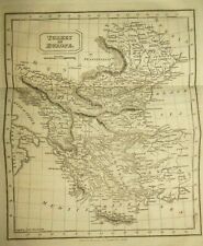 Original Antiquarian Map of Turkey in Europe (c1822) Thomas Kelly, Bulgaria, etc
-
$106.43
 NORTHERN INDIA - FINELY ENGRAVED TALLIS / RAPKIN MAP, 1851 WITH FINE VIGNETTES
-
$112.69
 SOUTHERN INDIA - FINELY ENGRAVED TALLIS / RAPKIN MAP, 1851 - WITH VIGNETTE VIEWS
-
$150.00
 Flemings Linen Backed Field Map Franco Prussian War 33x28 RARE
-
$55.00
 Map of Country Southwest of Boston 1896by The Appalachian Mountain Club ORIGINAL
-
$106.43
 FRANCE - FINELY ENGRAVED TALLIS / RAPKIN MAP, 1851 - WITH FINE VIGNETTE VIEWS
-
$55.00
 Map of The Country Southeast of Boston 1896 ORIGINAL by The Appalachian Mnt Club
-
$50.00
 Framed Original 1887 Antique Map GLADBACH GERMANY corner
-
$31.29
 Original Antiquarian Map of Sweden Denmark & Norway (c1822) Thomas Kelly, Europe
-
$16.27
 Vintage European Military? Folding Map c1880 of Horn (Austria) Zone 11, Col XIII
-
$93.91
 VENEZUELA, COLOMBIA, ECUADOR, GUAYANA, FINE ENGRAVED TALLIS / RAPKIN MAP 1851
-
$162.78
 WEST INDIA ISLANDS - CUBA, FLORIDA, FINELY ENGRAVED TALLIS / RAPKIN MAP, 1851
-
$40.00
 Original 1897 Antique Color Map of America in 1801 USA ~State Sub Divisions RARE
-
$815.24
1836 Pilatus, alpine panorama, G. Hoffmann, huge stone lithograph, Switzerland


