 Antiques (US)
Africa Maps
Asia Maps
Australia/Oceania Maps
Celestial Maps
Central America/Caribbean Maps
Curiosities Maps
Digital Maps
Europe Maps
Map & Globe Mixed Lots
Map & Globe Reproductions
North America Maps
South America Maps
World & Celestial Globes
World Maps

-
$65.00

 Large Watercolor Virgin Islands 1990 by J Longacre. Prof Framed And Matted 36x28
-
$12.46
 Vintage Marine chart - Admiralty Charts 192 East Schelde
-
$21.00
 Vintage 1992 Natical Chart Map Of New York, Lake Ontario, Mexico Bay, North Pond
-
$9.33
 1990 Vintage Admiralty Chart No 3673 Lézardrieux & Paimpol with approaches
-
$45.00
 Vintage Paper Historic Map of St. Martin/St. Maarten by Greenwith Galleries
-
$299.08
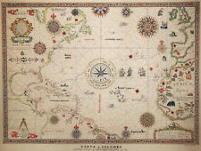 Map "Colombiadi" (Christopher Columbus) Emilio Delfino, 1991
-
$12.46
 Vintage Marine chart - Admiralty Charts 2052 - Orfordness To The Naze
-
$55.00
 NAUTICAL MAP OF NEW YORK CITY EAST RIVER, Tallman Island to Queensboro Bridge
-
$23.68
 ADMIRALTY CHART. No.2540. LOCH ALSH and APPROACHES. 1992 Edition.
-
$12.46
 Vintage Marine chart - Admiralty Charts 120 West Schelde
-
$24.92
 Vintage Admiralty Chart. No.1729. ISLANDS IN AMERICAN SAMOA. PACIFIC OCEAN.1990.
-
$7.46
 Nautical Charts Anguilla Sombrero Island BA 2047 + Admiralty letter
-
$12.46
 Vintage Marine chart - Admiralty Charts 1349 Ports In Normandy
-
$31.15
 U. S. SEA CHART. No. 12304. DELAWARE BAY. NEW JERSEY - DELAWARE. 1991.
-
$31.14
 Garnons Williams Framed Map of the QE2 & Other Historic Atlantic Ocean Crossings
-
$12.46
 Vintage Marine chart - Admiralty Charts 203 Zante To Paxos
-
$14.33
 ADMIRALTY SEA CHART. THAMES ESTUARY, KNOCK JOHN. No.1609. ENGLAND E. COAST. 1992
-
$9.35
 CHART MAP DEFENSE MAPPING DMAAC Soundings 52” X 35" TURKEY GREECE 54407
-
$12.46
 Vintage Marine chart - Admiralty Charts 325 Ostend To Flushing
-
$12.46
 Vintage Marine chart - Admiralty Charts 97 Zeebrugge / Brugge
-
$8.10
 ADMIRALTY SEA CHART. # 371. WEST INDIES. NORTHERN MARTINIQUE. 1991.
-
$19.94
 PUNTA STILO to BRINDISI, ITALY SOUTH EAST COAST, 1990 ADMIRALTY SEA CHART No.187
-
$12.45
 SEA ADMIRALTY SHIPPING SAILING SHIP YACHT CHART-NORTH SEA DOVER AND CALAIS
-
$12.46
 Vintage Marine chart - Admiralty Charts 2 British Isles
-
$12.46
 Vintage Marine chart - Admiralty Chart 1975 Thames Estuary Northern Part
-
$17.45
 Vintage Maritime Chart sea map Prawle point Hengistbury head Lyme Regis Poole
-
$17.45
 Vintage Maritime Chart sea map Dover Beachy Head Fecamp Cap Gris- Nez France
-
$15.58
 Vintage Maritime Chart sea navigation map Pertuis Bretton 2641 West France
-
$18.68
 Admiralty Chart - 2860 Outer Approaches to New York 1968 (1985 Printing)
-
$15.58
 Vintage Maritime Chart sea Cherbourg to Fe`camp navigation map 2613 France pic
-
$175.00
 vintage nautical maps


