 Antiques (US)
Africa Maps
Asia Maps
Australia/Oceania Maps
Celestial Maps
Central America/Caribbean Maps
Curiosities Maps
Digital Maps
Europe Maps
Map & Globe Mixed Lots
Map & Globe Reproductions
North America Maps
South America Maps
World & Celestial Globes
World Maps

-
$57.00

 ITALY Map 1875 ORIGINAL Large Steamship Routes Railways Telegraph Lines
-
$47.88
 1875 Oveanica Map Hawaii Australia New Zealand Philippines Samoa Fiji ORIGINAL
-
$137.50
 1849 Keith Johnston Large Antique Map Australia, NZ, America The Pacific (40961)
-
$60.49
 1873 Keith Johnston Antique Hydrographic Maps x 2 of Great Britain & Ireland
-
$19.00
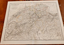
 Switzerland - Original 1895 Map by W & A.K. Johnston. Antique
-
$19.51
 Ancient PALESTINE Map Syria Wall Art 1000 BC Old Original Antique Keith Johnston
-
$31.23
 1861 EUROPEAN RUSSIA Keith Johnston Royal Atlas 24 by 19 inches Large
-
$31.23
 1861 EGYPT Lower NUBIA Keith Johnston Royal Atlas 24 by 19 inches Large
-
$37.41
 c1900 Johnston Colour Atlas Map Basin of Mediterranean Sea Malta North Africa
-
$99.99
 1872 Atlas Geography Antique Maps World America Europe Asia Africa UK Johnston
-
$37.41
 c1900 Johnston Atlas Colour Map Greece Cyclades Greek Islands Corfu Zante Aegean
-
$37.41
 1900 Johnston Atlas Coloured Map South America Southern Argentina Chile Uruguay
-
$37.41
 1900 Johnston Atlas Colour Map Northern South America Colombia Brazil Venezuela
-
$29.95
 Sweden & Norway (Scandinavia) antique map Keith Johnston 1860
-
$99.86
 1861 Hand Colour Map Blackwood Greece Greek Isles Corfu Aegean Sea Mediterranean
-
$99.86
 1861 Hand Coloured Map Blackwood Sweden Norway Scandinavia Baltic Sea Bothnia
-
$37.41
 1900 Johnston Colour Atlas Map Chart Empire of Germany Prussia Danzig Silesia
-
$31.16
 c1900 Johnston Colour Atlas Map France Departments Environs of Paris Corsica
-
$37.41
 c1900 Johnstons Atlas Map Sweden Norway Scandinavia Baltic Bothnia Gulf Atlantic
-
$37.41
 1900 Johnston Atlas Colour Map India Northern Part Nepal Bhutan Kashmir Pakistan
-
$37.41
 c1900 Johnstons Atlas Map Dominion Canada West Central Sheet Hudson Bay Winnipeg
-
$47.46
 AUSTRALIA, NEW SOUTH WALES, QUEENSLAND, original antique map, Johnston, 1871
-
$27.42
 1900 Johnston Colour Atlas Map Chart World Mercator Projection Unknown Antarctic
-
$37.41
 1900 Johnston Atlas Colour Map Central North America Canada Mexico United States
-
$29.91
 1900 Johnston Colour Atlas Map Chart World in Hemispheres Unknown Antarctic Seas
-
$59.95
 OCEANIA, PACIFIC, AUSTRALIA, NEW ZEALAND, original antique map, Johnston, 1871
-
$37.41
 1900 Johnston Atlas Coloured Map India Southern Part Ceylon Burma Malay Bengal
-
$99.86
 1861 Hand Colour Map Blackwood Europe Continent Russia UK Turkey Austria Nordic
-
$99.86
 1861 Hand Colour Map Blackwood France Regions Provinces Environs Paris Corsica
-
$59.89
 1861 Hand Coloured Map Blackwood Turkey Asia Minor Transcaucasia Russia Cyprus
-
$99.86
 1861 Hand Coloured Map Blackwood Austrian Empire Hungary Croatia Transylvania
-
$62.39
 1861 Hand Coloured Map Blackwood Switzerland Cantons Alps Savoy Piedmont Geneva
-
$27.42
 c1900 Johnston Colour Atlas Map Empire Germany Southern Portion Bavaria Prussia
-
$37.41
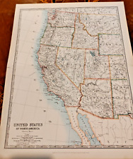 1900 Johnston Atlas Colour Map United States West California Washington Oregon
-
$37.41
 1900 Johnston Atlas Coloured Map China & Japan Islands Japan Korea Taiwan Taiwan
-
$32.41
 1900 Johnston Atlas Colour Map West India Islands Central America Caribbean Cuba
-
$37.41
 1900 Johnston Map Dominion Canada Eastern Newfoundland Nova Scotia New Brunswick
-
$225.00
Zoological Geography of Reptilia (Reptiles) Johnston, 1858
-
$62.39
 1861 Hand Coloured Map Blackwood Spain Portugal Balearic Mediterranean Pyrenees
-
$87.37
 1861 Hand Coloured Map Blackwood Turkey in Europe Moldova Romania Serbia Balkans
-
$43.72
 World map, in Hemispheres, Keith Johnston, 1880
-
$31.16
 1900 Johnston Colour Atlas Map Chart Continent Europe Turkey Russia Austria UK
-
$72.44
 IRELAND, Keith Johnston large original Antique Map c1870
-
$37.41
 1900 Johnston Atlas Coloured Map Central Asia Caspian Aral Sea Uzbekistan Russia
-
$43.72
 World map in hemispheres by Keith Johnston C. 1880
-
$37.41
 c1900 Johnstons Atlas Map Colonial Africa Continent Madagascar Indian Ocean
-
$37.41
 1900 Johnston Atlas Colour Map North West & South Africa Morocco Algeria Tunis
-
$37.41
 1900 Johnston Atlas Coloured Map Egypt Arabia Petraea Lower Nubia Sudan Sinai
-
$37.41
 c1900 Johnston Colour Atlas Map Switzerland Alps of Savoy & Piedmont Lake Geneva
-
$37.41
 c1900s Johnston Atlas Coloured Map Abyssinia & Upper Nubia Red Red Sea Gulf Aden
-
$31.16
 c1900 Johnston Colour Atlas Map Belgium & Netherlands Holland Luxemburg Brussels
-
$24.92
 1900 Johnston Colour Atlas Map Chart England & Wales Southern Pt Channel London
-
$22.42
 1900 Johnston Colour Atlas Map Chart England & Wales Northern Part Isle Man Sea
-
$37.41
 1900 Johnston Atlas Colour Map Central Pt United States Texas Louisiana Minisota
-
$34.91
 c1900s Johnston Atlas Coloured Map Spain & Portugal Balearica Islands Gibraltar
-
$37.41
 c1900s Johnston Atlas Colour Map Denmark North German Empire Schleswig Holstein
-
$37.41
 1900 Johnston Atlas Colour Map Southeast United States Atlantic New York Florida
-
$59.99
 Prussia 1849 Original Map - Alexander Keith Johnston
-
$89.99
 Switzerland 1850 Original Map - Alexander Keith Johnston
-
$99.99
 Belgium 1850 Original Map - Alexander Keith Johnston
-
$99.99
 Germany (Western States) 1850 Original Map - Alexander Keith Johnston
-
$225.00
Zoological Geography of Carnivore Animals Johnston 1858


