 Antiques (US)
Africa Maps
Asia Maps
Australia/Oceania Maps
Celestial Maps
Central America/Caribbean Maps
Curiosities Maps
Digital Maps
Europe Maps
Map & Globe Mixed Lots
Map & Globe Reproductions
North America Maps
South America Maps
World & Celestial Globes
World Maps

-
$48.00

 1853 Map Australia Hawaii Map Philippines ORIGINAL New Zealand Oceanica Borneo
-
$299.99
 AUTHENTIC LARGE COLOR MAP FROM 18TH CENTURY - Museum Grade Quality
-
$58.88
 1889 OHIO Map ORIGINAL Dayton Akron Cleveland Sandusky Columbus Cincinnati
-
$32.25
 1875 Iowa 17" Map Muscatine Co. Allendale Farm Art West Liberty Pella Wilton S2
-
$19.95
 Vintage SOUTH DAKOTA Map Auto Trails Highway Original Antique 1920s Road
-
$7.00
 Vintage New Jersey Map
-
$36.00
 Large Original 1898 Antique Map FLORIDA Jacksonville Miramar Orlando Tampa Miami
-
$36.00
 Large Original 1898 Antique Map IDAHO Boise Nampa Meridian Kuna Post Twin Falls
-
$32.50
 1941 Vintage Palestine Map Jerusalem Map Syria Lebanon Transjordan Map 1585
-
$48.88
 1853 Oceanica Australia Map ORIGINAL Pacific Hawaii New Zealand Polynesia
-
$16.99
 1856 Map Ancient Spain or Hispania Page 7 from The Long's Classical Atlas
-
$58.00
 1956 ARCTIC REGION NORTH POLE MAP Original Alaska Siberia Greenland Canada
-
$24.99
 West Donegal Township Colored Map Page From 1875 Historic Atlas Lancaster Co. PA
-
$48.88
 1852 Georgia Florida Map South Carolina Tennessee Louisiana Alabama Mississippi
-
$21.56
 Vintage 1902 DENVER COLORADO Map 14"x11" ~ Old Antique Original CAPITOL HILL
-
$24.44
 Vintage 1896 AUSTRIA Map 14"x11" Old Antique Original HUNGARY TRANSYLVANIA
-
$22.50
 1912 Antique Arizona State Map Vintage Map of Arizona Gallery Wall Decor 1586
-
$54.00
 1897 MEXICO Map ORIGINAL Vera Cruz STEAMSHIP Routes RAILWAYS States Battlefields
-
$16.95
 Vintage ST LOUIS Map City Street Wall Art Decor Missouri Original 1800s Antique
-
$54.00
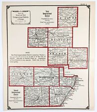 1905 Michigan County Map Jackson Hillsdale Eaton Lenawee Washrenaw Kalamazoo
-
$48.88
 1873 World Map ORIGINAL United States Europe Africa West Indies Australia
-
$48.88
 1898 TORONTO CANADA Map ORIGINAL Downtown City Lake Ontario Harbor Queens Park
-
$13.95
 Vintage PHILADELPHIA City Map Street Center City Wall Art Downtown 1940s
-
$48.88
 1899 OREGON Map ORIGINAL Portland Eugene Salem Medford Port Orford Coos Bay
-
$19.95
 1943 Vintage EUROPE WWII Map Wartime World War 2 Wall Art Decor Mediterranean
-
$58.88
 OLD MAP 1863 FRANCE BELGIUM HOLLAND EUROPE RAILROADS BATTLE FIELD BISCAY ANTIQUE
-
$48.88
 1881 BOULDER CANYON COLORADO Engraved View ORIGINAL Rocky Mountains
-
$48.88
 OLD 1896 Map PARIS LONDON BERLIN DUBLIN ROME ST PETERSBURG VIENNA EDINBURGH
-
$50.36
 Vintage 1902 SAN FRANCISCO CALIFORNIA Map 22"x14" Old Antique Original NOB HILL
-
$68.88
 1889 ITALY Map ORIGINAL Sicily Sardinia Rome Tuscany Corsica Venice Naples
-
$38.00
 1885 TEXAS Comanche Indian Village ORIGINAL ENGRAVING PRINT Native American
-
$164.88
 1916 FORT TRYON PARK INWOOD MANHATTAN NEW YORK CITY Land & Street Map ~ BROADWAY
-
$48.88
 1877 Henrietta New York ORIGINAL Print Lithograph Grocery Store MONROE COUNTY
-
$38.88
 1897 Sicily Central Italy Map ORIGINAL Salerno Messina Palermo Potenza Rome
-
$13.98
 1960's Vintage ROMAN EMPIRE Atlas Map - Old Antique Rand McNally World Atlas
-
$13.58
 1960's Vintage CAMBODIA, LAOS, VIETNAM, THAILAND & MALAYSIA Rand McNally Map
-
$48.88
 1956 Ontario Canada Map ORIGINAL Toronto Great Lakes Railroads Townships
-
$10.08
 Vintage ATLANTIC OCEAN Atlas Map Print 1964 Encyclopedia Britannica World Atlas
-
$28.76
 Vintage 1903 ARIZONA TERRITORY Map 14"x22" Old Antique Original GLOBE TOMBSTONE
-
$2035.00
 1628 Jodocus Hondius & Gerard Mercator Antique Map of Africa - Beautiful
-
$68.88
 1956 Vancouver British Columbia Map Canada Penticton Vernon Kamloops Nelson
-
$64.00
 1896 World Map ORIGINAL Eastern Hemisphere Polar Views Africa North America
-
$11.62
 1894 Antique NEW SOUTH WALES AUSTRALIA Atlas Map Encyclopedia Britannica
-
$44.00
 1897 Newfoundland Canada Map British Columbia Yukon Quebec Toronto Montreal
-
$59.00
 1889 Sweden Norway Map ORIGINAL Europe Scandinavia Stockholm Gothenburg Oslo
-
$58.88
 1891 CANADA Map Ontario Quebec Montreal ORIGINAL Toronto Great Lakes RAILROADS
-
$48.00
 1846 Europe Map Italy France Spain Madrid Palermo Milan Toulouse Greece
-
$48.88
 1899 Oregon map Umatilla Paiute Shoshone Indian Treaty Land Cessions Portland
-
$57.88
 1956 Map Brazil Colombia Panama Venezuela Medellin Caracas Quito Ecuador
-
$38.00
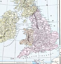
 1890 Saxon Medieval England Scotland Map London Hadrian's Wall Picts Shetland
-
$9.51
 1952 Antique BARBARIAN MIGRATIONS Map Vintage Hammond's New Supreme World Atlas
-
$59.88
 1898 GREECE Map Athens Thessaloniki Patras Piraeus Steamship Routes Cyclades
-
$58.88
 1877 SCOTTSVILLE NEW YORK Print Lithograph ORIGINAL Horses Cattle Farm
-
$48.88
 WORLD MAP 1873 Original Mountains Regions Plateaus Plains Warren's Atlas
-
$10.57
 Vintage PERU & ECUADOR Atlas Map Print 1964 Encyclopedia Britannica World Atlas
-
$38.00
 1916 NORWAY SWEDEN Map ORIGINAL Stockholm Christiania Gothenburg Halmstad Bergen
-
$44.88
 1897 North America Map ORIGINAL United States Mexico West Indies STEAMSHIP ROUTE
-
$44.88
 OLD 1897 Alaska Map Aleutian Islands Sitka Juneau Bering Strait Fort Hamlin
-
$63.00
 1898 British Isles Historical Map England Ireland Scotland Wales London
-
$63.00
 OLD 1889 CENTRAL AMERICA Map ORIGINAL Nicaragua Veragua Honduras San Salvador
-
$58.88
 1889 TURKEY Map ORIGINAL Cyprus Anatolia Asia Greece Constantinople Black Sea
-
$25.00
 The Spokane Valley WA - Rathdrum Prarie ID Aquifer Atlas / Map - 5th Edition NEW
-
$54.00
 1899 Pine Hill South Britain Connecticut Map ORIGINAL GEOLOGICAL Rattlesnake Hil
-
$11.95
 Vintage INDIANAPOLIS Map City Street Wall Art Original 1940s Antique Road
-
$12.95
 Vintage CINCINNATI Map City Street Ohio Wall Art Original Antique Road 1940s
-
$18.88
 1904 Map Of Europe By Rand McNally & Co.
-
$54.00
 1905 Michigan County Map Huron St Clair Lapeer Macomb Sanilac Harbor Beach
-
$19.50
 1941 Antique Europe Map Vintage Atlas Map of Europe Gallery Wall Decor 1580
-
$22.00
 Herefordshire Worcestershire Warwickshire - Original 1922 Ordnance Survey Map.
-
$19.00
 The Austrian Tyrol - Original Map by George Philip & Son. c1907. Tyrolia
-
$62.50
 1872 antique hand colored MAP pa SCHUYLKILL county 17.25"x13.75"
-
$54.00
 1905 Map UPPER PENINSULA MICHIGAN Lake Superior Mackinac Isle Royale Green Bay
-
$54.00
 1905 Upper Peninsula Michigan Map Chieppewa Mace Isle Royale Menominee Luce
-
$20.00
 1847 Map ~ TURKEY in EUROPE - CANDIA, BLACK SEA, HUNGARY - (14x17)-#1776
-
$24.00
 Leipzig, Germany - Original 1908 City Map by Meyers. Antique
-
$20.68
 Old Antique 1887 Large Atlas Map ~ INDIA - FURTHER INDIA ~ Free S&H
-
$14.95
 ca 1943 Antique INDIA Map Vintage Map of Burma Map of India Gallery Wall Art
-
$15.26
 ca 1945 Vintage ITALY Map WWII Era World War II Wall Art Decor Original Antique
-
$38.88
 1897 LOUISIANA Map ORIGINAL New Orleans Shreveport Baton Rouge Houma RAILROADS
-
$24.00
 Spain & Portugal - Original 1878 Map by William Hughes & John Dower. Antique
-
$9.61
 1952 Antique NEW YORK Atlas Map - Vintage MCM Hammond's New Supreme World Atlas
-
$54.00
 1905 Upper Peninsula Michigan Map Counties Marquette Houghton Kalamazoo Allegan
-
$44.88
 1897 Central Africa Map ORIGINAL Congo Somalia STEAMSHIP ROUTES Zambia
-
$58.00
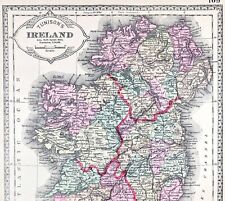 1891 Ireland Map ORIGINAL Kerry Dublin Belfast Counties RAILROADS Townships
-
$38.88
 1899 Switzerland Map ORIGINAL Liechtenstein Zurich Geneva Freibourg RAILROADS
-
$38.88
 OLD 1897 Europe Map Russia Switzerland Baltic States Ireland Denmark Hungary
-
$17.95
 1916 Antique Map of The United States Original Color Parcel Post Auto Routes
-
$48.00
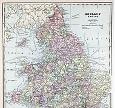 ENGLAND WALES Map 1889 ORIGINAL London Dover Railways Counties Townships G. CRAM
-
$49.88
 1897 Map of the World ORIGINAL North America Africa Europe Africa Polar Views
-
$38.88
 1899 Quebec Canada Map ORIGINAL Montreal St Lawrence Sherbrooke Richmond
-
$38.88
 1897 SOUTHERN NEW YORK Map Long Island Richmond Staten Island Bergen Queens
-
$10.78
 1954 Vintage BOLIVIA Antique Atlas Map - Mid Century Modern Britannica Atlas
-
$38.88
 ALABAMA Map 1899 ORIGINAL Native American Land Cessions Birmingham Gadsden
-
$17.00
 Oldenburg & the Weser River Basin - Original 1888 Map by Meyers. Germany
-
$11.91
 Vintage EAST AFRICA Atlas Map Print 1964 Encyclopedia Britannica World Atlas
-
$10.46
 Vintage COLOMBIA & VENEZUELA Atlas Map 1964 Encyclopedia Britannica World Atlas
-
$16.95
 1888 Antique Tiny New York Map MINIATURE Size Map of New York State Map 1554
-
$48.88
 1899 PERSIA Map ORIGINAL IRAN Tehran Minau STEAMSHIP RAILROADS Afghanistan
-
$58.00
 PHILIPPINES SOUTHEAST ASIA 1956 MAP Original Borneo Manila Celebes Sumatra
-
$58.88
 1853 Map of the World ORIGINAL ANTIQUE United States Africa Europe Australia


